Randonnée A pied Lanuéjols - 48 Gorges du Trevezel 11 06 17 - Photo

48 Gorges du Trevezel 11 06 17

 silvestreclaudine
silvestreclaudine

Utilisateur

© OpenStreetMap contributors
Longueur
Longueur
18,7 km
Altitude max
Altitude max
940 m
Dénivelé positif
Dénivelé positif
856 m
Km-Effort
Km-Effort  
30 km
Altitude min
Altitude min
561 m
Dénivelé négatif
Dénivelé négatif
854 m
Boucle
Boucle
Oui
Date de création :
2017-06-11 00:00:00.0
Dernière modification :
2019-09-22 15:21:29.564

(0 Avis)

A pied
A pied
--
Difficulté : Moyen

Scannez ce code QR pour ouvrir la randonnée dans l'application SityTrail

Application GPS de randonnée GRATUITE

Logo SityTrail SityTrail

IGN / Instituts géographiques

Télécharger SityTrail sur l'App Store Télécharger SityTrail sur Google Play

Logo SityTrail SityTrail World

Le monde est à vous

Télécharger SityTrail sur l'App Store Télécharger SityTrail sur Google Play Télécharger SityTrail sur Huawei AppGallery

À propos

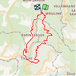
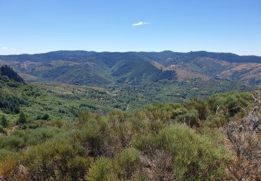
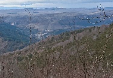
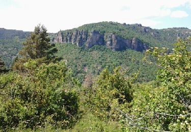
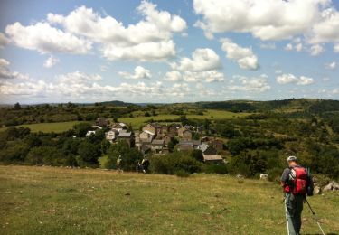
Randonnée A pied de 18,7 km à découvrir à Occitanie, Gard, Lanuéjols. Cette randonnée est proposée par silvestreclaudine.

Description

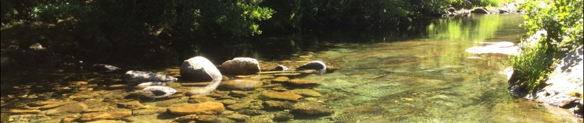
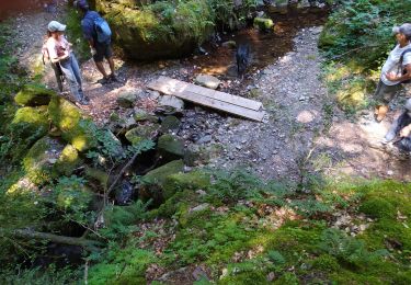
Depart près du pont puis passage à gue ( beaucoup d'eau ) suivant La saison. Pour descendre traverser la rivière à droite à l'entrée du champ , pas de difficultés majeur en dehors du gue

Profil altimétrique

Photos

Localisation

Pays :
France
Région :
Occitanie
Département/Province :
Gard
Commune :
Lanuéjols
Localité :
Unknown
Départ:(Dec)
Départ:(UTM)
532523 ; 4884636 (31T) N.

Randonnées à proximité

Randonnée Marche Trèves - st firmin - Photo
Marche
aldeu

Marche

Moyen
(1)
Trèves, Occitanie, Gard, France
6,9 km | 11,9 km-effort
2h 38min
Oui
Randonnée Marche Lanuéjols - Boucle Lanuejols - Pont de Claperousse - Photo
Marche
LBarel

Marche

Très facile
Lanuéjols, Occitanie, Gard, France
7,4 km | 9,2 km-effort
2h 0min
Oui
Randonnée Marche Lanuéjols - Commeiras - Photo
Marche
boudpn

Marche

Lanuéjols, Occitanie, Gard, France
16,3 km | 24 km-effort
6h 23min
Oui
Randonnée Marche Trèves - trevezel in live - Photo
Marche
CASSISFRAMBOISE

Marche

Très difficile
Trèves, Occitanie, Gard, France
17,6 km | 30 km-effort
4h 51min
Oui
Randonnée A pied Saint-Sauveur-Camprieu - GR 66A - Photo
A pied
PRO

A pied

Facile
Saint-Sauveur-Camprieu, Occitanie, Gard, France
10,6 km | 14,3 km-effort
3h 14min
Non
Randonnée Marche Dourbies - Comeiras- Canayere  - Photo
Marche
gege30

Marche

Moyen
Dourbies, Occitanie, Gard, France
10,9 km | 15,6 km-effort
2h 34min
Oui
Randonnée Marche Meyrueis - la croix de fer  - Photo
Marche
Erickcausse

Marche

Moyen
Meyrueis, Occitanie, Lozère, France
18,8 km | 26 km-effort
3h 49min
Oui
Randonnée Marche Trèves - Treves gte st Firmin Comeiras - Photo
Marche
JEANJOSY

Marche

Moyen
Trèves, Occitanie, Gard, France
18,5 km | 31 km-effort
5h 41min
Oui
Randonnée Marche Trèves - Trevezel forêt aiguoual  - Photo
Marche
genevieve

Marche

Difficile
Trèves, Occitanie, Gard, France
17,9 km | 30 km-effort
6h 18min
Oui


Fermer
Mes abonnements