Randonnée Marche Asson - Plateau de l'Isarce - Photo
 jysc238
jysc238

Utilisateur

© OpenStreetMap contributors
Longueur
Longueur
9,9 km
Altitude max
Altitude max
1375 m
Dénivelé positif
Dénivelé positif
868 m
Km-Effort
Km-Effort  
21 km
Altitude min
Altitude min
509 m
Dénivelé négatif
Dénivelé négatif
867 m
Boucle
Boucle
Oui
Date de création :
2018-04-17 11:33:22.6
Dernière modification :
2018-04-17 11:33:22.6

(0 Avis)

Marche
Marche
6h06
Difficulté : Difficile

Scannez ce code QR pour ouvrir la randonnée dans l'application SityTrail

Application GPS de randonnée GRATUITE

Logo SityTrail SityTrail

IGN / Instituts géographiques

Télécharger SityTrail sur l'App Store Télécharger SityTrail sur Google Play

Logo SityTrail SityTrail World

Le monde est à vous

Télécharger SityTrail sur l'App Store Télécharger SityTrail sur Google Play Télécharger SityTrail sur Huawei AppGallery

À propos

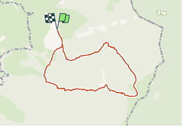
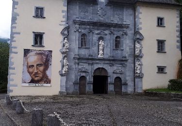
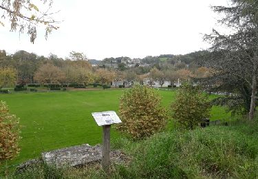
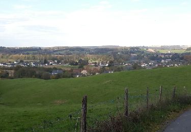
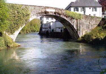
Randonnée Marche de 9,9 km à découvrir à Nouvelle-Aquitaine, Pyrénées-Atlantiques, Asson. Cette randonnée est proposée par jysc238.

Description

Départ depuis les carrières d'Asson.

Profil altimétrique

Localisation

Pays :
France
Région :
Nouvelle-Aquitaine
Département/Province :
Pyrénées-Atlantiques
Commune :
Asson
Localité :
Unknown
Départ:(Dec)
Départ:(UTM)
726036 ; 4774712 (30T) N.

Randonnées à proximité

Randonnée A pied Saint-Pé-de-Bigorre - Lengous et Montagnou - Photo
A pied
PRO

A pied

Facile
Saint-Pé-de-Bigorre, Occitanie, Hautes-Pyrénées, France
5,3 km | 7,4 km-effort
1h 40min
Oui
Randonnée Marche Saint-Pé-de-Bigorre - Les Soums Saint-Péens - Saint Pé de Bigorre - Photo
Marche
tracegps

Marche

Difficile
(1)
Saint-Pé-de-Bigorre, Occitanie, Hautes-Pyrénées, France
15,3 km | 31 km-effort
7h 0min
Oui
Randonnée Marche Lestelle-Bétharram - 2023 10 10 CHEMIN du PIÉMONT PYRÉNÉEN - 18ème étape : Lestelle-Bétharram - Asson - Bruges - Mifaget - Ste Colome - Arudy - Photo
Marche
LEGUE

Marche

Moyen
Lestelle-Bétharram, Nouvelle-Aquitaine, Pyrénées-Atlantiques, France
28 km | 36 km-effort
6h 9min
Non
Randonnée A pied Saint-Pé-de-Bigorre - Le sentier du Bénac - Photo
A pied
PRO

A pied

Facile
Saint-Pé-de-Bigorre, Occitanie, Hautes-Pyrénées, France
8,1 km | 14,3 km-effort
3h 14min
Oui
Randonnée Marche Lestelle-Bétharram - LESTELLE BETHARRAM entre amis - Photo
Marche
GUIDE
marmotte65

Marche

Très facile
Lestelle-Bétharram, Nouvelle-Aquitaine, Pyrénées-Atlantiques, France
9,5 km | 12,5 km-effort
2h 29min
Oui
Randonnée Marche Lestelle-Bétharram - 64-grottes de Lestelle-Betharram - Photo
Marche
pilgrim08

Marche

Moyen
Lestelle-Bétharram, Nouvelle-Aquitaine, Pyrénées-Atlantiques, France
11 km | 14 km-effort
2h 14min
Oui
Randonnée Marche Lestelle-Bétharram - Ballade Lestelle-betharram - Photo
Marche
pilgrim08

Marche

Très facile
Lestelle-Bétharram, Nouvelle-Aquitaine, Pyrénées-Atlantiques, France
6,5 km | 7,8 km-effort
1h 30min
Oui
Randonnée Marche Lestelle-Bétharram - croix des hauteurs - Photo
Marche
pilgrim08

Marche

Moyen
Lestelle-Bétharram, Nouvelle-Aquitaine, Pyrénées-Atlantiques, France
5,8 km | 7,6 km-effort
1h 14min
Oui
Randonnée Marche Lestelle-Bétharram - Lestelle - Boucle des Bastides - Photo
Marche
tracegps

Marche

Moyen
Lestelle-Bétharram, Nouvelle-Aquitaine, Pyrénées-Atlantiques, France
12,2 km | 16,3 km-effort
3h 0min
Oui


Fermer
Mes abonnements