Randonnée Course à pied Serralongue - Le grau - Serralongue - Case Minore - Les Coulomines - Le mouré  - Photo

Le grau - Serralongue - Case Minore - Les Coulomines - Le mouré

 marc.coste@free.fr
marc.coste@free.fr

Utilisateur

© OpenStreetMap contributors
Longueur
Longueur
14,8 km
Altitude max
Altitude max
862 m
Dénivelé positif
Dénivelé positif
481 m
Km-Effort
Km-Effort  
21 km
Altitude min
Altitude min
526 m
Dénivelé négatif
Dénivelé négatif
488 m
Boucle
Boucle
Oui
Date de création :
2018-04-17 11:54:11.944
Dernière modification :
2018-04-17 11:54:11.944

(0 Avis)

Course à pied
Course à pied
1h42
Difficulté : Moyen

Scannez ce code QR pour ouvrir la randonnée dans l'application SityTrail

Application GPS de randonnée GRATUITE

Logo SityTrail SityTrail

IGN / Instituts géographiques

Télécharger SityTrail sur l'App Store Télécharger SityTrail sur Google Play

Logo SityTrail SityTrail World

Le monde est à vous

Télécharger SityTrail sur l'App Store Télécharger SityTrail sur Google Play Télécharger SityTrail sur Huawei AppGallery

À propos

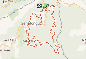
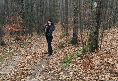
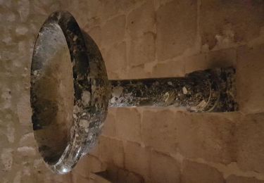
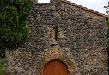
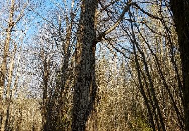
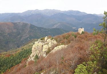
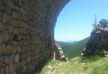
Randonnée Course à pied de 14,8 km à découvrir à Occitanie, Pyrénées-Orientales, Serralongue. Cette randonnée est proposée par marc.coste@free.fr.

Profil altimétrique

Localisation

Pays :
France
Région :
Occitanie
Département/Province :
Pyrénées-Orientales
Commune :
Serralongue
Localité :
Unknown
Départ:(Dec)
Départ:(UTM)
464118 ; 4694719 (31T) N.

Randonnées à proximité

Randonnée Marche Le Tech - l,allau st guillem - Photo
Marche
66Gribouille83

Marche

Très difficile
Le Tech, Occitanie, Pyrénées-Orientales, France
12,1 km | 19,5 km-effort
5h 27min
Oui
Randonnée Marche Montferrer - montferer - Photo
Marche
66Gribouille83

Marche

Difficile
(1)
Montferrer, Occitanie, Pyrénées-Orientales, France
11,8 km | 16,9 km-effort
5h 32min
Oui
Randonnée Marche Le Tech - 3 - Photo
Marche
ricou1964

Marche

Facile
Le Tech, Occitanie, Pyrénées-Orientales, France
15,1 km | 23 km-effort
4h 21min
Oui
Randonnée Marche Saint-Laurent-de-Cerdans - St laurent de cerdans - Photo
Marche
peillo

Marche

Très facile
Saint-Laurent-de-Cerdans, Occitanie, Pyrénées-Orientales, France
10,2 km | 13,9 km-effort
3h 6min
Non
Randonnée Marche Lamanère - lamanere-coral_T - Photo
Marche
force

Marche

Très facile
Lamanère, Occitanie, Pyrénées-Orientales, France
14,9 km | 25 km-effort
5h 18min
Oui
Randonnée Marche Lamanère - Lamanere_PuigDeComaNegra_T - Photo
Marche
force

Marche

Très facile
(1)
Lamanère, Occitanie, Pyrénées-Orientales, France
15,9 km | 28 km-effort
5h 48min
Oui
Randonnée Marche Saint-Laurent-de-Cerdans - Cami_Retirade-Aigua_T - Photo
Marche
force

Marche

Moyen
Saint-Laurent-de-Cerdans, Occitanie, Pyrénées-Orientales, France
11,3 km | 16,8 km-effort
3h 39min
Oui
Randonnée Marche Lamanère - Tours de Cabrens - Photo
Marche
jcmartin

Marche

Moyen
Lamanère, Occitanie, Pyrénées-Orientales, France
12 km | 19,6 km-effort
4h 14min
Oui
Randonnée Marche Serralongue - serralongue Tours de Cabrens_T - Photo
Marche
force

Marche

Moyen
Serralongue, Occitanie, Pyrénées-Orientales, France
13,3 km | 22 km-effort
4h 39min
Oui


Fermer
Mes abonnements