


 - 2018 09 11 - Photo 21")
 - 2018 09 11 - Photo 22")
 - 2018 09 11 - Photo 23")
 - 2018 09 11 - Photo 24")
 - 2018 09 11 - Photo 25")
 - 2018 09 11 - Photo 26")
 - 2018 09 11 - Photo 27")
 - 2018 09 11 - Photo 28")
 - 2018 09 11 - Photo 29")
 - 2018 09 11 - Photo 30")
 - 2018 09 11 - Photo 31")
 - 2018 09 11 - Photo 32")
 - 2018 09 11 - Photo 33")
 - 2018 09 11 - Photo 34")
 - 2018 09 11 - Photo 35")
 - 2018 09 11 - Photo 36")
 - 2018 09 11 - Photo 37")
 - 2018 09 11 - Photo 38")
 - 2018 09 11 - Photo 39")
 - 2018 09 11 - Photo 40")
 - 2018 09 11 - Photo 41")
 - 2018 09 11 - Photo 42")
 - 2018 09 11 - Photo 43")
 - 2018 09 11 - Photo 44")
 - 2018 09 11 - Photo 45")
 - 2018 09 11 - Photo 46")
 - 2018 09 11 - Photo 47")
 - 2018 09 11 - Photo 48")
 - 2018 09 11 - Photo 49")
 - 2018 09 11 - Photo 50")
 - 2018 09 11 - Photo 51")
 - 2018 09 11 - Photo 52")

7,2 km | 15,3 km-effort

Gebruiker


Gratisgps-wandelapplicatie
 SityTrail
IGN / Geografische instituten
SityTrail World
De wereld gaat voor u open
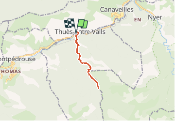
Tocht Stappen van 12,3 km beschikbaar op Occitanië, Pyrénées-Orientales, Thuès-Entre-Valls. Deze tocht wordt voorgesteld door Orcal37.
Thuès-Entre-Valls - Gorges de la Cartança - 13.1km D 4h30mn (30mn) - 2018 09 11
 - 2018 09 11 - Photo 1")
 - 2018 09 11 - Photo 2")
 - 2018 09 11 - Photo 3")
 - 2018 09 11 - Photo 4")
 - 2018 09 11 - Photo 5")
 - 2018 09 11 - Photo 6")
 - 2018 09 11 - Photo 7")
 - 2018 09 11 - Photo 8")
 - 2018 09 11 - Photo 9")
 - 2018 09 11 - Photo 10")
 - 2018 09 11 - Photo 11")
 - 2018 09 11 - Photo 12")
 - 2018 09 11 - Photo 13")
 - 2018 09 11 - Photo 14")
 - 2018 09 11 - Photo 15")
 - 2018 09 11 - Photo 16")
 - 2018 09 11 - Photo 17")
 - 2018 09 11 - Photo 18")
 - 2018 09 11 - Photo 19")
 - 2018 09 11 - Photo 20")
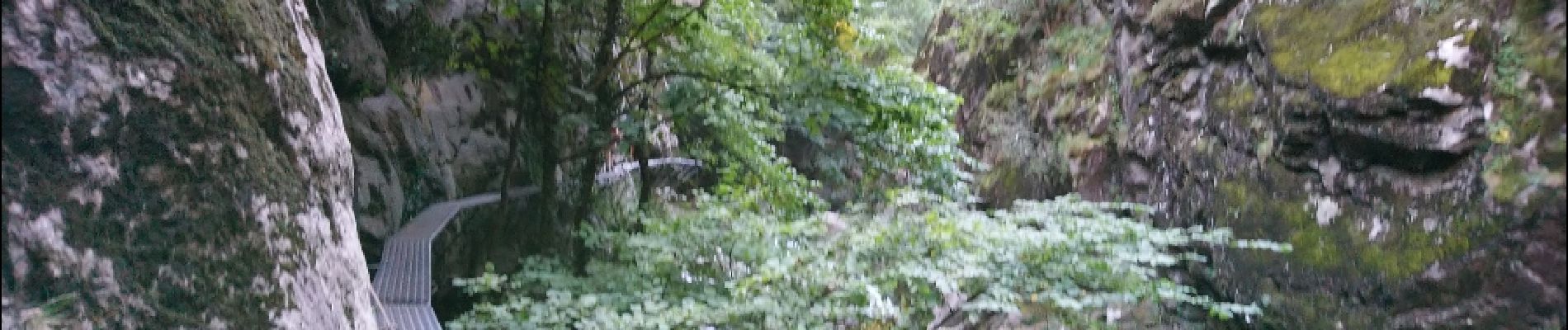
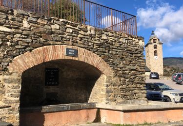
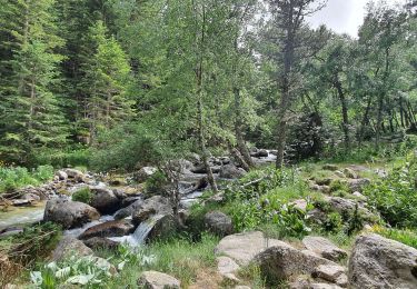
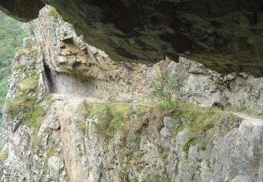
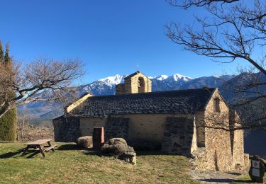
52 fotos in totaal. Klik op een foto om ze allemaal in de galerij weer te geven.

Stappen

Stappen

Stappen

Stappen

Stappen
Stappen
Stappen
Te voet
Stappen