Tocht Mountainbike Blavignac - sur les traces de benoit 46 depuis motocross - Photo

sur les traces de benoit 46 depuis motocross

 kayakiste15
kayakiste15

Gebruiker

© OpenStreetMap contributors
Lengte
Lengte
39 km
Max. hoogte
Max. hoogte
1108 m
Positief hoogteverschil
831 m
Km-Effort
Km-Effort  
51 km
Min. hoogte
Min. hoogte
871 m
Negatief hoogteverschil
864 m
Boucle
Boucle
Neen
Datum van aanmaak :
2019-05-26 09:07:00.967
Laatste wijziging :
2019-05-26 11:34:32.39

(0 Bericht)

Mountainbike
Mountainbike
2h00
Moeilijkheid : Medium

Scan deze QR-code om de tocht te openen in de SityTrail-applicatie

Gratisgps-wandelapplicatie

Logo SityTrail SityTrail

IGN / Geografische instituten

SityTrail uit de App Store downloaden SityTrail uit Google Play downloaden

Logo SityTrail SityTrail World

De wereld gaat voor u open

SityTrail uit de App Store downloaden SityTrail uit Google Play downloaden SityTrail op Huawei AppGallery downloaden

Over ons

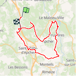
Tocht Mountainbike van 39 km beschikbaar op Occitanië, Lozère, Blavignac. Deze tocht wordt voorgesteld door kayakiste15.

Beschrijving

roulant avec des coups de cul

Hoogteprofiel

Plaatsbepaling

Land:
France
Regio :
Occitanië
Departement/Provincie :
Lozère
Gemeente :
Blavignac
Locatie:
Unknown
Vertrek:(UTM)
520727 ; 4967049 (31T) N.

Wandeltochten in de omgeving

Tocht Mountainbike Les Monts-Verts - Berc - Le Bacon vieux - Trémoulouzet - Photo
Mountainbike
JujuDelfio

Mountainbike

Medium
Les Monts-Verts, Occitanië, Lozère, France
11,7 km | 15 km-effort
1h 15min
Ja
Tocht Mountainbike Les Monts-Verts - Le Puech de Berc - Photo
Mountainbike
JujuDelfio

Mountainbike

Gemakkelijk
Les Monts-Verts, Occitanië, Lozère, France
8,7 km | 10,9 km-effort
50min
Ja
Tocht Mountainbike Les Monts-Verts - Berc - Graniboule - Photo
Mountainbike
JujuDelfio

Mountainbike

Medium
Les Monts-Verts, Occitanië, Lozère, France
35 km | 43 km-effort
2h 40min
Ja
Tocht Stappen Blavignac - Les balcons de la Truyère - Photo
Stappen
guitounette

Stappen

Zeer moeilijk
Blavignac, Occitanië, Lozère, France
16,6 km | 26 km-effort
5h 49min
Ja
Tocht Elektrische fiets Saint-Chély-d'Apcher - 3_250423 - Photo
Elektrische fiets
ricou1964

Elektrische fiets

Moeilijk
Saint-Chély-d'Apcher, Occitanië, Lozère, France
40 km | 52 km-effort
5h 22min
Neen
Tocht Stappen Val d'Arcomie - autour de St Just - Photo
Stappen
jfdeligementon

Stappen

Zeer moeilijk
Val d'Arcomie, Auvergne-Rhône-Alpes, Cantal, France
13,3 km | 19,3 km-effort
4h 22min
Ja
Tocht Mountainbike Val d'Arcomie - ST JUST 19 km VTT Loubaresse - Photo
Mountainbike
benoit48

Mountainbike

Heel gemakkelijk
Val d'Arcomie, Auvergne-Rhône-Alpes, Cantal, France
18,9 km | 26 km-effort
1h 18min
Ja
Tocht Stappen Prunières - Apcher  la Tuyère - Photo
Stappen
JEANJOSY

Stappen

Heel gemakkelijk
Prunières, Occitanië, Lozère, France
16,8 km | 22 km-effort
4h 43min
Ja


Sluiten
Mijn abonnementen