8 km | 10,9 km-effort
Caladroy
ThonyM
Gebruiker
Lengte
15,9 km
Max. hoogte
514 m
Positief hoogteverschil
433 m
Km-Effort
22 km
Min. hoogte
226 m
Negatief hoogteverschil
431 m
Boucle
Ja
Datum van aanmaak :
2020-02-19 07:42:56.0
Laatste wijziging :
2020-02-19 12:04:41.798
4h20
Moeilijkheid : Medium
Gratisgps-wandelapplicatie
Over ons
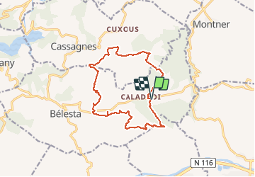
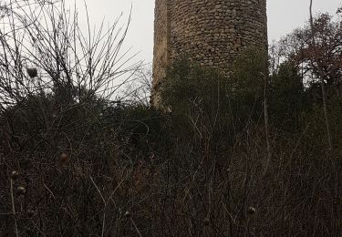
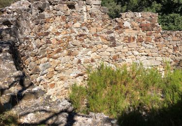
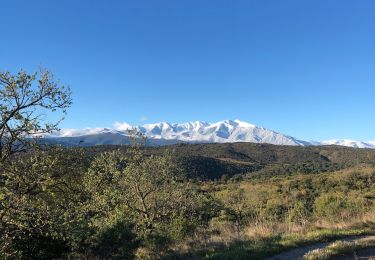
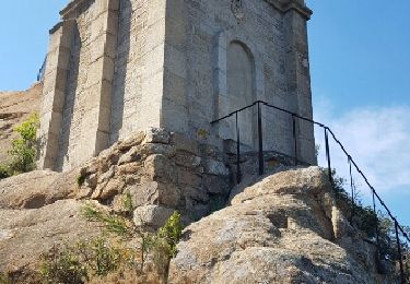
Tocht Stappen van 15,9 km beschikbaar op Occitanië, Pyrénées-Orientales, Bélesta. Deze tocht wordt voorgesteld door ThonyM.
Beschrijving
Un parcours facile et ludique. Peut-être à éviter en plein été
Plaatsbepaling
Land:
France
Regio :
Occitanië
Departement/Provincie :
Pyrénées-Orientales
Gemeente :
Bélesta
Locatie:
Unknown
Vertrek:(Dec)
Vertrek:(UTM)
471269 ; 4729960 (31T) N.
Opmerkingen
Wandeltochten in de omgeving
Boucle du Pic Aubeill
Stappen
Gemakkelijk
(1)
Bélesta,
Occitanië,
Pyrénées-Orientales,
France
2h 24min
Ja
pic d'abeille
Stappen
Heel gemakkelijk
(2)
Cassagnes,
Occitanië,
Pyrénées-Orientales,
France
8,1 km | 10,8 km-effort
3h 0min
Ja
millas n'efface millas fait le 27 02 2023
Stappen
Medium
Millas,
Occitanië,
Pyrénées-Orientales,
France
8,3 km | 9 km-effort
2h 33min
Ja
F66 Cassagnes pic Aubeill
Stappen
Gemakkelijk
Cassagnes,
Occitanië,
Pyrénées-Orientales,
France
6,3 km | 8,4 km-effort
2h 20min
Neen
Ille belesta ille
Stappen
Medium
Ille-sur-Têt,
Occitanië,
Pyrénées-Orientales,
France
16,1 km | 22 km-effort
4h 17min
Ja
20200907 tour depuis Bélesta
Stappen
Gemakkelijk
Bélesta,
Occitanië,
Pyrénées-Orientales,
France
15,5 km | 21 km-effort
4h 3min
Ja
Belesta
Stappen
Medium
Bélesta,
Occitanië,
Pyrénées-Orientales,
France
48 km | 0 m-effort
6h 42min
Neen
ille sur tet orgues église casenove et truffiere
Andere activiteiten
Heel gemakkelijk
Ille-sur-Têt,
Occitanië,
Pyrénées-Orientales,
France
16,2 km | 20 km-effort
4h 36min
Neen
Ille sur tet
Stappen
Heel gemakkelijk
Ille-sur-Têt,
Occitanië,
Pyrénées-Orientales,
France
16,4 km | 22 km-effort
6h 31min
Neen