Tocht Stappen Castelnou - Autour de Castelnou via St Marti de la Roca  - Photo

Autour de Castelnou via St Marti de la Roca

 zazie
zazie

Gebruiker

© OpenStreetMap contributors
Lengte
Lengte
13,5 km
Max. hoogte
Max. hoogte
513 m
Positief hoogteverschil
549 m
Km-Effort
Km-Effort  
21 km
Min. hoogte
Min. hoogte
193 m
Negatief hoogteverschil
547 m
Boucle
Boucle
Ja
Datum van aanmaak :
2021-02-25 10:24:44.819
Laatste wijziging :
2021-02-25 14:32:02.479

(0 Bericht)

Stappen
Stappen
3h11
Moeilijkheid : Medium

Scan deze QR-code om de tocht te openen in de SityTrail-applicatie

Gratisgps-wandelapplicatie

Logo SityTrail SityTrail

IGN / Geografische instituten

SityTrail uit de App Store downloaden SityTrail uit Google Play downloaden

Logo SityTrail SityTrail World

De wereld gaat voor u open

SityTrail uit de App Store downloaden SityTrail uit Google Play downloaden SityTrail op Huawei AppGallery downloaden

Over ons

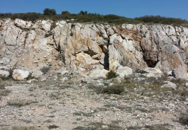
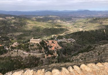
Tocht Stappen van 13,5 km beschikbaar op Occitanië, Pyrénées-Orientales, Castelnou. Deze tocht wordt voorgesteld door zazie.

Beschrijving

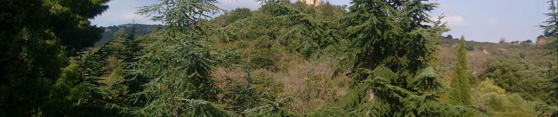
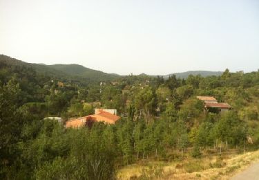
Première partie sans ombrage jusqu'à l'ermitage.
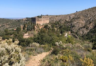
Retour à l'ombre des lièges.
Pas de point d'eau sauf à Castelnou

Hoogteprofiel

Foto's

Plaatsbepaling

Land:
France
Regio :
Occitanië
Departement/Provincie :
Pyrénées-Orientales
Gemeente :
Castelnou
Locatie:
Unknown
Vertrek:(UTM)
475691 ; 4718825 (31T) N.

Wandeltochten in de omgeving

Tocht Stappen Castelnou - CASTELNOU 66 -  CAMELAS - ermitage San Marti de La Roca - Photo
Stappen
jeff66

Stappen

Moeilijk
(1)
Castelnou, Occitanië, Pyrénées-Orientales, France
10,8 km | 16,7 km-effort
2h 19min
Ja
Tocht Stappen Thuir - Thuir à Castelnou - Photo
Stappen
timousse

Stappen

Medium
(1)
Thuir, Occitanië, Pyrénées-Orientales, France
14,1 km | 20 km-effort
4h 13min
Ja
Tocht Stappen Castelnou - Thuir  - Photo
Stappen
Jean-François BALANGER

Stappen

Heel gemakkelijk
(1)
Castelnou, Occitanië, Pyrénées-Orientales, France
9,3 km | 12,1 km-effort
4h 4min
Neen
Tocht Stappen Castelnou - castel nous  - Photo
Stappen
Jean-François BALANGER

Stappen

Heel gemakkelijk
(1)
Castelnou, Occitanië, Pyrénées-Orientales, France
11,9 km | 16,7 km-effort
4h 0min
Ja
Tocht Stappen Sainte-Colombe-de-la-Commanderie - THUIR 66 - Castelnou - Ste Colombe de la C. - Photo
Stappen
jeff66

Stappen

Medium
(2)
Sainte-Colombe-de-la-Commanderie, Occitanië, Pyrénées-Orientales, France
14,8 km | 21 km-effort
2h 56min
Ja
Tocht Stappen Montauriol - Montauriol : les points de vue. - Photo
Stappen
prehault

Stappen

Gemakkelijk
(4)
Montauriol, Occitanië, Pyrénées-Orientales, France
4 km | 5,3 km-effort
1h 8min
Ja
Tocht Stappen Camélas - Camelas Castelnou  - Photo
Stappen
fpa

Stappen

Gemakkelijk
Camélas, Occitanië, Pyrénées-Orientales, France
11,7 km | 18 km-effort
4h 4min
Ja
Tocht Stappen Sainte-Colombe-de-la-Commanderie - 20230316 Sté Colombe-Castelnou - Photo
Stappen
ThonyM

Stappen

Medium
Sainte-Colombe-de-la-Commanderie, Occitanië, Pyrénées-Orientales, France
16,3 km | 23 km-effort
3h 55min
Ja
Tocht Stappen Castelnou - 20210328 Castelnou-Camelas- boucl - Photo
Stappen
ThonyM

Stappen

Medium
Castelnou, Occitanië, Pyrénées-Orientales, France
15,4 km | 23 km-effort
4h 1min
Ja


Sluiten
Mijn abonnementen