Tocht 4x4 Casteljaloux - Houeilles girolles - Photo
 ptickt
ptickt

Gebruiker

© OpenStreetMap contributors
Lengte
Lengte
16,2 km
Max. hoogte
Max. hoogte
147 m
Positief hoogteverschil
226 m
Km-Effort
Km-Effort  
19 km
Min. hoogte
Min. hoogte
70 m
Negatief hoogteverschil
151 m
Boucle
Boucle
Neen
Datum van aanmaak :
2021-03-21 09:41:10.894
Laatste wijziging :
2021-06-09 13:58:13.758

(0 Bericht)

4x4
4x4
2h18
Moeilijkheid : Heel gemakkelijk

Scan deze QR-code om de tocht te openen in de SityTrail-applicatie

Gratisgps-wandelapplicatie

Logo SityTrail SityTrail

IGN / Geografische instituten

SityTrail uit de App Store downloaden SityTrail uit Google Play downloaden

Logo SityTrail SityTrail World

De wereld gaat voor u open

SityTrail uit de App Store downloaden SityTrail uit Google Play downloaden SityTrail op Huawei AppGallery downloaden

Over ons

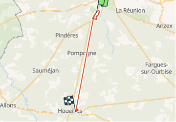
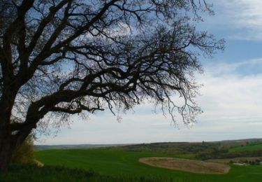
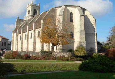
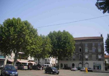
Tocht 4x4 van 16,2 km beschikbaar op Nieuw-Aquitanië, Lot-et-Garonne, Casteljaloux. Deze tocht wordt voorgesteld door ptickt.

Beschrijving

girolles

Hoogteprofiel

Plaatsbepaling

Land:
France
Regio :
Nieuw-Aquitanië
Departement/Provincie :
Lot-et-Garonne
Gemeente :
Casteljaloux
Locatie:
Unknown
Vertrek:(UTM)
266309 ; 4908828 (31T) N.

Wandeltochten in de omgeving

Tocht Te voet Pompogne - Pompogne, le clocher et le pin - 12.3 km - Photo
Te voet
PRO

Te voet

Gemakkelijk
Pompogne, Nieuw-Aquitanië, Lot-et-Garonne, France
12,1 km | 13,9 km-effort
3h 8min
Ja
Tocht Te voet Beauziac - Beauziac, balade vers l'église du Tren - 6.7 km - Photo
Te voet
PRO

Te voet

Gemakkelijk
Beauziac, Nieuw-Aquitanië, Lot-et-Garonne, France
6,5 km | 7,7 km-effort
1h 44min
Ja
Tocht Te voet Pompogne - La Réunion - La Taillade, vacances dans les bois de la Réunion - 3.4 km - Photo
Te voet
PRO

Te voet

Gemakkelijk
Pompogne, Nieuw-Aquitanië, Lot-et-Garonne, France
3 km | 3,3 km-effort
45min
Ja
Tocht Te voet La Réunion - La Réunion - La Taillade, par les églises de Beyrac et Couthures - 21.3 km - Photo
Te voet
PRO

Te voet

Medium
La Réunion, Nieuw-Aquitanië, Lot-et-Garonne, France
21 km | 25 km-effort
5h 46min
Ja
Tocht Stappen Beauziac - beauziac - Photo
Stappen
christiane01

Stappen

Gemakkelijk
Beauziac, Nieuw-Aquitanië, Lot-et-Garonne, France
6,7 km | 7,8 km-effort
2h 21min
Ja
Tocht Fiets Casteljaloux - Circuit des Cadets de Gascogne - Casteljaloux - Photo
Fiets
tracegps

Fiets

Medium
Casteljaloux, Nieuw-Aquitanië, Lot-et-Garonne, France
86 km | 103 km-effort
4h 30min
Ja
Tocht Mountainbike Casteljaloux - Casteljaloux, porte de la forêt landaise - Pays Val de Garonne - Gascogne - Photo
Mountainbike
tracegps

Mountainbike

Medium
Casteljaloux, Nieuw-Aquitanië, Lot-et-Garonne, France
9,2 km | 11,1 km-effort
1h 15min
Ja
Tocht Stappen Casteljaloux - Casteljaloux, porte de la forêt landaise - Pays Val de Garonne - Gascogne - Photo
Stappen
tracegps

Stappen

Medium
Casteljaloux, Nieuw-Aquitanië, Lot-et-Garonne, France
9,2 km | 11,1 km-effort
3h 0min
Ja
Tocht Mountainbike Casteljaloux - Casteljaloux, au pays des Cadets de Gascogne - Pays Val de Garonne - Gascogne - Photo
Mountainbike
tracegps

Mountainbike

Moeilijk
Casteljaloux, Nieuw-Aquitanië, Lot-et-Garonne, France
17,5 km | 20 km-effort
2h 15min
Ja


Sluiten
Mijn abonnementen