


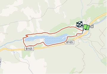

5,7 km | 7,7 km-effort

Tous les sentiers balisés d’Europe PRO


Gratisgps-wandelapplicatie
 SityTrail
IGN / Geografische instituten
SityTrail World
De wereld gaat voor u open
Tocht Te voet van 3,1 km beschikbaar op Tirol, Bezirk Schwaz, Gemeinde Gerlos. Deze tocht wordt voorgesteld door SityTrail - itinéraires balisés pédestres.
Trail created by Gerlos.
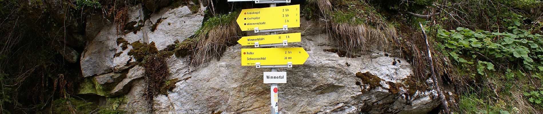
Symbol: Gelbe Blechschilder mit blauem Richtungspfeil und violettem, unteren Rand


Te voet
Te voet

Te voet

Te voet
Te voet

Stappen
Stappen
Stappen
Stappen