


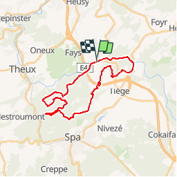


10,8 km | 14,6 km-effort


Gebruiker


Gratisgps-wandelapplicatie
 SityTrail
IGN / Geografische instituten
SityTrail World
De wereld gaat voor u open
Tocht Mountainbike van 24 km beschikbaar op Wallonië, Luik, Jalhay. Deze tocht wordt voorgesteld door francois58.
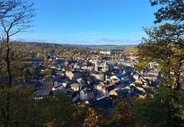
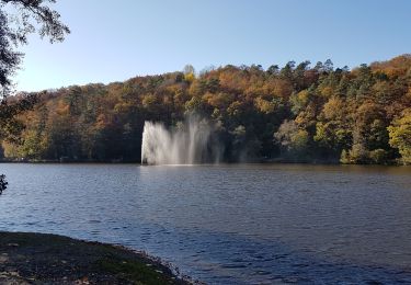
Superbe rando tant par ses paysages que par ses sentes et sentiers - qqs passages un tout petit peu techniques - merci Pierre pour ce beau guidage !

Stappen

Stappen

Stappen

Stappen

Te voet
Stappen

Stappen
Stappen

Lopen