


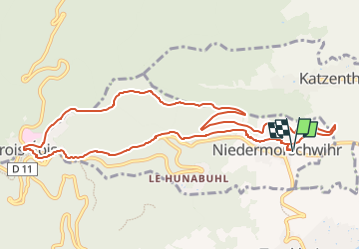

17,1 km | 25 km-effort


Gebruiker


Gratisgps-wandelapplicatie
 SityTrail
IGN / Geografische instituten
SityTrail World
De wereld gaat voor u open
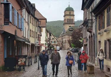
Tocht Stappen van 11 km beschikbaar op Grand Est, Haut-Rhin, Niedermorschwihr. Deze tocht wordt voorgesteld door E.BURCK.
Pour aller aux Trois Epis au départ de Niedermorschwihr pour faciliter le circuit. Dénivelé de 420 m et 10.9 km au total.
ACCÈS :
- direction Colmar puis par Ingersheim direction Trois Epis, puis Niedermorschwihr.
PARKING :
- à droite à l'entrée de Niedermorschwihr en venant de Ingersheim. Au cas ou il n'y aurait plus de place il y a un deuxième parking près du cimetière, il faut prendre la première rue à gauche.
48.099861, 7.276621 ou
N 48°05'59", E 07°16'36"
RESTAURATION : Restaurant "Le Turckheim Croix d'Or"
aux Trois Epis
Tél.: 03 89 49 83 55

Stappen

Stappen
Stappen
Paardrijden
Paardrijden

Mountainbike

Stappen
Stappen

Te voet