Tocht Stappen Aubais - VILLETELLE 30 - LA ROQUE D'AUBAIS - AUBAIS - Photo

VILLETELLE 30 - LA ROQUE D'AUBAIS - AUBAIS

 jeff66
jeff66

Gebruiker

© OpenStreetMap contributors
Lengte
Lengte
14,2 km
Max. hoogte
Max. hoogte
98 m
Positief hoogteverschil
216 m
Km-Effort
Km-Effort  
17 km
Min. hoogte
Min. hoogte
14 m
Negatief hoogteverschil
216 m
Boucle
Boucle
Ja
Datum van aanmaak :
2015-06-08 00:00:00.0
Laatste wijziging :
2015-06-08 00:00:00.0

(0 Bericht)

Stappen
Stappen
2h24
Moeilijkheid : Medium

Scan deze QR-code om de tocht te openen in de SityTrail-applicatie

Gratisgps-wandelapplicatie

Logo SityTrail SityTrail

IGN / Geografische instituten

SityTrail uit de App Store downloaden SityTrail uit Google Play downloaden

Logo SityTrail SityTrail World

De wereld gaat voor u open

SityTrail uit de App Store downloaden SityTrail uit Google Play downloaden SityTrail op Huawei AppGallery downloaden

Over ons

Tocht Stappen van 14,2 km beschikbaar op Occitanië, Gard, Aubais. Deze tocht wordt voorgesteld door jeff66.

Beschrijving

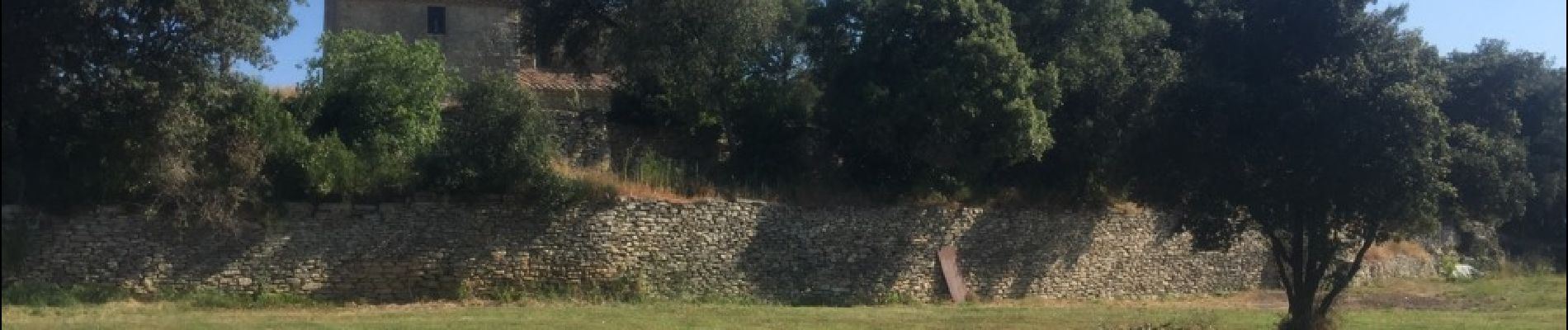
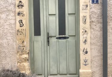
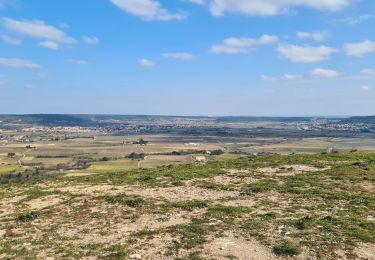
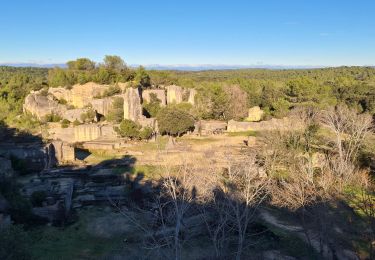
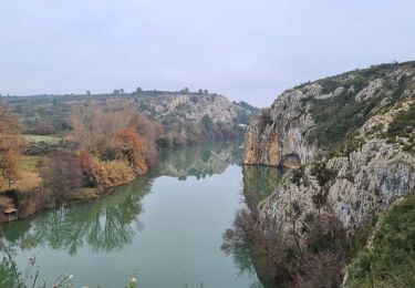
VILLETELLE 30 - Moulin à eau de Carrière - chemin de Peysal - LA ROQUE D'AUBAIS - piste DFCI C42 - berges du Vidourle - plaine et garrigues de la Roque - panorama sur le pic St loup les Cévennes - le cros de Faye i- chemin du moulin à vent - Condamine - mas de Nouis - cimetière c- Mas Begon - AUBAIS  - rue des Cazeaux - Mas de Rieu - chemin du Rieu - chemin DFCI C12 - villa des pins - Valecroze - oliveraie - chemin dans les bois - Puech de Villeneuve - pylône - garrigues planes - la pierre plantée - PEYRA plantada le menhir - pin de Mistico - Mas de Riquet - mas de Lauziére - chemin du mas de Foukart - église St Nazaire - mas du four à chaux - romarin - écurie du pont romain - le travers - chemin de la maisonnette de Danton - grand chemin

Hoogteprofiel

Foto's

Plaatsbepaling

Land:
France
Regio :
Occitanië
Departement/Provincie :
Gard
Gemeente :
Aubais
Locatie:
Unknown
Vertrek:(Dec)
Vertrek:(UTM)
592078 ; 4843393 (31T) N.

Wandeltochten in de omgeving

Tocht Stappen Sommières -  SOMMIERES 30 - VILLEVIEILLE châteaux- JUNAS les carrières  - Photo
Stappen
jeff66

Stappen

Medium
(2)
Sommières, Occitanië, Gard, France
14 km | 16,9 km-effort
2h 34min
Ja
Tocht Mountainbike Villetelle - Grande Traversée de l'Hérault à VTT - De Ambrussum à Fondespierre - Photo
Mountainbike
tracegps

Mountainbike

Medium
(2)
Villetelle, Occitanië, Hérault, France
29 km | 33 km-effort
3h 30min
Neen
Tocht Stappen Junas - Entre Junas et Aujargues - Photo
Stappen
GUIDE
randotines

Stappen

Gemakkelijk
Junas, Occitanië, Gard, France
7,9 km | 9,4 km-effort
2h 2min
Ja
Tocht Paard Gallargues-le-Montueux - Aujargues - Photo
Paard
N-Letessier

Paard

Gemakkelijk
(1)
Gallargues-le-Montueux, Occitanië, Gard, France
28 km | 32 km-effort
5h 33min
Ja
Tocht Stappen Sommières - Autour de Villevielle 30 - Photo
Stappen
guignier

Stappen

Gemakkelijk
(2)
Sommières, Occitanië, Gard, France
10,5 km | 12,3 km-effort
3h 0min
Ja
Tocht Stappen Junas - Aubais  - Photo
Stappen
Galoche

Stappen

Heel gemakkelijk
Junas, Occitanië, Gard, France
6,4 km | 7,8 km-effort
1h 39min
Ja
Tocht Stappen Congénies - congenies-lemazet-calvisson - Photo
Stappen
v.rabot

Stappen

Medium
Congénies, Occitanië, Gard, France
16,9 km | 21 km-effort
5h 0min
Ja
Tocht Stappen Aubais - Aubais-junas-moulin_de_corbières - Photo
Stappen
v.rabot

Stappen

Medium
Aubais, Occitanië, Gard, France
15,5 km | 18,3 km-effort
5h 0min
Ja
Tocht Stappen Villetelle - villetelle  - Photo
Stappen
v.rabot

Stappen

Gemakkelijk
Villetelle, Occitanië, Hérault, France
6,6 km | 7,9 km-effort
1h 34min
Ja


Sluiten
Mijn abonnementen