Tocht Stappen Err - d'Err à Bolquère - Photo
 gberger
gberger

Gebruiker

© OpenStreetMap contributors
Lengte
Lengte
12,9 km
Max. hoogte
Max. hoogte
1629 m
Positief hoogteverschil
487 m
Km-Effort
Km-Effort  
18,5 km
Min. hoogte
Min. hoogte
1351 m
Negatief hoogteverschil
224 m
Boucle
Boucle
Neen
Datum van aanmaak :
2015-09-20 00:00:00.0
Laatste wijziging :
2015-09-20 00:00:00.0

(0 Bericht)

Stappen
Stappen
4h10
Moeilijkheid : Gemakkelijk

Scan deze QR-code om de tocht te openen in de SityTrail-applicatie

Gratisgps-wandelapplicatie

Logo SityTrail SityTrail

IGN / Geografische instituten

SityTrail uit de App Store downloaden SityTrail uit Google Play downloaden

Logo SityTrail SityTrail World

De wereld gaat voor u open

SityTrail uit de App Store downloaden SityTrail uit Google Play downloaden SityTrail op Huawei AppGallery downloaden

Over ons

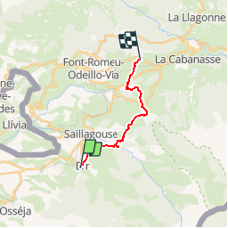
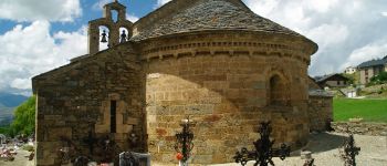
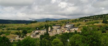
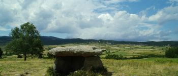
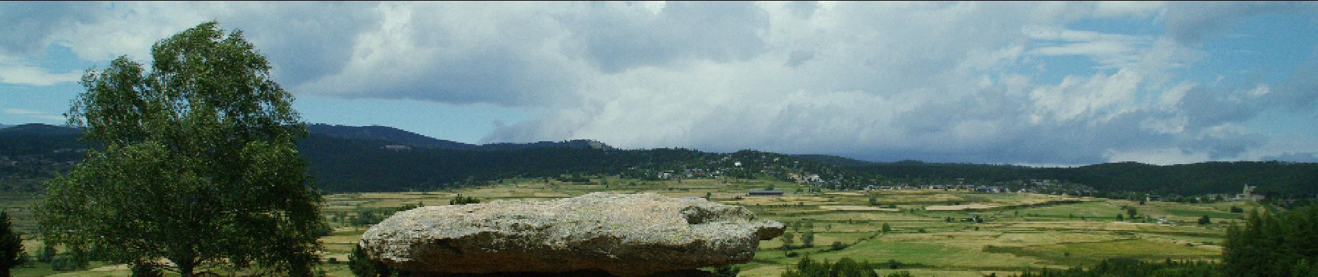
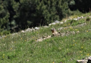
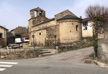
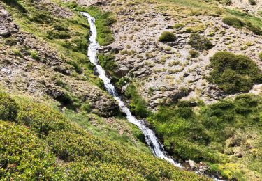
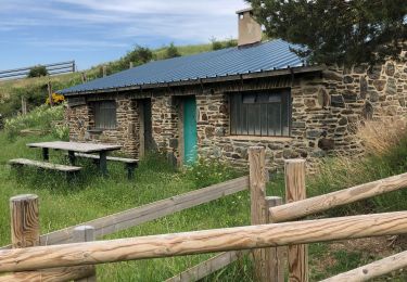
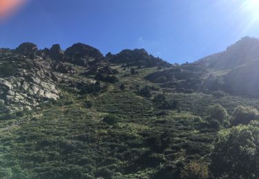
Tocht Stappen van 12,9 km beschikbaar op Occitanië, Pyrénées-Orientales, Err. Deze tocht wordt voorgesteld door gberger.

Beschrijving

Une randonnée sur le plateau de Cerdagne à combiner avec un aller ou un retour par le train jaune, de Bolquère à Err.
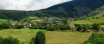
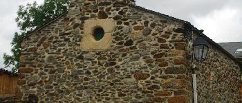
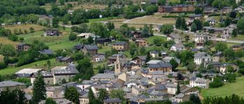
Hoogteprofiel

Foto's

POI's

POI Saillagouse - Vedrinyans - Photo
gberger
SAILLAGOUSE 
POI Saillagouse - Chapelle de Vedrinyans - Photo
gberger
POI Saillagouse - Sallagouse - Photo
gberger
SAILLAGOUSE 
POI Llo - Llo - Photo
gberger
LLO 
POI Eyne - Eyne - Photo
gberger
EYNE 
POI Eyne - Dolmen - Photo
gberger
EYNE 

Plaatsbepaling

Land:
France
Regio :
Occitanië
Departement/Provincie :
Pyrénées-Orientales
Gemeente :
Err
Locatie:
Unknown
Vertrek:(Dec)
Vertrek:(UTM)
420398 ; 4699032 (31T) N.

Wandeltochten in de omgeving

Tocht Stappen Nahuja - boucle de Nahuja - Photo
Stappen
crijack

Stappen

Medium
(1)
Nahuja, Occitanië, Pyrénées-Orientales, France
11,8 km | 18,2 km-effort
2h 44min
Ja
Tocht Stappen Eyne - Eyne,col de Nuria,pic d'Eyne,Torre d'Eyne,Eyne. - Photo
Stappen
Machaon6

Stappen

Zeer moeilijk
(1)
Eyne, Occitanië, Pyrénées-Orientales, France
24 km | 43 km-effort
8h 44min
Ja
Tocht Stappen Eyne - Vallée d'Eyne - Photo
Stappen
GUIDE
nadinebondoux

Stappen

Medium
Eyne, Occitanië, Pyrénées-Orientales, France
10,7 km | 17,6 km-effort
4h 40min
Ja
Tocht Stappen Eyne - eyne - Photo
Stappen
gardelg

Stappen

Medium
(2)
Eyne, Occitanië, Pyrénées-Orientales, France
6,2 km | 8,2 km-effort
2h 1min
Ja
Tocht Stappen Eyne - La vallée d'Eyne - Photo
Stappen
suresnois

Stappen

Moeilijk
Eyne, Occitanië, Pyrénées-Orientales, France
11,2 km | 18 km-effort
7h 8min
Ja
Tocht Stappen Estavar - 20220328 Estavar-Tartassonne(?) - Photo
Stappen
ThonyM

Stappen

Medium
Estavar, Occitanië, Pyrénées-Orientales, France
14,8 km | 22 km-effort
3h 16min
Ja
Tocht Stappen Eyne - 20210722 vallée d’Eyne-Pic de Nuria et Finestrelle - Photo
Stappen
ThonyM

Stappen

Moeilijk
Eyne, Occitanië, Pyrénées-Orientales, France
21 km | 37 km-effort
5h 56min
Ja
Tocht Stappen Saillagouse - 20210627 à partir de Saillagouse  - Photo
Stappen
ThonyM

Stappen

Medium
(1)
Saillagouse, Occitanië, Pyrénées-Orientales, France
16,2 km | 26 km-effort
3h 47min
Ja
Tocht Stappen Eyne - valle´e d'Eyne - Photo
Stappen
altaya

Stappen

Gemakkelijk
(1)
Eyne, Occitanië, Pyrénées-Orientales, France
13,7 km | 23 km-effort
4h 17min
Ja


Sluiten
Mijn abonnementen