Villar-Saint-Pancrace, Hautes-Alpes, On foot: Best trails, routes and walks

3 comments

Villar-Saint-Pancrace: Discover the best trails: 1 on foot, 34 walking, 1 nordic walking and 1 running. All these trails, routes and outdoor activities are available in our SityTrail applications for smartphones and tablets.


The best trails (37)

Trail Walking Villar-Saint-Pancrace - Briançonnais Chalets des Ayes - Photo
Walking 7.105
Km

Walking

Medium
Villar-Saint-Pancrace, Provence-Alpes-Côte d'Azur, Hautes-Alpes, France
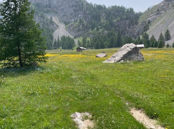
7.1 km | 12 km-effort
2h 15min
367 m
366 m
Yes
Orcal37

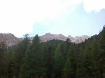
• Briançonnais - boucle à partir de Chalets des Ayes

Trail Walking Villar-Saint-Pancrace - crête de Vallouret - Photo
Walking 11.472
Km

Walking

Medium
Villar-Saint-Pancrace, Provence-Alpes-Côte d'Azur, Hautes-Alpes, France
11.5 km | 22 km-effort
6h 9min
760 m
769 m
Yes
orsel

Trail Walking Villar-Saint-Pancrace - tour de peyre eraute - Photo
Walking 28.329
Km

Walking

Medium
Villar-Saint-Pancrace, Provence-Alpes-Côte d'Azur, Hautes-Alpes, France
28 km | 50 km-effort
6h 44min
1642 m
1638 m
Yes
tchoua

Trail Walking Villar-Saint-Pancrace - 190628orceyrette - Photo
Walking 7.993
Km

Walking

Very easy
Villar-Saint-Pancrace, Provence-Alpes-Côte d'Azur, Hautes-Alpes, France
8 km | 12.7 km-effort
3h 30min
353 m
352 m
Yes
michelfehrenbach

Trail Walking Villar-Saint-Pancrace - Lac de l'Orceyrette, depuis chalet des Ayes 30-07-18 - Photo
Walking 9.323
Km

Walking

Easy
Villar-Saint-Pancrace, Provence-Alpes-Côte d'Azur, Hautes-Alpes, France
9.3 km | 13.6 km-effort
2h 51min
329 m
292 m
No
annefrance70

Trail Walking Villar-Saint-Pancrace - fort breton - Photo
Walking 11.855
Km

Walking

Very difficult
Villar-Saint-Pancrace, Provence-Alpes-Côte d'Azur, Hautes-Alpes, France
11.9 km | 21 km-effort
5h 35min
711 m
710 m
Yes
louisalexandre

Trail Walking Villar-Saint-Pancrace - 20230627 Briancon La cachalot - Photo
Walking 18.068
Km

Walking

Very difficult
Villar-Saint-Pancrace, Provence-Alpes-Côte d'Azur, Hautes-Alpes, France
18.1 km | 33 km-effort
7h 0min
1244 m
825 m
No
Jean-Marc Golberg

Trail Walking Villar-Saint-Pancrace - La boucle du fort de la Croix de Bretagne - Photo
Walking 10.512
Km

Walking

Medium
(3)
Villar-Saint-Pancrace, Provence-Alpes-Côte d'Azur, Hautes-Alpes, France
10.5 km | 19.6 km-effort
Unknown
679 m
679 m
Yes
puchol

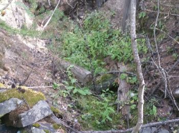
• Partez à travers les bois pour découvrir ce fort construit entre 1876 et 1879 . Cette randonnée sous forme de boucle ...

Trail Walking Villar-Saint-Pancrace - Rando lac de l'orceyrette 23 06 2022 Gr C - Photo
Walking 9.255
Km

Walking

Easy
Villar-Saint-Pancrace, Provence-Alpes-Côte d'Azur, Hautes-Alpes, France
9.3 km | 14.6 km-effort
2h 54min
398 m
397 m
Yes
lizeretti

Trail Walking Villar-Saint-Pancrace - Lac du Plan Vallon - Photo
Walking 13.936
Km

Walking

Medium
Villar-Saint-Pancrace, Provence-Alpes-Côte d'Azur, Hautes-Alpes, France
13.9 km | 25 km-effort
5h 47min
865 m
865 m
Yes
jpb83

Trail Walking Villar-Saint-Pancrace - le lac orceyrette avril 21 - Photo
Walking 15.752
Km

Walking

Easy
Villar-Saint-Pancrace, Provence-Alpes-Côte d'Azur, Hautes-Alpes, France
15.8 km | 25 km-effort
3h 50min
664 m
679 m
Yes
Evenc

Trail Walking Villar-Saint-Pancrace - Saint Pancrace botanique (05) - Photo
Walking 3.09
Km

Walking

Easy
Villar-Saint-Pancrace, Provence-Alpes-Côte d'Azur, Hautes-Alpes, France
3.1 km | 5.6 km-effort
2h 3min
188 m
185 m
Yes
JeanPierreNancy

Trail Walking Villar-Saint-Pancrace - Lac de l’Orceylerette - Photo
Walking 6.74
Km

Walking

Medium
Villar-Saint-Pancrace, Provence-Alpes-Côte d'Azur, Hautes-Alpes, France
6.7 km | 9.4 km-effort
2h 48min
201 m
192 m
Yes
dmarquaire

Trail Walking Villar-Saint-Pancrace - grand tour de l'orceyrette - Photo
Walking 14.182
Km

Walking

Difficult
Villar-Saint-Pancrace, Provence-Alpes-Côte d'Azur, Hautes-Alpes, France
14.2 km | 23 km-effort
4h 28min
677 m
677 m
Yes
mc&jf

Trail Walking Villar-Saint-Pancrace - fort de Bretagne  - Photo
Walking 11.62
Km

Walking

Medium
Villar-Saint-Pancrace, Provence-Alpes-Côte d'Azur, Hautes-Alpes, France
11.6 km | 21 km-effort
5h 39min
710 m
709 m
Yes
puchol

Trail Walking Villar-Saint-Pancrace - Lac d’Orceyrette - 5km-2h-128m - Photo
Walking 5.689
Km

Walking

Easy
Villar-Saint-Pancrace, Provence-Alpes-Côte d'Azur, Hautes-Alpes, France
5.7 km | 7.4 km-effort
2h 2min
126 m
127 m
Yes
delalex

Trail Walking Villar-Saint-Pancrace - 20230627 gta étape 22 - Photo
Walking 17.845
Km

Walking

Difficult
Villar-Saint-Pancrace, Provence-Alpes-Côte d'Azur, Hautes-Alpes, France
17.8 km | 34 km-effort
7h 2min
1285 m
866 m
No
marieamelie

Trail Nordic walking Villar-Saint-Pancrace - cerveyette chemin nord - Photo
Nordic walking 2.484
Km

Nordic walking

Very easy
Villar-Saint-Pancrace, Provence-Alpes-Côte d'Azur, Hautes-Alpes, France
2.5 km | 4.3 km-effort
21min
164 m
46 m
No
Evenc

Trail Walking Villar-Saint-Pancrace - Col de Taure / Lac Orseyere - Photo
Walking 12.37
Km

Walking

Medium
Villar-Saint-Pancrace, Provence-Alpes-Côte d'Azur, Hautes-Alpes, France
12.4 km | 20 km-effort
4h 11min
585 m
586 m
Yes
EGalifer

Trail Walking Villar-Saint-Pancrace - Col des Ayes en circuit - Photo
Walking 16.388
Km

Walking

Medium
Villar-Saint-Pancrace, Provence-Alpes-Côte d'Azur, Hautes-Alpes, France
16.4 km | 27 km-effort
7h 17min
827 m
828 m
Yes
radisnoir

20 trails displayed on 37

FREE GPS app for hiking

Logo SityTrail SityTrail

IGN / Geographical institutes

Download SityTrail from the App Store Download SityTrail from Google Play

Logo SityTrail SityTrail World

The world is yours!

Download SityTrail from the App Store Download SityTrail from Google Play Download SityTrail on Huawei AppGallery

Activities

Close
My subscriptions