Hautes-Alpes, Provence-Alpes-Côte d'Azur, On foot: Best trails, routes and walks

655 comments

Hautes-Alpes: Discover the best trails: 196 on foot, 6877 walking, 80 nordic walking, 117 running and 52 trail. All these trails, routes and outdoor activities are available in our SityTrail applications for smartphones and tablets.


The best trails (7303)

Trail Walking Crévoux - La Cascade de Razis - Photo
Walking 7.226
Km

Walking

Medium
(5)
Crévoux, Provence-Alpes-Côte d'Azur, Hautes-Alpes, France
7.2 km | 11 km-effort
3h 30min
280 m
281 m
Yes
tracegps

Trail Walking Crots - Le Cirque de Morgon - Photo
Walking 10.586
Km

Walking

Difficult
(5)
Crots, Provence-Alpes-Côte d'Azur, Hautes-Alpes, France
10.6 km | 21 km-effort
5h 30min
787 m
785 m
Yes
tracegps

Trail Walking Les Orres - le pic de Boussolenc par la tête du vallon Rémollon - Photo
Walking 7.724
Km
GUIDE

Walking

Medium
(1)
Les Orres, Provence-Alpes-Côte d'Azur, Hautes-Alpes, France
7.7 km | 13.7 km-effort
4h 50min
447 m
446 m
Yes
amiral13

Trail Walking Orcières - Le Forest des marches - Photo
Walking 6.255
Km
GUIDE

Walking

Easy
(2)
Orcières, Provence-Alpes-Côte d'Azur, Hautes-Alpes, France
6.3 km | 9.9 km-effort
1h 42min
263 m
290 m
Yes
nadinebondoux

Trail Walking Vallouise-Pelvoux - 2020-09-09 Marche Lac de L'Eychauda - Photo
Walking 14.486
Km
GUIDE

Walking

Easy
(1)
Vallouise-Pelvoux, Provence-Alpes-Côte d'Azur, Hautes-Alpes, France
14.5 km | 28 km-effort
6h 2min
977 m
979 m
Yes
holtzv

Trail Walking Le Saix - R08 La boucle des cascades jaunes - Photo
Walking 5.461
Km
GUIDE+

Walking

Very easy
(1)
Le Saix, Provence-Alpes-Côte d'Azur, Hautes-Alpes, France
5.5 km | 10.3 km-effort
2h 10min
365 m
365 m
Yes
Camping Les Rives du Lac

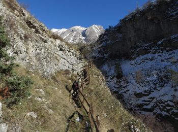
• Very nice hike from the village of Saix (810m). The start is at the metal cross at the back of the church. Going down...

Trail Walking Théus - R47   Les Demoiselles Coiffees - Photo
Walking 6.738
Km
GUIDE+

Walking

Very easy
(2)
Théus, Provence-Alpes-Côte d'Azur, Hautes-Alpes, France
6.7 km | 13.4 km-effort
2h 31min
487 m
532 m
Yes
Camping Les Rives du Lac

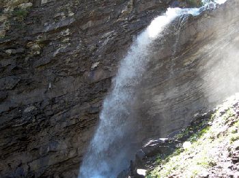
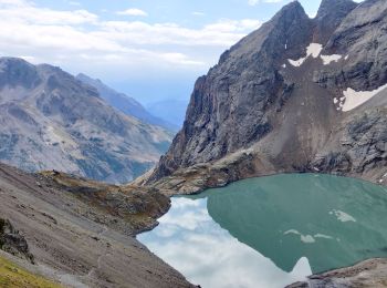
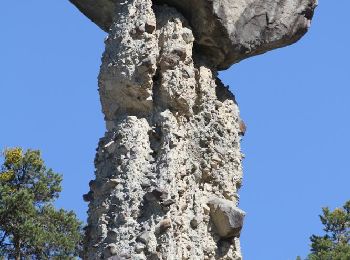
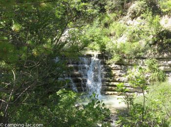
• Very nice phenomenon due to glacial erosion." Complete explanations available on this site: Formation of the young la...

Trail Walking La Faurie - R40   Les Marmites du Diable - Photo
Walking 5.872
Km
GUIDE+

Walking

Medium
(6)
La Faurie, Provence-Alpes-Côte d'Azur, Hautes-Alpes, France
5.9 km | 10.4 km-effort
2h 7min
341 m
341 m
Yes
Camping Les Rives du Lac

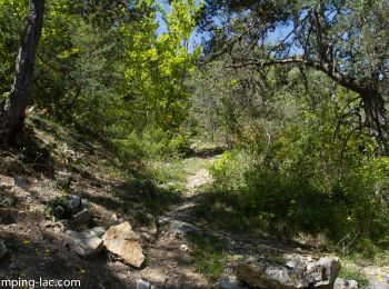
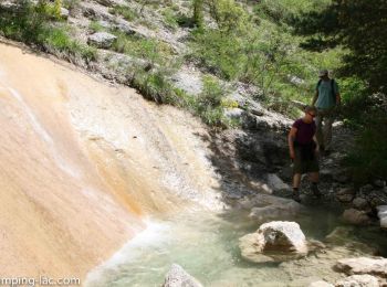
• A varied hike, starting along the pots (where you can swim), then crossing a forest before accessing a track. On the ...

Trail Walking Le Dévoluy - R29   La crete des Beaumes - Photo
Walking 8.959
Km
GUIDE+

Walking

Medium
(2)
Le Dévoluy, Provence-Alpes-Côte d'Azur, Hautes-Alpes, France
9 km | 16 km-effort
3h 17min
525 m
526 m
Yes
Camping Les Rives du Lac

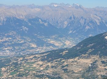
• A rather short and easy hike but which offers a circular point of view on the whole massif. To do if you only have t...

Trail Walking Le Dévoluy - R28   Le Col de Rabou - Photo
Walking 10.601
Km
GUIDE+

Walking

Medium
(1)
Le Dévoluy, Provence-Alpes-Côte d'Azur, Hautes-Alpes, France
10.6 km | 17.9 km-effort
3h 52min
548 m
547 m
Yes
Camping Les Rives du Lac

• A nice hike which provides views on the valley. Be quiet and look around, bighorn sheeps are never far in this area !

Trail Walking Le Dévoluy - R27   Les gorges du Rif - Photo
Walking 7.504
Km
GUIDE+

Walking

Easy
(1)
Le Dévoluy, Provence-Alpes-Côte d'Azur, Hautes-Alpes, France
7.5 km | 11.5 km-effort
2h 27min
302 m
302 m
Yes
Camping Les Rives du Lac

• Easy hike through the beautiful Rif Gorges. This hike can be lengthened by following the road of the Col du Noyer and...

Trail Walking Manteyer - R14   Pic de Ceuze - Photo
Walking 9.571
Km
GUIDE+

Walking

Medium
(5)
Manteyer, Provence-Alpes-Côte d'Azur, Hautes-Alpes, France
9.6 km | 15.6 km-effort
4h 30min
454 m
457 m
Yes
Camping Les Rives du Lac

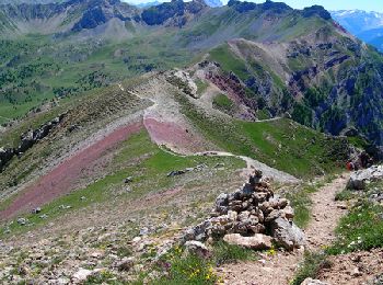
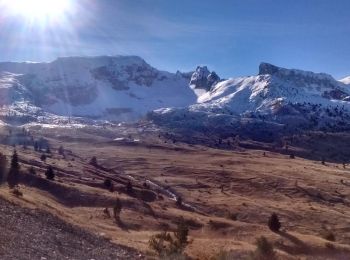
• The cliff of Céüse offers one of the most beautiful views of the Alps. Begin the hike by heading west so that the sun...

Trail Walking Le Dévoluy - R13   Le Col de Lauteret - Photo
Walking 8.484
Km
GUIDE+

Walking

Medium
(1)
Le Dévoluy, Provence-Alpes-Côte d'Azur, Hautes-Alpes, France
8.5 km | 15.9 km-effort
3h 12min
552 m
560 m
Yes
Camping Les Rives du Lac

• "A trail leaves in a beautiful valley and follows a meadow.A easy hike with a beautiful view of the Bure massif.It is...

Trail Walking Le Dévoluy - R12   Le Col des Aiguilles - Photo
Walking 10.16
Km
GUIDE+

Walking

Medium
(1)
Le Dévoluy, Provence-Alpes-Côte d'Azur, Hautes-Alpes, France
10.2 km | 19.2 km-effort
3h 56min
676 m
676 m
Yes
Camping Les Rives du Lac

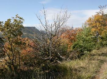
• A magnificent hike taking the GR94 from the Col du Festre, in a protected valley. Beautiful passage over the waterfal...

Trail Walking Le Dévoluy - R11   Cabane Rama - Photo
Walking 5.481
Km
GUIDE+

Walking

Very easy
(4)
Le Dévoluy, Provence-Alpes-Côte d'Azur, Hautes-Alpes, France
5.5 km | 8.4 km-effort
1h 46min
219 m
222 m
Yes
Camping Les Rives du Lac

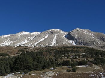
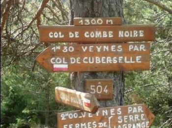
• "The Col du Festre is the boundary between Buëch and Dévoluy and a major climate barrier between southern Alps and n...

Trail Walking Veynes - R10   Le tour des Eygaux - Photo
Walking 7.823
Km
GUIDE+

Walking

Very easy
(4)
Veynes, Provence-Alpes-Côte d'Azur, Hautes-Alpes, France
7.8 km | 11.3 km-effort
2h 24min
263 m
263 m
Yes
Camping Les Rives du Lac

• Pleasant hike mostly in the woods, which crosses the 2 trays of Eygaux. Beautiful view of Dévoluy, the Longeagne moun...

Trail Walking Veynes - R09   Le tour de Veynes - Photo
Walking 9.516
Km
GUIDE+

Walking

Very easy
(3)
Veynes, Provence-Alpes-Côte d'Azur, Hautes-Alpes, France
9.5 km | 12.3 km-effort
2h 40min
206 m
206 m
Yes
Camping Les Rives du Lac

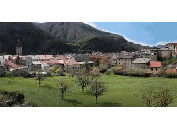
• Small family hike that will allow you to discover the old town of Veynes, the Roman road. Nice view of the valley fro...

Trail Walking Le Saix - R07   le fai - Photo
Walking 5.143
Km
GUIDE+

Walking

Easy
(4)
Le Saix, Provence-Alpes-Côte d'Azur, Hautes-Alpes, France
5.1 km | 8 km-effort
1h 42min
218 m
217 m
Yes
Camping Les Rives du Lac

• A hike from the pretty village of Saix. The parade of Gouravour is impressive. The break at the farm of Faï is always...

Trail Walking Veynes - R06   glaise - Photo
Walking 9.065
Km
GUIDE+

Walking

Easy
(1)
Veynes, Provence-Alpes-Côte d'Azur, Hautes-Alpes, France
9.1 km | 14.9 km-effort
3h 4min
440 m
444 m
Yes
Camping Les Rives du Lac

• Balade très agréable dans les alpages et en sous bois. Nous vous conseillons de monter en direction du col de la Sell...

Trail Walking Veynes - R52   Le col de Cuberselle - Photo
Walking 10.766
Km
GUIDE+

Walking

Medium
(3)
Veynes, Provence-Alpes-Côte d'Azur, Hautes-Alpes, France
10.8 km | 17.2 km-effort
3h 31min
480 m
476 m
Yes
Camping Les Rives du Lac

• A varied hike between the plateau and mountain pastures Egarets contained. The start is located at the pool Veynes. I...

20 trails displayed on 7303

FREE GPS app for hiking

Logo SityTrail SityTrail

IGN / Geographical institutes

Download SityTrail from the App Store Download SityTrail from Google Play

Logo SityTrail SityTrail World

The world is yours!

Download SityTrail from the App Store Download SityTrail from Google Play Download SityTrail on Huawei AppGallery

Activities

Nearby regions

Close
My subscriptions