Fontcouverte-la-Toussuire, Savoy: Best trails, routes and walks

2 comments

Fontcouverte-la-Toussuire: Discover the best trails: 31 hiking trails and 4 bike and mountain-bike routes. All these trails, routes and outdoor activities are available in our SityTrail applications for smartphones and tablets.


The best trails (46)
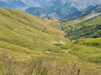
Trail Walking Fontcouverte-la-Toussuire - L'Ouillon - Photo
Walking 11.629
Km

Walking

Difficult
Fontcouverte-la-Toussuire, Auvergne-Rhône-Alpes, Savoy, France
11.6 km | 22 km-effort
4h 59min
758 m
754 m
Yes
fredmig67

Trail Snowshoes Fontcouverte-la-Toussuire - la Toussuire  - cret Morandet -le grand Truc  - Photo
Snowshoes 6.426
Km

Snowshoes

Very easy
Fontcouverte-la-Toussuire, Auvergne-Rhône-Alpes, Savoy, France
6.4 km | 13.2 km-effort
2h 53min
511 m
508 m
Yes
GEGERANDO17

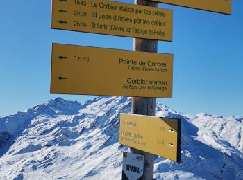
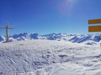
Trail Nordic walking Fontcouverte-la-Toussuire - crêtes Toussuire Corbier - Photo
Nordic walking 17.005
Km

Nordic walking

Difficult
Fontcouverte-la-Toussuire, Auvergne-Rhône-Alpes, Savoy, France
17 km | 32 km-effort
6h 33min
1073 m
1218 m
No
fb73300

Trail Walking Fontcouverte-la-Toussuire - 20190811 Toussuire - Croix de Coin Cavour - Cime de l'Ouillon - Photo
Walking 12.679
Km

Walking

Medium
Fontcouverte-la-Toussuire, Auvergne-Rhône-Alpes, Savoy, France
12.7 km | 23 km-effort
3h 47min
757 m
759 m
No
Fabricecha

Trail Walking Fontcouverte-la-Toussuire - Toussuire - 3 croix - Photo
Walking 7.804
Km

Walking

Medium
Fontcouverte-la-Toussuire, Auvergne-Rhône-Alpes, Savoy, France
7.8 km | 13.1 km-effort
3h 55min
397 m
396 m
Yes
jeanboulay

Trail Mountain bike Fontcouverte-la-Toussuire - VTT Toussuire - Photo
Mountain bike 17.229
Km

Mountain bike

Difficult
(1)
Fontcouverte-la-Toussuire, Auvergne-Rhône-Alpes, Savoy, France
17.2 km | 28 km-effort
1h 46min
792 m
792 m
Yes
philmascio

Trail Walking Fontcouverte-la-Toussuire - Toussuire - 3 croix - Photo
Walking 7.803
Km

Walking

Medium
Fontcouverte-la-Toussuire, Auvergne-Rhône-Alpes, Savoy, France
7.8 km | 13.1 km-effort
3h 55min
397 m
396 m
Yes
PegaseJM

Trail Walking Fontcouverte-la-Toussuire - Fontcouverte bottieres - Photo
Walking 10.971
Km

Walking

Medium
Fontcouverte-la-Toussuire, Auvergne-Rhône-Alpes, Savoy, France
11 km | 17.8 km-effort
5h 19min
513 m
514 m
Yes
PegaseJM

Trail Walking Fontcouverte-la-Toussuire - Col de la Croix de Fer au départ du Ts Médaille d'or  - Photo
Walking 9.775
Km

Walking

Medium
Fontcouverte-la-Toussuire, Auvergne-Rhône-Alpes, Savoy, France
9.8 km | 17.1 km-effort
5h 19min
550 m
555 m
Yes
fredmig67

Trail Walking Fontcouverte-la-Toussuire - pont de Merderel - Le Roset - Fontcouverte-l - Photo
Walking 8.95
Km

Walking

Difficult
Fontcouverte-la-Toussuire, Auvergne-Rhône-Alpes, Savoy, France
8.9 km | 16.7 km-effort
2h 53min
582 m
580 m
Yes
GEGERANDO17

Trail Walking Fontcouverte-la-Toussuire - Boucle forestière Fontcouvert - Photo
Walking 9.795
Km

Walking

Medium
Fontcouverte-la-Toussuire, Auvergne-Rhône-Alpes, Savoy, France
9.8 km | 16.2 km-effort
4h 58min
480 m
480 m
Yes
PegaseJM

Trail Cycle Fontcouverte-la-Toussuire - L'Arvan Villards édition 2009 - 65 km - Photo
Cycle 65.468
Km

Cycle

Difficult
Fontcouverte-la-Toussuire, Auvergne-Rhône-Alpes, Savoy, France
65 km | 99 km-effort
3h 0min
2513 m
2515 m
Yes
tracegps

Trail Cycle Fontcouverte-la-Toussuire - L'Arvan Villards édition 2009 - 91 km - Photo
Cycle 92.523
Km

Cycle

Very difficult
Fontcouverte-la-Toussuire, Auvergne-Rhône-Alpes, Savoy, France
93 km | 134 km-effort
4h 30min
3120 m
3123 m
Yes
tracegps

Trail Cycle Fontcouverte-la-Toussuire - L'Arvan Villards édition 2009 - 116 km - Photo
Cycle 114.057
Km

Cycle

Very difficult
Fontcouverte-la-Toussuire, Auvergne-Rhône-Alpes, Savoy, France
114 km | 164 km-effort
6h 0min
3729 m
3731 m
Yes
tracegps

Trail Walking Fontcouverte-la-Toussuire - L’Ouillon  - Photo
Walking 9.836
Km

Walking

Very easy
Fontcouverte-la-Toussuire, Auvergne-Rhône-Alpes, Savoy, France
9.8 km | 19.5 km-effort
3h 34min
723 m
725 m
Yes
GOHIER

Trail Walking Fontcouverte-la-Toussuire - Le grand truc - Photo
Walking 10.522
Km

Walking

Medium
Fontcouverte-la-Toussuire, Auvergne-Rhône-Alpes, Savoy, France
10.5 km | 18.7 km-effort
3h 34min
612 m
616 m
Yes
fredmig67

Trail Walking Fontcouverte-la-Toussuire - balade raquettes Toussuire - Photo
Walking 4.081
Km

Walking

Easy
Fontcouverte-la-Toussuire, Auvergne-Rhône-Alpes, Savoy, France
4.1 km | 5.9 km-effort
2h 32min
139 m
125 m
No
Alinus12

Trail Touring skiing Fontcouverte-la-Toussuire - la Toussuire / pointe de l'Ouillon - Photo
Touring skiing 5.89
Km

Touring skiing

Difficult
Fontcouverte-la-Toussuire, Auvergne-Rhône-Alpes, Savoy, France
5.9 km | 13.4 km-effort
2h 24min
738 m
27 m
No
laurentnecca

Trail Walking Fontcouverte-la-Toussuire - Le Corbier Le Cruet et Les Combes de Villarembert depuis la Toussuire - Photo
Walking 9.772
Km

Walking

Medium
Fontcouverte-la-Toussuire, Auvergne-Rhône-Alpes, Savoy, France
9.8 km | 15.3 km-effort
3h 27min
373 m
549 m
No
fredmig67

Trail Touring skiing Fontcouverte-la-Toussuire - La Toussuire / l'Ouillon - Photo
Touring skiing 5.244
Km

Touring skiing

Medium
Fontcouverte-la-Toussuire, Auvergne-Rhône-Alpes, Savoy, France
5.2 km | 12.2 km-effort
2h 30min
685 m
27 m
No
laurentnecca

20 trails displayed on 46

FREE GPS app for hiking

Logo SityTrail SityTrail

IGN / Geographical institutes

Download SityTrail from the App Store Download SityTrail from Google Play

Logo SityTrail SityTrail World

The world is yours!

Download SityTrail from the App Store Download SityTrail from Google Play Download SityTrail on Huawei AppGallery

Activities

Close
My subscriptions