


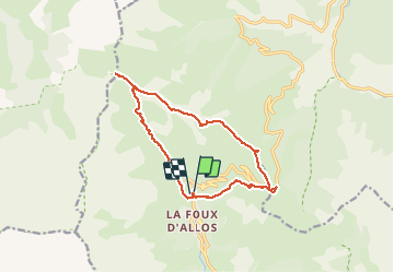

15.5 km | 24 km-effort


User


FREE GPS app for hiking
 SityTrail
IGN / Geographical institutes
SityTrail World
The world is yours!
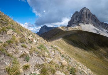
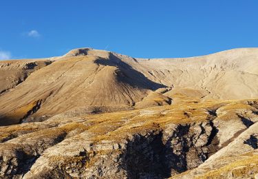
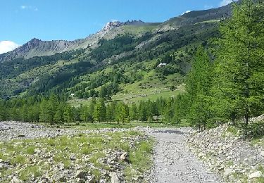
Trail Walking of 14.4 km to be discovered at Provence-Alpes-Côte d'Azur, Alpes-de-Haute-Provence, Allos. This trail is proposed by ajd26.
depart de la station La foux Val d'Allos, très joli panoramas à parti du col de la tete Sestriere et retour sans suivre la route du col


Walking
Walking

Mountain bike
Walking
Walking
Walking

Walking

Walking
Walking