Unknown, Azores: Best trails, routes and walks

12 comments

Unknown: Discover the best trails: 156 hiking trails. All these trails, routes and outdoor activities are available in our SityTrail applications for smartphones and tablets.
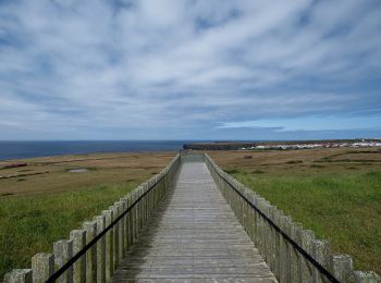
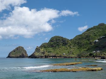
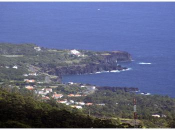
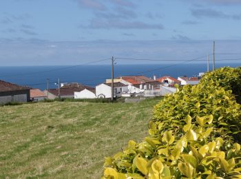

The best trails (222)

Trail On foot Vila do Porto - GR1SMA Great Route of Santa Maria - Photo
On foot 77.344
Km
PRO

On foot

Very difficult
(1)
Vila do Porto, Azores, Unknown, Portugal
77 km | 114 km-effort
25h 58min
2771 m
2781 m
Yes
SityTrail - itinéraires balisés pédestres

• Discover the hiking route Great Route of Santa Maria. View the map and download the GPS track. Website: http://trail...

Trail On foot Santa Bárbara - PR6SMA Areia Branca - Photo
On foot 11.34
Km
PRO

On foot

Medium
(1)
Santa Bárbara, Azores, Unknown, Portugal
11.3 km | 20 km-effort
4h 36min
671 m
676 m
No
SityTrail - itinéraires balisés pédestres

• This linear route connects Praia Formosa (south coast) to Baía of São Lourenço (northeast coast), making the connecti...

Trail On foot Santo Amaro - PT-Leads to Velas - Photo
On foot 3.473
Km
PRO

On foot

Easy
Santo Amaro, Azores, Unknown, Portugal
3.5 km | 4.7 km-effort
1h 4min
44 m
246 m
No
SityTrail - itinéraires balisés pédestres

• Leads to Velas

Trail On foot Ribeirinha - Ribeirinha - Photo
On foot 8.002
Km
PRO

On foot

Easy
Ribeirinha, Azores, Unknown, Portugal
8 km | 13.9 km-effort
3h 9min
442 m
447 m
Yes
SityTrail - itinéraires balisés pédestres

• This circular route in the village of Ribeirinha evolves partially in the protected area for habitats and species man...

Trail On foot Achadinha - PRC38SMI Lomba D’El Rei - Photo
On foot 4.368
Km
PRO

On foot

Easy
Achadinha, Azores, Unknown, Portugal
4.4 km | 7 km-effort
1h 36min
201 m
200 m
Yes
SityTrail - itinéraires balisés pédestres

• Discover the hiking route PRC38SMI Lomba D'EL Rei. View the map and download the GPS track. Website: http://trails.v...

Trail On foot Achadinha - PR21SMI Padrão das Alminhas - Salto da Farinha - Photo
On foot 3.608
Km
PRO

On foot

Easy
Achadinha, Azores, Unknown, Portugal
3.6 km | 5.8 km-effort
1h 19min
133 m
262 m
No
SityTrail - itinéraires balisés pédestres

• Discover the hiking route PR21SMI Padrão das Alminhas - Salto da Farinha. View the map and download the GPS track. W...

Trail On foot Ribeiras - Quintas e Ribeiras - Photo
On foot 12.883
Km
PRO

On foot

Medium
Ribeiras, Azores, Unknown, Portugal
12.9 km | 23 km-effort
5h 8min
778 m
580 m
No
SityTrail - itinéraires balisés pédestres

• Symbol: Yellow over Red

Trail On foot Calheta de Nesquim - Calheta do Nesquim - Photo
On foot 7.372
Km
PRO

On foot

Easy
Calheta de Nesquim, Azores, Unknown, Portugal
7.4 km | 11.3 km-effort
2h 34min
305 m
266 m
No
SityTrail - itinéraires balisés pédestres

• Descubra o percurso pedestre PRC11PIC Calheta do Nesquim. Consulte o Mapa e faça download do GPS. Website: http://tr...

Trail On foot Horta (Angústias) - Entre Montes - Photo
On foot 3.255
Km
PRO

On foot

Easy
Horta (Angústias), Azores, Unknown, Portugal
3.3 km | 5.4 km-effort
1h 13min
161 m
163 m
Yes
SityTrail - itinéraires balisés pédestres

• Symbol: Yellow over Red

Trail On foot Maia - PRC36SMI Pedra Queimada - Lajinha - Degredo - Photo
On foot 5.999
Km
PRO

On foot

Easy
Maia, Azores, Unknown, Portugal
6 km | 10 km-effort
2h 16min
302 m
299 m
Yes
SityTrail - itinéraires balisés pédestres

• Discover the hiking route PRC36SMI Pedra Queimada - Lajinha - Degredo. View the map and download the GPS track. Webs...

Trail On foot Ribeira Quente - PR12SMI Agrião - Photo
On foot 7.53
Km
PRO

On foot

Easy
Ribeira Quente, Azores, Unknown, Portugal
7.5 km | 13 km-effort
2h 57min
416 m
402 m
No
SityTrail - itinéraires balisés pédestres

• Discover the hiking route PR12SMI Trilho do Agrião. View the map and download the GPS track. Website: http://trails....

Trail On foot Norte Pequeno - Norte Pequeno - Photo
On foot 8.32
Km
PRO

On foot

Easy
Norte Pequeno, Azores, Unknown, Portugal
8.3 km | 15.4 km-effort
3h 29min
523 m
548 m
No
SityTrail - itinéraires balisés pédestres

• Discover the hiking route PRC6SJO Trilho do Norte Pequeno. View the map and download the GPS track. Website: http://...

Trail On foot Norte Grande (Neves) - Pico do Pedro – Pico da Esperança – Fajã do Ouvidor - Photo
On foot 12.302
Km
PRO

On foot

Easy
Norte Grande (Neves), Azores, Unknown, Portugal
12.3 km | 17 km-effort
3h 51min
310 m
480 m
No
SityTrail - itinéraires balisés pédestres

• Discover the hiking route PR4SJO Pico do Pedro – Pico da Esperança – Fajã do Ouvidor. View the map and download the G...

Trail On foot São João - Mistérios do Sul do Pico - Photo
On foot 6.78
Km
PRO

On foot

Easy
São João, Azores, Unknown, Portugal
6.8 km | 8.4 km-effort
1h 55min
131 m
108 m
No
SityTrail - itinéraires balisés pédestres

• Discover the hiking route PR15PIC Mistérios do Sul do Pico. View the map and download the GPS track. Website: http:/...

Trail On foot São Roque do Pico - Lagoa do Capitão - Photo
On foot 4.728
Km
PRO

On foot

Easy
São Roque do Pico, Azores, Unknown, Portugal
4.7 km | 6.7 km-effort
1h 31min
20 m
529 m
No
SityTrail - itinéraires balisés pédestres

• Discover the hiking route PR13PIC Lagoa do Capitão. View the map and download the GPS track. Website: http://trails....

Trail On foot Santa Luzia - Caminhos de Santa Luzia - Photo
On foot 9.51
Km
PRO

On foot

Easy
Santa Luzia, Azores, Unknown, Portugal
9.5 km | 12.9 km-effort
2h 56min
254 m
261 m
No
SityTrail - itinéraires balisés pédestres

• Discover the hiking route PR1PIC Caminhos de Santa Luzia. View the map and download the GPS track. Website: http://t...

Trail On foot Prainha - Caminho dos Burros - Vertente Norte - Photo
On foot 14.917
Km
PRO

On foot

Medium
Prainha, Azores, Unknown, Portugal
14.9 km | 26 km-effort
6h 0min
1055 m
297 m
No
SityTrail - itinéraires balisés pédestres

• Discover the hiking route PR2PIC Caminho dos Burros: vertente Norte. View the map and download the GPS track. Websit...

Trail On foot São Roque do Pico - Caminho das Lagoas - Photo
On foot 22.014
Km
PRO

On foot

Medium
São Roque do Pico, Azores, Unknown, Portugal
22 km | 28 km-effort
6h 22min
374 m
690 m
No
SityTrail - itinéraires balisés pédestres

• Discover the hiking route PR7PIC Caminho das Voltas. View the map and download the GPS track. Website: http://trails...

Trail On foot São Pedro - PR1SMA Costa Norte - Photo
On foot 8.952
Km
PRO

On foot

Easy
São Pedro, Azores, Unknown, Portugal
9 km | 13.6 km-effort
3h 5min
303 m
483 m
No
SityTrail - itinéraires balisés pédestres

• Symbol: Yellow over Red

Trail On foot Santo Espírito - PR4SMA Santo Espírito - Maia - Photo
On foot 4.024
Km
PRO

On foot

Easy
(1)
Santo Espírito, Azores, Unknown, Portugal
4 km | 5.4 km-effort
1h 13min
25 m
326 m
No
SityTrail - itinéraires balisés pédestres

• Discover the hiking route PR4SMA Santo Espírito. View the map and download the GPS track. Website: http://trails.vis...

20 trails displayed on 222

FREE GPS app for hiking

Logo SityTrail SityTrail

IGN / Geographical institutes

Download SityTrail from the App Store Download SityTrail from Google Play

Logo SityTrail SityTrail World

The world is yours!

Download SityTrail from the App Store Download SityTrail from Google Play Download SityTrail on Huawei AppGallery

Activities

Nearby regions

Close
My subscriptions