Point of interest Vollore-Montagne - Point repère 4 - Photo

Point repère 4

Description

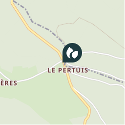
4. Traverser la D42 pour prendre en face. Au carrefour suivant, on descend à gauche dans le hameau des Rallières que l'on traverse. On continue par le même chemin. A un carrefour en T, on prend à gauche. A la croix des tuiles, on continue en face. On franchit le ruisseau avant de prendre à droite à la route pour rejoindre le point de départ

Photos

Point repère 4 can be discovered in the following trails...
Trail Other activity Vollore-Montagne - Sans titre - Photo
Other activity
Zeugma13

Other activity

Very easy
Vollore-Montagne, Auvergne-Rhône-Alpes, Puy-de-Dôme, France
15.6 km | 22 km-effort
Unknown
Yes
 Zeugma13
Zeugma13

User

© OpenStreetMap contributors

Positioning

Country:
France
Region :
Auvergne-Rhône-Alpes
Department/Province :
Puy-de-Dôme
Municipality :
Vollore-Montagne
Location:
Unknown
Creation date :
2019-01-15 13:58:19.598
Updated on
2019-01-15 13:58:19.598

(0 Reviews)


Points of interest nearby

Point of interest Vollore-Ville - 3 - Photo
Zeugma13
VOLLORE-VILLE 
Point of interest Vollore-Montagne - Point repère 3 - Photo
Zeugma13
VOLLORE-MONTAGNE 
Point of interest Vollore-Montagne - Départ - Photo
Zeugma13
VOLLORE-MONTAGNE 
Point of interest Sainte-Agathe - 2 - Photo
Zeugma13
SAINTE-AGATHE 
Point of interest Noirétable - Point repère 2 - Photo
Zeugma13
NOIRÉTABLE 
Point of interest Vollore-Montagne - Point repère 1 - Photo
Zeugma13
VOLLORE-MONTAGNE 
Point of interest Vollore-Ville - 1 - Photo
Zeugma13
VOLLORE-VILLE 
Point of interest Vollore-Ville - 4 - Photo
Zeugma13
VOLLORE-VILLE 


Close
My subscriptions