Home
World
NEW
Premium
Shop
Trails
Articles
Help and support
Français
English
Nederlands
Español
Italiano
Deutsch
Log in
Home
World
Premium
Shop
Trails
Articles
Help and support
SityTrail
>
Points of interest
>
GCW1C2
SityTrail
>
Points of interest
>
GCW1C2
GCW1C2
Description
La Cheminée by micka38, Tradit
Photos
GCW1C2 can be discovered in the following trails...
tracegps
Crêt Coquet
Walking
Medium
(3)
Hautecour, Auvergne-Rhône-Alpes, Savoy, France
6.5 km | 9.6 km-effort
3h 30min
Yes
tracegps
User
©
OpenStreetMap
contributors
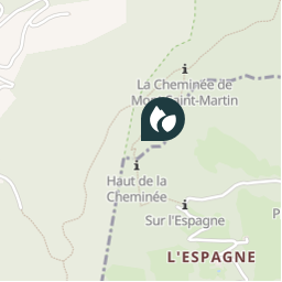
Positioning
Country:
France
Region :
Auvergne-Rhône-Alpes
Department/Province :
Isère
Municipality :
Voreppe
Location:
Unknown
Positioning
45.27935 / 5.66925
Creation date :
2018-04-09 12:14:59.017
Updated on
2018-04-09 12:14:59.017
(0 Reviews)
Comments
Please log in to post a review or rate the element
Points of interest nearby
tracegps
GCW1C2
VOREPPE
tracegps
GCW1C2
VOREPPE
tracegps
GCW1C2
VOREPPE
tracegps
GCW1C2
VOREPPE
tracegps
GCW1C2
VOREPPE
tracegps
GCW1C2
VOREPPE
tracegps
GCW1C2
VOREPPE
tracegps
GCW1C2
VOREPPE
Close
My subscriptions