Home
World
NEW
Premium
Shop
Trails
Articles
Help and support
Français
English
Nederlands
Español
Italiano
Deutsch
Log in
Home
World
Premium
Shop
Trails
Articles
Help and support
SityTrail
>
Points of interest
>
Sommet d'Antenac
SityTrail
>
Points of interest
>
Sommet d'Antenac
Sommet d'Antenac
Description
Photos
Sommet d'Antenac can be discovered in the following trails...
sga31
Sommet d'Antenac (1990m) depuis Mayrègne
Walking
Medium
Mayrègne, Occitania, Haute-Garonne, France
15.3 km | 28 km-effort
5h 45min
Yes
sga31
User
©
OpenStreetMap
contributors
Positioning
Country:
France
Region :
Occitania
Department/Province :
Haute-Garonne
Municipality :
Saint-Paul-d'Oueil
Location:
Unknown
Positioning
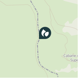
42.85643 / 0.5649859999999762
Creation date :
2018-04-10 17:48:44.819
Updated on
2018-04-10 17:48:44.819
(0 Reviews)
Comments
Please log in to post a review or rate the element
Points of interest nearby
sga31
Sommet d'Antenac
SAINT-PAUL-D'OUEIL
sga31
Col
MAYRÈGNE
sga31
Col
MAYRÈGNE
sga31
Cabane de la Plagne
MAYRÈGNE
sga31
Cabane de la Plagne
MAYRÈGNE
sga31
Bifurcation
MAYRÈGNE
sga31
Bifurcation
MAYRÈGNE
sga31
Mayregne
MAYRÈGNE
Close
My subscriptions