Trail Walking Mayrègne - Sommet d'Antenac (1990m) depuis Mayrègne - Photo

Sommet d'Antenac (1990m) depuis Mayrègne

 sga31
sga31

User

© OpenStreetMap contributors
Length
Length
15.3 km
Max alt
Max alt
1980 m
Uphill gradient
Uphill gradient
940 m
Km-Effort
Km-Effort  
28 km
Min alt
Min alt
1083 m
Downhill gradient
Downhill gradient
946 m
Boucle
Boucle
Yes
Creation date :
2014-12-10 00:00:00.0
Updated on :
2014-12-10 00:00:00.0

(0 Reviews)

Walking
Walking
5h45
Difficulty : Medium

Scan this QR Code to open this trail in the SityTrail application

FREE GPS app for hiking

Logo SityTrail SityTrail

IGN / Geographical institutes

Download SityTrail from the App Store Download SityTrail from Google Play

Logo SityTrail SityTrail World

The world is yours!

Download SityTrail from the App Store Download SityTrail from Google Play Download SityTrail on Huawei AppGallery

About

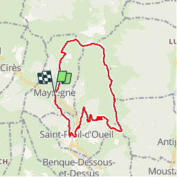
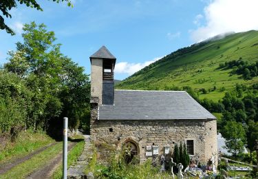
Trail Walking of 15.3 km to be discovered at Occitania, Haute-Garonne, Mayrègne. This trail is proposed by sga31.

Description

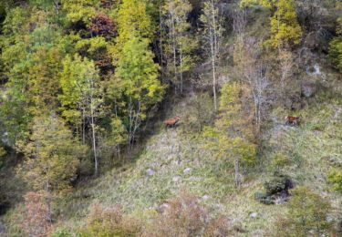
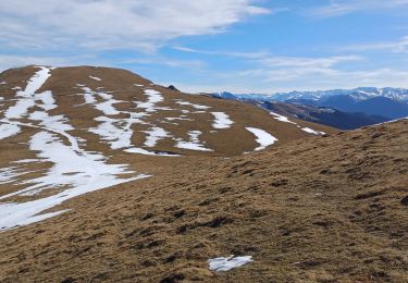
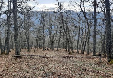
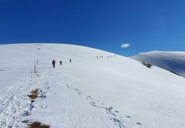
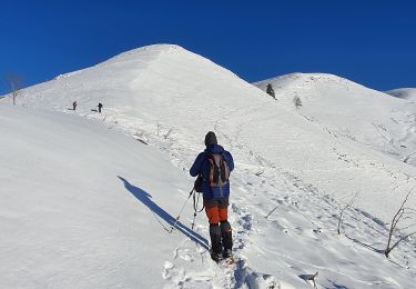
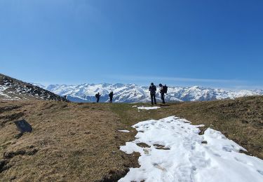
Une belle randonnée réalisée presque entièrement à découvert, avec un long et magnifique parcours de crête.A savourer été comme hiver, les larges crêtes se prêtant bien à la pratique des raquettes.

Elevation profile

Points of interest

Point of interest Mayrègne - Mayregne  - Photo
sga31
MAYRÈGNE 
Point of interest Mayrègne - Bifurcation - Photo
sga31
MAYRÈGNE 
Point of interest Mayrègne - Cabane de la Plagne - Photo
sga31
Point of interest Mayrègne - Col - Photo
sga31
MAYRÈGNE 
Point of interest Saint-Paul-d'Oueil - Sommet d'Antenac - Photo
sga31
SAINT-PAUL-D'OUEIL 
Point of interest Antignac - Col - Photo
sga31
ANTIGNAC 
Point of interest Saint-Paul-d'Oueil - Saint-Paul d Oueil - Photo
sga31
SAINT-PAUL-D'OUEIL 

Positioning

Country:
France
Region :
Occitania
Department/Province :
Haute-Garonne
Municipality :
Mayrègne
Location:
Unknown
Start:(UTM)
298981 ; 4746373 (31T) N.

Trails nearby

Trail Walking Bourg-d'Oueil - Le Mont Né - Photo
Walking
tracegps

Walking

Very difficult
(1)
Bourg-d'Oueil, Occitania, Haute-Garonne, France
8.9 km | 19.6 km-effort
5h 0min
Yes
Trail Walking Saccourvielle - Cap de Salières en boucle depuis Saccourvielle - Photo
Walking
GUIDE
lhomme.ph

Walking

Medium
Saccourvielle, Occitania, Haute-Garonne, France
12.1 km | 24 km-effort
6h 23min
Yes
Trail Walking Mayrègne - mail de la pène de Rustier en boucle depuis Mayrègne  - Photo
Walking
GUIDE
lhomme.ph

Walking

Medium
Mayrègne, Occitania, Haute-Garonne, France
11.7 km | 21 km-effort
6h 2min
Yes
Trail Walking Saint-Aventin - Cabane de Courreau en boucle depuis St Aventin  - Photo
Walking
GUIDE
lhomme.ph

Walking

Medium
Saint-Aventin, Occitania, Haute-Garonne, France
13.3 km | 24 km-effort
6h 10min
Yes
Trail Walking Mayrègne - Cap de Serrède en boucle depuis Mayrègne  - Photo
Walking
GUIDE
lhomme.ph

Walking

Medium
Mayrègne, Occitania, Haute-Garonne, France
6.6 km | 15.2 km-effort
4h 11min
Yes
Trail On foot Benque-Dessous-et-Dessus - Boucle dans la vallée du Larboust et la Vallée d'Oueil - Photo
On foot
PRO

On foot

Easy
Benque-Dessous-et-Dessus, Occitania, Haute-Garonne, France
4.9 km | 8.7 km-effort
1h 58min
No
Trail Walking Mayrègne - Sommet d'Antenac EN BOUCLE - Photo
Walking
chrisgps

Walking

Medium
Mayrègne, Occitania, Haute-Garonne, France
13.3 km | 25 km-effort
7h 19min
No
Trail Walking Poubeau - cap de la Lit en boucle - Photo
Walking
chrisgps

Walking

Medium
Poubeau, Occitania, Haute-Garonne, France
13.2 km | 25 km-effort
7h 46min
No
Trail Walking Antignac - cap de Salieres en boucle depuis Antignac - Photo
Walking
chrisgps

Walking

Difficult
Antignac, Occitania, Haute-Garonne, France
12.7 km | 28 km-effort
8h 8min
Yes


Close
My subscriptions