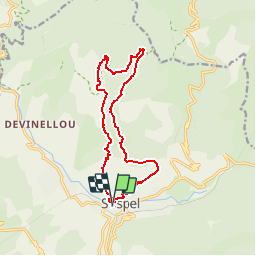
![](/images/other/stat-length.png)
![Trail Mountain bike Sospel - Espace VTT FFC de Sospel - N° 2 : Le bois de l'Hermite - Photo](https://media.geolcdn.com/t/1900/400/ext.pjpeg?maxdim=2&url=https%3A%2F%2Fservices.sitytrail.com%2FGeolivesWS%2FDownloadMedia.ashx%3FTrailID%3D101737%26Media%3D1985_1.jpg)
Espace VTT FFC de Sospel - N° 2 : Le bois de l'Hermite
tracegps
User
![Length](/images/other/stat-length.png)
![Max alt](https://static1.geolcdn.com/siteimages/upload/files/1508320355ic_sort_altitude_max_24dp.png)
![Uphill gradient](https://static1.geolcdn.com/siteimages/upload/files/1508320355ic_sort_den_pos_24dp.png)
![Km-Effort](/images/other/stat-length.png)
![Min alt](https://static1.geolcdn.com/siteimages/upload/files/1508320355ic_sort_altitude_min_24dp.png)
![Downhill gradient](https://static1.geolcdn.com/siteimages/upload/files/1508320355ic_sort_den_neg_24dp.png)
![Boucle](https://static1.geolcdn.com/siteimages/upload/files/16400158638029165_repeat_loop_refresh_sync_direction_icon.png)
![Mountain bike](https://static1.geolcdn.com/sitytour/trail-icons/202.png)
2h00
Difficulty : Very difficult
![Scan this QR Code to open this trail in the SityTrail application](https://capi.geolives.com/qq0zvz2zws4bq2lad0pu/sitytour/trails/101737/qr.png?size=200)
FREE GPS app for hiking
About
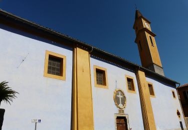
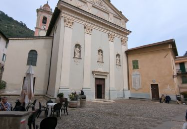
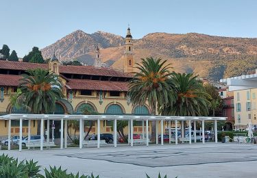
Trail Mountain bike of 14.2 km to be discovered at Provence-Alpes-Côte d'Azur, Maritime Alps, Sospel. This trail is proposed by tracegps.
Description
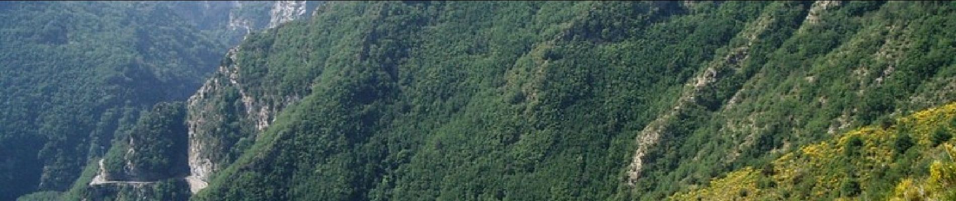
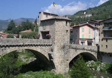
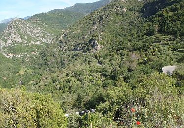
Espace VTT FFC Sospel Circuit labellisé par la Fédération Française de Cyclisme. En bordure du Parc National du Mercantour, une montée d'un intérêt technique indéniable, et une belle descente en sous-bois. Rencontre possible avec sangliers et chevreuils. Vallon sauvage. Du parking de la poste, prendre la direction des écoles de Sospel. Prendre la montée très raide sur route jusqu'au premier lacet, pour rejoindre le GR52 à gauche. Montée technique jusqu'à la route communale. Ici, tout droit pour reprendre le GR52 à 200m à droite jusqu'à la baisse de Figuiera. Continuer la route en direction de la baisse de Levens. Après le tunnel, et rejoint le bassin ONF (sur votre gauche, fontaine), faire encore 200 m et tourner à droite pour une descente très rapide en sous-bois jusqu'au vallon qu'il faudra traverser. Prendre le sentier en face (lacets serrés en poussette).Arrivé à la baisse de l'Agaisen, prendre à gauche sans franchir réellement le col et tout de suite à droite pour contourner le mont Agaisen par le haut. Rejoint la route, repiquer en face un peu plus haut, puis sur le second tronçon de route, encore à gauche, les escaliers. Suivre le sentier jusqu'à la route communale et prendre à droite la direction de Sospel.
Positioning
Comments
Trails nearby
![Trail On foot Sospel - Circuit du Cuore - Photo](https://media.geolcdn.com/t/375/260/ext.jpg?maxdim=2&url=https%3A%2F%2Fmedia.geolcdn.com%2Ff%2F874c44c6-9655-4f1b-91f3-823e79b13bac.jpeg)
![On foot On foot](https://static1.geolcdn.com/sitytour/trail-icons/100.png)
On foot
![](/images/other/stat-length.png)
![](https://static1.geolcdn.com/siteimages/upload/files/16400158638029165_repeat_loop_refresh_sync_direction_icon.png)
![Trail On foot Sospel - Tour du mont Grazian - Photo](https://media.geolcdn.com/t/375/260/ext.jpg?maxdim=2&url=https%3A%2F%2Fmedia.geolcdn.com%2Ff%2F1da10739-2e7a-4ef9-ac53-576dd44be28a.jpeg)
![On foot On foot](https://static1.geolcdn.com/sitytour/trail-icons/100.png)
On foot
![](/images/other/stat-length.png)
![](https://static1.geolcdn.com/siteimages/upload/files/16400158638029165_repeat_loop_refresh_sync_direction_icon.png)
![Trail On foot Sospel - Boucle du mont Agaisen - Photo](https://media.geolcdn.com/t/375/260/ext.jpg?maxdim=2&url=https%3A%2F%2Fmedia.geolcdn.com%2Ff%2F8adecf07-fe22-4434-84e5-fdafc3720390.jpeg)
![On foot On foot](https://static1.geolcdn.com/sitytour/trail-icons/100.png)
On foot
![](/images/other/stat-length.png)
![](https://static1.geolcdn.com/siteimages/upload/files/16400158638029165_repeat_loop_refresh_sync_direction_icon.png)
![Trail Walking Sospel - 06 - Moyen Pays - 46. Tour du Mont Grazian - Photo](https://media.geolcdn.com/t/375/260/ext.jpg?maxdim=2&url=https%3A%2F%2Fstatic1.geolcdn.com%2Fsiteimages%2Fupload%2Ffiles%2F1553511878bg_sport_marche.png)
![Walking Walking](https://static1.geolcdn.com/sitytour/trail-icons/101.png)
Walking
![](/images/other/stat-length.png)
![](https://static1.geolcdn.com/siteimages/upload/files/16400158638029165_repeat_loop_refresh_sync_direction_icon.png)
![Trail Walking Sospel - Sospel à Airole - Photo](https://media.geolcdn.com/t/375/260/ext.jpg?maxdim=2&url=https%3A%2F%2Fmedia.geolcdn.com%2Ff%2F622c1387-f27c-4930-b49d-58faf0703426.jpg)
![Walking Walking](https://static1.geolcdn.com/sitytour/trail-icons/101.png)
Walking
![](/images/other/stat-length.png)
![](https://static1.geolcdn.com/siteimages/upload/files/16400158638029165_repeat_loop_refresh_sync_direction_icon.png)
![Trail Walking Castillon - Castillon : Mt Ours - Photo](https://media.geolcdn.com/t/375/260/ext.jpg?maxdim=2&url=https%3A%2F%2Fmedia.geolcdn.com%2Ff%2F18e786f6-adf4-41b3-a67d-83ef4f1666ea.jpg)
![Walking Walking](https://static1.geolcdn.com/sitytour/trail-icons/101.png)
Walking
![](/images/other/stat-length.png)
![](https://static1.geolcdn.com/siteimages/upload/files/16400158638029165_repeat_loop_refresh_sync_direction_icon.png)
![Trail Walking Castillon - Du col de Castillon pour la crête du Mt Razet - Photo](https://media.geolcdn.com/t/375/260/ext.jpg?maxdim=2&url=https%3A%2F%2Fmedia.geolcdn.com%2Ff%2Fe81c49f2-8db0-4c72-8c27-b5f2f0f4c321.jpg)
![Walking Walking](https://static1.geolcdn.com/sitytour/trail-icons/101.png)
Walking
![](/images/other/stat-length.png)
![](https://static1.geolcdn.com/siteimages/upload/files/16400158638029165_repeat_loop_refresh_sync_direction_icon.png)
![Trail Walking Sospel - Cime de Penas - Photo](https://media.geolcdn.com/t/375/260/ext.jpg?maxdim=2&url=https%3A%2F%2Fmedia.geolcdn.com%2Ff%2F5d598a7f-6c92-4be0-8e5c-3f4abdadf3be.jpg)
![Walking Walking](https://static1.geolcdn.com/sitytour/trail-icons/101.png)
Walking
![](/images/other/stat-length.png)
![](https://static1.geolcdn.com/siteimages/upload/files/16400158638029165_repeat_loop_refresh_sync_direction_icon.png)
![Trail Walking Sospel - Sospel Menton dernière étape 2020 - Photo](https://media.geolcdn.com/t/375/260/ext.jpg?maxdim=2&url=https%3A%2F%2Fmedia.geolcdn.com%2Ff%2Fd470a1b4-df5a-49d0-8315-831d3291e676.jpg)
![Walking Walking](https://static1.geolcdn.com/sitytour/trail-icons/101.png)
Walking
![](/images/other/stat-length.png)
![](https://static1.geolcdn.com/siteimages/upload/files/16400158638029165_repeat_loop_refresh_sync_direction_icon.png)