


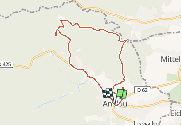


11.9 km | 15.9 km-effort


User


FREE GPS app for hiking
 SityTrail
IGN / Geographical institutes
SityTrail World
The world is yours!
Trail Walking of 8 km to be discovered at Grand Est, Bas-Rhin, Andlau. This trail is proposed by tracegps.
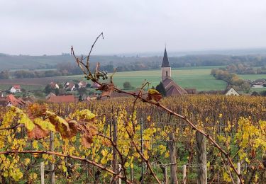
Prendre la route goudronnée marquée du disque rouge qui monte, au travers de plantations de vignes, au col du Cray. Le même sentier se poursuit pour aller au rocher Sainte-Richarde... La suite et d’autres informations et photos sont disponibles ICI Balade proposée par « Alsace en randonnée.» Balisage : la plupart des sentiers dans la montagne vosgienne sont tracés, entretenus et balisés bénévolement par les membres du Club Vosgien, d'une façon tout à fait remarquable. Les différents signes en couleur (rectangle, disque, triangle, croix, etc...) sont reproduits sur la carte.


Walking

Mountain bike
Horseback riding

Walking

Walking
Walking
Walking
Walking