


7.9 km | 9.9 km-effort


User


FREE GPS app for hiking
 SityTrail
IGN / Geographical institutes
SityTrail World
The world is yours!
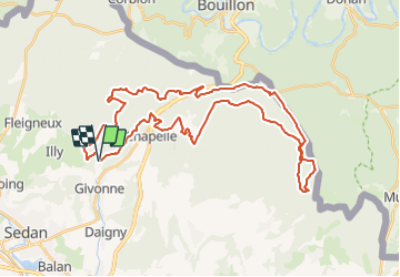
Trail Mountain bike of 40 km to be discovered at Grand Est, Ardennes, Givonne. This trail is proposed by tracegps.
Espace VTT FFC Pays Sedanais Le Banet Circuit officiel labellisé par la Fédération Française de Cyclisme. Le Pays sedanais comporte 16 circuits balisés. Grâce à la variété des sites, les sorties sont adaptées aussi bien aux balades en famille qu'aux raids en solitaire. Votre périple pourra vous mener à l'aplomb de la vallée de la Semois entourant la superbe petite bourgade de Bouillon, en Belgique. Attention : Les pistes sont interdites les jours de chasse en batture, la nuit et par temps de neige. Sedan Sprint Club

Walking
Walking
Walking

Mountain bike
Nordic walking

Coupling
On foot
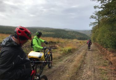
Mountain bike
Walking