Trail Walking Area B (Shelter Bay/Mica Creek) - Crete Abbott  parc des glaciers - Photo
 marcagif
marcagif

User

© OpenStreetMap contributors
Length
Length
13.9 km
Max alt
Max alt
2272 m
Uphill gradient
Uphill gradient
1044 m
Km-Effort
Km-Effort  
28 km
Min alt
Min alt
1224 m
Downhill gradient
Downhill gradient
1054 m
Boucle
Boucle
No
Creation date :
2019-01-15 14:59:19.72
Updated on :
2019-01-15 14:59:19.72

(0 Reviews)

Walking
Walking
5h43
Difficulty : Difficult

Scan this QR Code to open this trail in the SityTrail application

FREE GPS app for hiking

Logo SityTrail SityTrail

IGN / Geographical institutes

Download SityTrail from the App Store Download SityTrail from Google Play

Logo SityTrail SityTrail World

The world is yours!

Download SityTrail from the App Store Download SityTrail from Google Play Download SityTrail on Huawei AppGallery

About

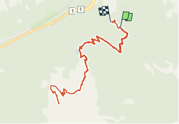
Trail Walking of 13.9 km to be discovered at British Columbia, Columbia-Shuswap Regional District, Area B (Shelter Bay/Mica Creek). This trail is proposed by marcagif.

Description

start from the  campground to the ridge . trail #18
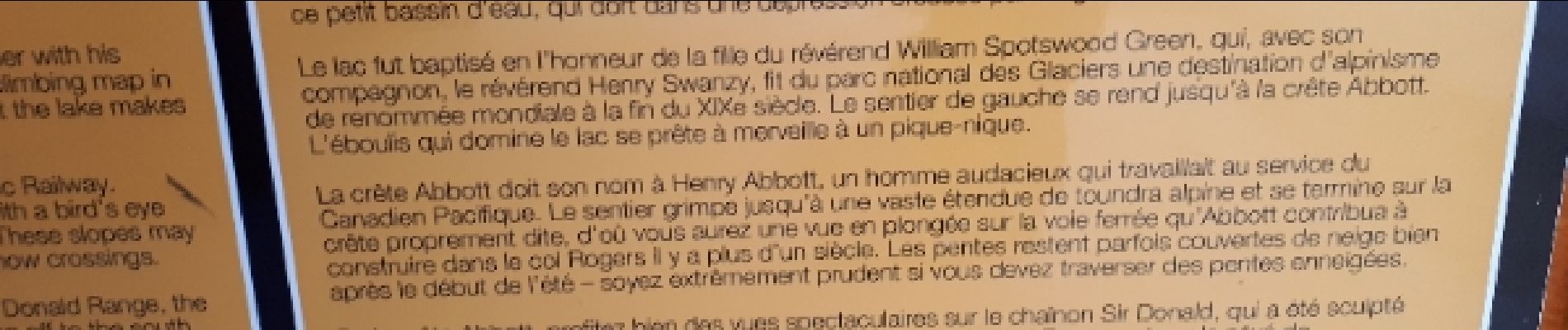
Elevation profile

Photos

Positioning

Country:
Canada
Region :
British Columbia
Department/Province :
Columbia-Shuswap Regional District
Municipality :
Area B (Shelter Bay/Mica Creek)
Location:
Unknown
Start:(UTM)
465531 ; 5679384 (11U) N.

Trails nearby

Trail Walking Area A (Kicking Horse/Kinbasket Lake) - Wikiloc - CAN 19-Collado Balu // Balu Pass - Photo
Walking
GUIDE
Alizée.pee

Walking

Very difficult
Area A (Kicking Horse/Kinbasket Lake), British Columbia, Columbia-Shuswap Regional District, Canada
11.7 km | 22 km-effort
4h 28min
Yes
Trail Trail Area B (Shelter Bay/Mica Creek) - glacier nal park Abbot - Photo
Trail
Bertrand Simon

Trail

Medium
Area B (Shelter Bay/Mica Creek), British Columbia, Columbia-Shuswap Regional District, Canada
13.4 km | 25 km-effort
6h 13min
No


Close
My subscriptions