Trail Mountain bike Annezin - Rando Busnes départ Annezin  - Photo

Rando Busnes départ Annezin

 tracegps
tracegps

User

© OpenStreetMap contributors
Length
Length
45 km
Max alt
Max alt
83 m
Uphill gradient
Uphill gradient
270 m
Km-Effort
Km-Effort  
49 km
Min alt
Min alt
15 m
Downhill gradient
Downhill gradient
269 m
Boucle
Boucle
Yes
Creation date :
2014-12-10 00:00:00.0
Updated on :
2014-12-10 00:00:00.0

(0 Reviews)

Mountain bike
Mountain bike
3h00
Difficulty : Medium

Scan this QR Code to open this trail in the SityTrail application

FREE GPS app for hiking

Logo SityTrail SityTrail

IGN / Geographical institutes

Download SityTrail from the App Store Download SityTrail from Google Play

Logo SityTrail SityTrail World

The world is yours!

Download SityTrail from the App Store Download SityTrail from Google Play Download SityTrail on Huawei AppGallery

About

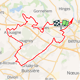
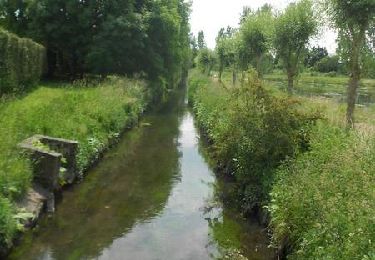
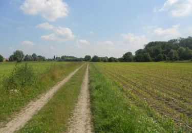
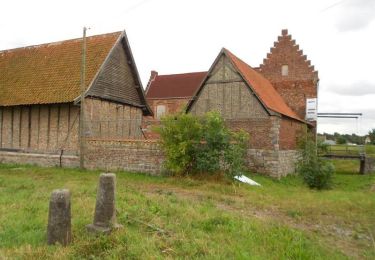
Trail Mountain bike of 45 km to be discovered at Hauts-de-France, Pas-de-Calais, Annezin. This trail is proposed by tracegps.

Description

Le site Ch’ti GPS. Perds te pas avec mi ! Sympa. Chemin, Foret, Ligne de chemin de fer... Parcours de Busnes modifié Départ sur Annezin...

Elevation profile

Photos

Positioning

Country:
France
Region :
Hauts-de-France
Department/Province :
Pas-de-Calais
Municipality :
Annezin
Location:
Unknown
Start:(UTM)
472658 ; 5598183 (31U) N.

Trails nearby

Trail Walking Hinges - Le Rietz  -  Hinges - Photo
Walking
tracegps

Walking

Medium
(3)
Hinges, Hauts-de-France, Pas-de-Calais, France
12.3 km | 13.4 km-effort
3h 0min
Yes
Trail Walking Béthune - Le sentier de Catorive. -  Béthune - Photo
Walking
tracegps

Walking

Medium
(2)
Béthune, Hauts-de-France, Pas-de-Calais, France
8.3 km | 9 km-effort
2h 0min
Yes
Trail Walking Labourse - randonnée labourse  - Photo
Walking
Chene62

Walking

Very difficult
Labourse, Hauts-de-France, Pas-de-Calais, France
20 km | 22 km-effort
2h 45min
No
Trail Walking Béthune - Béthune - Photo
Walking
Marie-Claire-mcp

Walking

Very easy
Béthune, Hauts-de-France, Pas-de-Calais, France
5.6 km | 6.2 km-effort
2h 7min
Yes
Trail Walking Labourse - Sentier des familles - Labourse  - Photo
Walking
tracegps

Walking

Easy
Labourse, Hauts-de-France, Pas-de-Calais, France
5.3 km | 5.7 km-effort
1h 19min
Yes
Trail Walking Vaudricourt - Sentier des paysages - Vaudricourt - Photo
Walking
tracegps

Walking

Easy
(2)
Vaudricourt, Hauts-de-France, Pas-de-Calais, France
6.4 km | 7 km-effort
1h 34min
Yes
Trail Walking Fouquières-lès-Béthune - Le sentier des 2 riviéres -  Fouquières lez Béthune - Photo
Walking
tracegps

Walking

Medium
Fouquières-lès-Béthune, Hauts-de-France, Pas-de-Calais, France
8.2 km | 8.9 km-effort
2h 4min
Yes
Trail Walking Beuvry - Le Marais de Beuvry - Photo
Walking
tracegps

Walking

Medium
Beuvry, Hauts-de-France, Pas-de-Calais, France
12.8 km | 13.8 km-effort
3h 0min
Yes
Trail Cycle Beuvry - Autour du beffroi (de Béthune) - Beuvry - Photo
Cycle
tracegps

Cycle

Medium
Beuvry, Hauts-de-France, Pas-de-Calais, France
36 km | 39 km-effort
2h 0min
Yes


Close
My subscriptions