Trail Equestrian Le Roux - Boucle Le Bouteirou - Mont Gerbier de Jonc  - Etape 3 - Photo

Boucle Le Bouteirou - Mont Gerbier de Jonc - Etape 3

 tracegps
tracegps

User

© OpenStreetMap contributors
Length
Length
23 km
Max alt
Max alt
1424 m
Uphill gradient
Uphill gradient
547 m
Km-Effort
Km-Effort  
30 km
Min alt
Min alt
1197 m
Downhill gradient
Downhill gradient
515 m
Boucle
Boucle
No
Creation date :
2014-12-10 00:00:00.0
Updated on :
2014-12-10 00:00:00.0

(0 Reviews)

Equestrian
Equestrian
3h30
Difficulty : Medium

Scan this QR Code to open this trail in the SityTrail application

FREE GPS app for hiking

Logo SityTrail SityTrail

IGN / Geographical institutes

Download SityTrail from the App Store Download SityTrail from Google Play

Logo SityTrail SityTrail World

The world is yours!

Download SityTrail from the App Store Download SityTrail from Google Play Download SityTrail on Huawei AppGallery

About

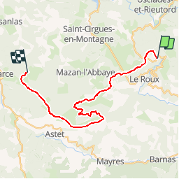
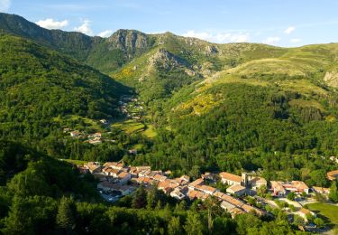
Trail Equestrian of 23 km to be discovered at Auvergne-Rhône-Alpes, Ardèche, Le Roux. This trail is proposed by tracegps.

Description

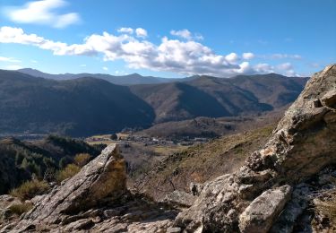
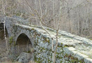
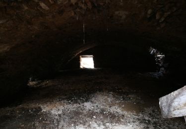
Boucle Le Bouteirou - Mont Gerbier de Jonc – Etape 3 Retour au Bouteirou tout en suivant la ligne de partage des eaux vers les ruines du village de Chaumiène et la traversée du bois de Mazan avec l'abbaye, domaine reboisé à l'époque par les moines cisterciens. Une randonnée suggérée par Le Bouteirou.

Elevation profile

Photos

Positioning

Country:
France
Region :
Auvergne-Rhône-Alpes
Department/Province :
Ardèche
Municipality :
Le Roux
Location:
Unknown
Start:(UTM)
591878 ; 4954524 (31T) N.

Trails nearby

Trail Walking Montpezat-sous-Bauzon - 07-Montpezat-sous-Bauzon - Plantades-Clastre-St-Roch-Clastre - Photo
Walking
Maryma

Walking

Medium
Montpezat-sous-Bauzon, Auvergne-Rhône-Alpes, Ardèche, France
7.3 km | 11.6 km-effort
2h 0min
Yes
Trail Walking Le Roux - 2012-06-24 14h24m52 le roux - Photo
Walking
Michel07

Walking

Medium
(2)
Le Roux, Auvergne-Rhône-Alpes, Ardèche, France
12.9 km | 19.9 km-effort
3h 31min
Yes
Trail Walking Montpezat-sous-Bauzon - Balade-Le Villaret-La Forêt- Les Malfaugères - Photo
Walking
coureursdecretes

Walking

Medium
Montpezat-sous-Bauzon, Auvergne-Rhône-Alpes, Ardèche, France
5.8 km | 7.7 km-effort
1h 50min
Yes
Trail Walking Saint-Cirgues-en-Montagne - 2023-01-26_11h40m10_Rieutord Bauzon Vestide 13km-1 - Photo
Walking
chancha

Walking

Difficult
Saint-Cirgues-en-Montagne, Auvergne-Rhône-Alpes, Ardèche, France
12.6 km | 17.6 km-effort
3h 59min
Yes
Trail Walking Montpezat-sous-Bauzon - Montpezat - Le Fau - Chalias - Les plantades - Photo
Walking
coureursdecretes

Walking

Difficult
Montpezat-sous-Bauzon, Auvergne-Rhône-Alpes, Ardèche, France
11.1 km | 18.6 km-effort
4h 14min
Yes
Trail Walking Le Roux - SityTrail - 2961881 - lalligierxhaute-grace-v2 - Photo
Walking
coureursdecretes

Walking

Very difficult
Le Roux, Auvergne-Rhône-Alpes, Ardèche, France
14 km | 19.1 km-effort
4h 19min
Yes
Trail Walking Montpezat-sous-Bauzon - Fontaulière-Montpezat sous Bauzon  - Photo
Walking
zoe.vienne

Walking

Easy
Montpezat-sous-Bauzon, Auvergne-Rhône-Alpes, Ardèche, France
7.6 km | 10.2 km-effort
1h 49min
No
Trail Walking Usclades-et-Rieutord - Bas de rieutore  - Photo
Walking
Henri Quesada

Walking

Very easy
Usclades-et-Rieutord, Auvergne-Rhône-Alpes, Ardèche, France
18.6 km | 28 km-effort
9h 14min
No
Trail Walking Montpezat-sous-Bauzon - Montpezat les Plantades chalias - Photo
Walking
raab

Walking

Medium
Montpezat-sous-Bauzon, Auvergne-Rhône-Alpes, Ardèche, France
7.8 km | 11.9 km-effort
2h 47min
Yes


Close
My subscriptions