


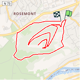

16.8 km | 24 km-effort

User


FREE GPS app for hiking
 SityTrail
IGN / Geographical institutes
SityTrail World
The world is yours!
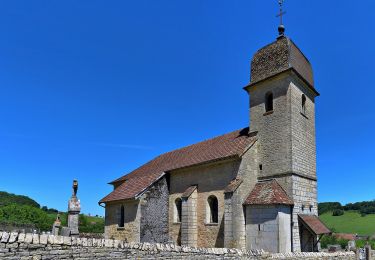
Trail Mountain bike of 7.3 km to be discovered at Bourgogne-Franche-Comté, Doubs, Besançon. This trail is proposed by tracegps.
Ce circuit est de niveau "Moyen". C'est un circuit très court mais avec de bonnes côtes. La montée du début est hyper costaud mais sur 100m heureusement. Ensuite, on empreinte le chemin en cailloux pour monter au fort. Après avoir passé plusieurs épingles, on y arrive. La vue est somptueuse sur le Doubs et sur la Malcombe. On aperçoit en face le fort de Planoise. il faut s'avancer jusqu'au bord de la falaise et en contrebas, il y a une mini grotte. La descente est hyper sympa, et on reprend un bout de goudron pour contourner par un autre sentier la montagne. La encore une montée d'enfer pour arriver à une petite marre. La descente se fait sur des petits escaliers fait de tronc. Plus loin, on traverse un champs, puis retour au départ.

Walking
Walking
Walking
Walking
On foot
On foot
On foot
On foot
On foot