


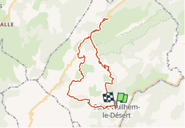


11 km | 15.2 km-effort


User


FREE GPS app for hiking
 SityTrail
IGN / Geographical institutes
SityTrail World
The world is yours!
Trail Walking of 19.7 km to be discovered at Occitania, Hérault, Saint-Guilhem-le-Désert. This trail is proposed by tracegps.
Excellent en petit groupe avec possibilité de manger aux Lavagnes (Prévoir 2h de plus), Il y a de l'eau à l'Ermitage derrière la bâtisse... Très bien aussi pour un entrainement Raid-Trail

Walking

Walking

Walking

Walking
Walking

Walking
Walking
Walking
Walking
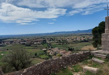
superbe randonnée