Trail Mountain bike Bourg-Saint-Maurice - Tour du Mont Blanc VTT - Le Chapieux à Chamonix - Photo

Tour du Mont Blanc VTT - Le Chapieux à Chamonix

 tracegps
tracegps

User

© OpenStreetMap contributors
Length
Length
68 km
Max alt
Max alt
2311 m
Uphill gradient
Uphill gradient
2566 m
Km-Effort
Km-Effort  
104 km
Min alt
Min alt
943 m
Downhill gradient
Downhill gradient
3068 m
Boucle
Boucle
No
Creation date :
2014-12-10 00:00:00.0
Updated on :
2014-12-10 00:00:00.0

(0 Reviews)

Mountain bike
Mountain bike
5h45
Difficulty : Very difficult

Scan this QR Code to open this trail in the SityTrail application

FREE GPS app for hiking

Logo SityTrail SityTrail

IGN / Geographical institutes

Download SityTrail from the App Store Download SityTrail from Google Play

Logo SityTrail SityTrail World

The world is yours!

Download SityTrail from the App Store Download SityTrail from Google Play Download SityTrail on Huawei AppGallery

About

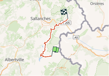
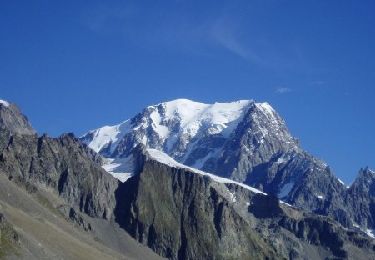
Trail Mountain bike of 68 km to be discovered at Auvergne-Rhône-Alpes, Savoy, Bourg-Saint-Maurice. This trail is proposed by tracegps.

Description

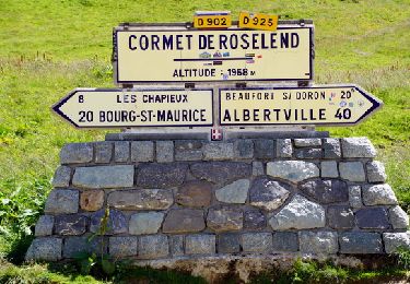
Étape très longue, c’est possible de la couper à Contamines, après il y a une 6eme étape, Contamines Coll de Voza et Les Houches. Au col de La Gitte, il faut pousser le vélo pendant 15 m. Après le descente est très difficile, montée au col Joly est très bonne.

Elevation profile

Photos

Positioning

Country:
France
Region :
Auvergne-Rhône-Alpes
Department/Province :
Savoy
Municipality :
Bourg-Saint-Maurice
Location:
Unknown
Start:(UTM)
323565 ; 5062805 (32T) N.

Trails nearby

Trail Walking Bourg-Saint-Maurice - le lac de Mya, le col des Fours et la tête  sud des Fours - Photo
Walking
GUIDE
amiral13

Walking

Difficult
Bourg-Saint-Maurice, Auvergne-Rhône-Alpes, Savoy, France
12.3 km | 26 km-effort
6h 20min
Yes
Trail Walking Beaufort - Ref de la Laie vers refuge du Presset - Photo
Walking
stjullie

Walking

Medium
(1)
Beaufort, Auvergne-Rhône-Alpes, Savoy, France
10.6 km | 19.8 km-effort
5h 17min
No
Trail Walking Beaufort - Col et lac du grand fond  - Photo
Walking
Le_Grand

Walking

Very difficult
Beaufort, Auvergne-Rhône-Alpes, Savoy, France
13.3 km | 23 km-effort
5h 15min
Yes
Trail Walking Beaufort - Col de la Sauce, Rocher du Vent - Photo
Walking
GUIDE
David25400

Walking

Easy
Beaufort, Auvergne-Rhône-Alpes, Savoy, France
9.1 km | 17.6 km-effort
3h 51min
Yes
Trail Walking Bourg-Saint-Maurice - Le refuge de La Croix du bonhomme Elisabetta soldoni - Photo
Walking
GUIDE
Roger Philippe Wallez

Walking

Very difficult
Bourg-Saint-Maurice, Auvergne-Rhône-Alpes, Savoy, France
17.2 km | 32 km-effort
8h 6min
No
Trail Touring skiing Bourg-Saint-Maurice - autour du lac de Mya - Photo
Touring skiing
nadd73

Touring skiing

Easy
Bourg-Saint-Maurice, Auvergne-Rhône-Alpes, Savoy, France
10.1 km | 25 km-effort
4h 42min
No
Trail Walking Les Contamines-Montjoie - Beaufortain: Autour de La Pierra Menta: J4 - Ref du Col du Bonhomme - Gite de Plan Mya - Photo
Walking
patjobou

Walking

Difficult
Les Contamines-Montjoie, Auvergne-Rhône-Alpes, Upper Savoy, France
13.1 km | 21 km-effort
4h 2min
No
Trail Walking Bourg-Saint-Maurice - Col de Seigne - Photo
Walking
Hugues Michel

Walking

Difficult
Bourg-Saint-Maurice, Auvergne-Rhône-Alpes, Savoy, France
10.1 km | 19.1 km-effort
3h 1min
Yes
Trail Walking Beaufort - Combe de la Neuva depuis le Cormet de Roselend - Photo
Walking
walrou63

Walking

Very difficult
Beaufort, Auvergne-Rhône-Alpes, Savoy, France
14.2 km | 23 km-effort
4h 20min
Yes


Close
My subscriptions