Trail Walking Eaux-Bonnes - Traversée dans les Pyrénées de Gourette à Luz Saint Sauveur - Photo

Traversée dans les Pyrénées de Gourette à Luz Saint Sauveur

 tracegps
tracegps

User

© OpenStreetMap contributors
Length
Length
95 km
Max alt
Max alt
2738 m
Uphill gradient
Uphill gradient
6296 m
Km-Effort
Km-Effort  
181 km
Min alt
Min alt
727 m
Downhill gradient
Downhill gradient
7005 m
Boucle
Boucle
No
Creation date :
2014-12-10 00:00:00.0
Updated on :
2014-12-10 00:00:00.0

(0 Reviews)

Walking
Walking
54h00
Difficulty : Very difficult

Scan this QR Code to open this trail in the SityTrail application

FREE GPS app for hiking

Logo SityTrail SityTrail

IGN / Geographical institutes

Download SityTrail from the App Store Download SityTrail from Google Play

Logo SityTrail SityTrail World

The world is yours!

Download SityTrail from the App Store Download SityTrail from Google Play Download SityTrail on Huawei AppGallery

About

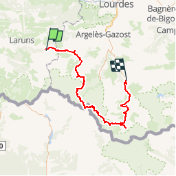
Trail Walking of 95 km to be discovered at New Aquitaine, Pyrénées-Atlantiques, Eaux-Bonnes. This trail is proposed by tracegps.

Description

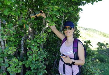
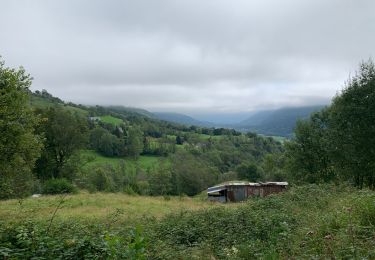
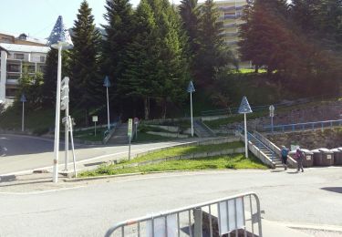
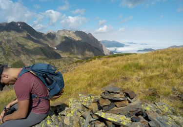
Magnifique Traversée dans les Pyrénées de Gourette à Luz Saint Sauveur Jour 1 : de Luz Saint Sauveur à Arrens Marsous Jour 2 : de Arrens Marsous au Lac du Barbat / Bivouac Jour 3 : du Lac du Barbat au Refuge Wallon / Bivouac Jour 4 : du Refuge Wallon au Refuge des Oulettes de Gaube/ Bivouac Jour 5 : du Refuge des Oulettes à Gavarnie / Camping Jour 6 : de Gavarnie à Luz St Sauveur.

Elevation profile

Photos

Points of interest

Point of interest Arrens-Marsous - Jour 1 Arrens Marsous - Photo
tracegps
ARRENS-MARSOUS 
Point of interest Luz-Saint-Sauveur - Jour 6 / Luz St Sauveur / Bivouac - Photo
tracegps
Point of interest Gavarnie-Gèdre - Jour 5 / Gavarnie / Camping - Photo
tracegps

Positioning

Country:
France
Region :
New Aquitaine
Department/Province :
Pyrénées-Atlantiques
Municipality :
Eaux-Bonnes
Location:
Unknown
Start:(UTM)
718037 ; 4759545 (30T) N.

Trails nearby

Trail On foot Arbéost - SityTrail - Arbeost le tour des quartiers d'Arbeost fait - Photo
On foot
GUIDE
marmotte65

On foot

Easy
(1)
Arbéost, Occitania, Hautespyrenees, France
6.7 km | 12.3 km-effort
Unknown
Yes
Trail Walking Eaux-Bonnes - Le Pic Sanctus 2482m depuis Gourette - Photo
Walking
tracegps

Walking

Difficult
(1)
Eaux-Bonnes, New Aquitaine, Pyrénées-Atlantiques, France
11.4 km | 26 km-effort
6h 0min
Yes
Trail On foot Béost - Les crêtes d’Andreyt - Photo
On foot
PRO

On foot

Easy
Béost, New Aquitaine, Pyrénées-Atlantiques, France
9.6 km | 14.7 km-effort
3h 20min
Yes
Trail On foot Eaux-Bonnes - Le Lac d'Anglas - Photo
On foot
PRO

On foot

Easy
Eaux-Bonnes, New Aquitaine, Pyrénées-Atlantiques, France
3.6 km | 10.6 km-effort
2h 24min
No
Trail Walking Eaux-Bonnes - GOURETTE Terra aventura - Photo
Walking
GUIDE
marmotte65

Walking

Medium
Eaux-Bonnes, New Aquitaine, Pyrénées-Atlantiques, France
5 km | 9.1 km-effort
2h 4min
Yes
Trail Walking Béost - crête d'adreyt - Photo
Walking
JJ Albert

Walking

Easy
Béost, New Aquitaine, Pyrénées-Atlantiques, France
9.4 km | 15 km-effort
3h 16min
Yes
Trail Walking Eaux-Bonnes - GR 10 - 17ème étape : Gourette - com de Tortes - Arrens - Photo
Walking
LEGUE

Walking

Medium
Eaux-Bonnes, New Aquitaine, Pyrénées-Atlantiques, France
14.4 km | 27 km-effort
4h 28min
No
Trail Walking Eaux-Bonnes - GOURETTE gr10v Balisage avec May et Sylvie  - Photo
Walking
GUIDE
marmotte65

Walking

Difficult
Eaux-Bonnes, New Aquitaine, Pyrénées-Atlantiques, France
5.6 km | 12.2 km-effort
2h 24min
No
Trail Walking Eaux-Bonnes - pic sanctus - Photo
Walking
fred TMT

Walking

Difficult
Eaux-Bonnes, New Aquitaine, Pyrénées-Atlantiques, France
13.3 km | 29 km-effort
4h 19min
No


Close
My subscriptions