Trail Walking Montmelas-Saint-Sorlin - Col de Saint Bonnet (13-09-18)  - Photo
© OpenStreetMap contributors
Length
Length
8.1 km
Max alt
Max alt
719 m
Uphill gradient
Uphill gradient
286 m
Km-Effort
Km-Effort  
11.9 km
Min alt
Min alt
504 m
Downhill gradient
Downhill gradient
286 m
Boucle
Boucle
Yes
Creation date :
2019-01-15 16:12:21.175
Updated on :
2019-01-15 16:12:21.175

(1 Reviews)

Walking
Walking
2h29
Difficulty : Easy

Scan this QR Code to open this trail in the SityTrail application

FREE GPS app for hiking

Logo SityTrail SityTrail

IGN / Geographical institutes

Download SityTrail from the App Store Download SityTrail from Google Play

Logo SityTrail SityTrail World

The world is yours!

Download SityTrail from the App Store Download SityTrail from Google Play Download SityTrail on Huawei AppGallery

About

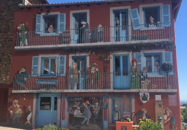
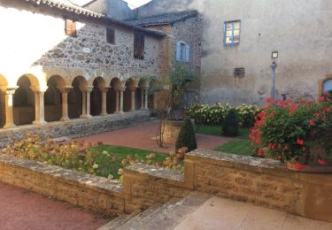
Trail Walking of 8.1 km to be discovered at Auvergne-Rhône-Alpes, Rhône, Montmelas-Saint-Sorlin. This trail is proposed by Thomasdanielle.

Description

D/A du Col de Saint Bonnet
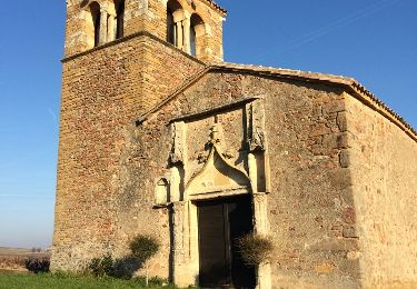
Petite randonnée très ombragée
agréable par grosse chaleur
8,1 km - D. 287 m

Elevation profile

Positioning

Country:
France
Region :
Auvergne-Rhône-Alpes
Department/Province :
Rhône
Municipality :
Montmelas-Saint-Sorlin
Location:
Unknown
Start:(UTM)
623150 ; 5097709 (31T) N.

Comments

Please log in to post a review or rate the element


Ombragée parfait en temps de chaleur mais peu de panoramas à voir, plein de mûres à ramasser


Trails nearby

Trail Walking Saint-Cyr-le-Chatoux - Saint-cyr-le-Chatoux
Walking
Thomasdanielle

Walking

Medium
(2)
Saint-Cyr-le-Chatoux, Auvergne-Rhône-Alpes, Rhône, France
11.7 km | 16.7 km-effort
3h 45min
Yes
Trail Walking Rivolet - Rivolet - Photo
Walking
jpcoco

Walking

Medium
(2)
Rivolet, Auvergne-Rhône-Alpes, Rhône, France
11.1 km | 17.2 km-effort
3h 42min
No
Trail On foot Vaux-en-Beaujolais - SityTrail - 3843016 - etape-2 - Photo
On foot
chessyca

On foot

Very difficult
Vaux-en-Beaujolais, Auvergne-Rhône-Alpes, Rhône, France
22 km | 35 km-effort
7h 58min
No
Trail Walking Lacenas - Lacenas (11 km - D 310 m) RG - Photo
Walking
Thomasdanielle

Walking

Easy
Lacenas, Auvergne-Rhône-Alpes, Rhône, France
10.6 km | 14.7 km-effort
2h 38min
Yes
Trail Walking Vaux-en-Beaujolais - Vaulx en beaujolais  - Photo
Walking
aurel69

Walking

Easy
(1)
Vaux-en-Beaujolais, Auvergne-Rhône-Alpes, Rhône, France
14.3 km | 22 km-effort
4h 25min
Yes
Trail Walking Salles-Arbuissonnas-en-Beaujolais - Salles-Arbuissonnas-en-Beaujolais - Photo
Walking
Thomasdanielle

Walking

Easy
Salles-Arbuissonnas-en-Beaujolais, Auvergne-Rhône-Alpes, Rhône, France
16.4 km | 23 km-effort
4h 55min
Yes
Trail Walking Denicé - Denice´ - 2 - (69) - Photo
Walking
Thomasdanielle

Walking

Very easy
Denicé, Auvergne-Rhône-Alpes, Rhône, France
11.5 km | 17.4 km-effort
3h 17min
Yes
Trail Walking Denicé - Denicé (69) - Photo
Walking
Thomasdanielle

Walking

Easy
Denicé, Auvergne-Rhône-Alpes, Rhône, France
11.6 km | 17.5 km-effort
3h 17min
Yes
Trail Walking Le Perréon - le Perréon (69) - Photo
Walking
Thomasdanielle

Walking

Easy
Le Perréon, Auvergne-Rhône-Alpes, Rhône, France
10.8 km | 16.5 km-effort
3h 17min
Yes


Close
My subscriptions