Trail Mountain bike Firfol - Course VTT de Firfol du 09 05 2010 - 9 km par tour - Photo

Course VTT de Firfol du 09 05 2010 - 9 km par tour

 tracegps
tracegps

User

© OpenStreetMap contributors
Length
Length
8.7 km
Max alt
Max alt
155 m
Uphill gradient
Uphill gradient
167 m
Km-Effort
Km-Effort  
10.9 km
Min alt
Min alt
77 m
Downhill gradient
Downhill gradient
168 m
Boucle
Boucle
Yes
Creation date :
2014-12-10 00:00:00.0
Updated on :
2014-12-10 00:00:00.0

(0 Reviews)

Mountain bike
Mountain bike
49m
Difficulty : Difficult

Scan this QR Code to open this trail in the SityTrail application

FREE GPS app for hiking

Logo SityTrail SityTrail

IGN / Geographical institutes

Download SityTrail from the App Store Download SityTrail from Google Play

Logo SityTrail SityTrail World

The world is yours!

Download SityTrail from the App Store Download SityTrail from Google Play Download SityTrail on Huawei AppGallery

About

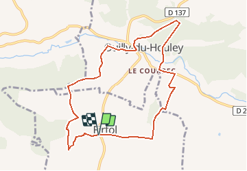
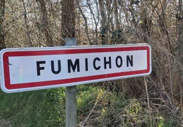
Trail Mountain bike of 8.7 km to be discovered at Normandy, Calvados, Firfol. This trail is proposed by tracegps.

Description

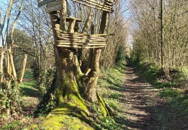
Course VTT UFOLEP de Firfol du 09 05 2010, entre 1 tour et 4 tours selon les catégories. Beau parcours très rapide en conditions sèches, 1ère grosse descente sur Ouilly du Houlley (un vrai plaisir), puis remontée derrière le château, passage sur un petit pont au dessus du ruisseau "La Paquine", à nouveau une belle descente, attention danger "grosses racines" avec des vitesses de plus de 50 km/H, on traverse une nouvelle fois la Paquine sur un petit pont ou dans le ruisseau en fonction de chacun mais surtout de la T°c puis remontée tranquille vers Firfol, ça roule.

Elevation profile

Positioning

Country:
France
Region :
Normandy
Department/Province :
Calvados
Municipality :
Firfol
Location:
Unknown
Start:(UTM)
304597 ; 5448025 (31U) N.

Trails nearby

Trail Walking Glos - Au tour. De GLOS - Photo
Walking
pauldurand

Walking

Glos, Normandy, Calvados, France
9 km | 10.9 km-effort
3h 20min
Yes
Trail Walking Hermival-les-Vaux - Hermival les Vaux - Photo
Walking
werth

Walking

Medium
Hermival-les-Vaux, Normandy, Calvados, France
18.2 km | 22 km-effort
5h 12min
Yes
Trail Mountain bike Glos - Autour de Glos - Photo
Mountain bike
tracegps

Mountain bike

Difficult
Glos, Normandy, Calvados, France
39 km | 50 km-effort
2h 30min
Yes
Trail Walking Ouilly-du-Houley - Ouille du Houley - Photo
Walking
Eve - Line

Walking

Medium
Ouilly-du-Houley, Normandy, Calvados, France
11.3 km | 14.4 km-effort
3h 9min
Yes
Trail Walking Fumichon - Fumichon - Photo
Walking
Eve - Line

Walking

Medium
(1)
Fumichon, Normandy, Calvados, France
13.9 km | 16.4 km-effort
2h 43min
Yes
Trail Walking Moyaux - Moyaux - Photo
Walking
Eve - Line

Walking

Easy
Moyaux, Normandy, Calvados, France
11.8 km | 12.8 km-effort
2h 17min
Yes
Trail Walking Hermival-les-Vaux - roque - Photo
Walking
serisier

Walking

Very easy
Hermival-les-Vaux, Normandy, Calvados, France
23 km | 28 km-effort
6h 0min
Yes
Trail Mountain bike Courtonne-la-Meurdrac - Rando de Courtonne La Meurdrac - Photo
Mountain bike
tracegps

Mountain bike

Difficult
Courtonne-la-Meurdrac, Normandy, Calvados, France
30 km | 36 km-effort
2h 30min
Yes
Trail Walking Courtonne-la-Meurdrac - Rando de Courtonne La Meurdrac - Photo
Walking
tracegps

Walking

Very difficult
Courtonne-la-Meurdrac, Normandy, Calvados, France
30 km | 36 km-effort
5h 0min
Yes


Close
My subscriptions