Trail Mountain bike Toulouse - Fil Vert VTT du Grand Toulouse - Edition 2010 30km - Photo

Fil Vert VTT du Grand Toulouse - Edition 2010 30km

 tracegps
tracegps

User

© OpenStreetMap contributors
Length
Length
29 km
Max alt
Max alt
257 m
Uphill gradient
Uphill gradient
464 m
Km-Effort
Km-Effort  
35 km
Min alt
Min alt
130 m
Downhill gradient
Downhill gradient
461 m
Boucle
Boucle
Yes
Creation date :
2014-12-10 00:00:00.0
Updated on :
2014-12-10 00:00:00.0

(1 Reviews)

Mountain bike
Mountain bike
2h30
Difficulty : Medium

Scan this QR Code to open this trail in the SityTrail application

FREE GPS app for hiking

Logo SityTrail SityTrail

IGN / Geographical institutes

Download SityTrail from the App Store Download SityTrail from Google Play

Logo SityTrail SityTrail World

The world is yours!

Download SityTrail from the App Store Download SityTrail from Google Play Download SityTrail on Huawei AppGallery

About

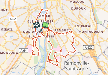
Trail Mountain bike of 29 km to be discovered at Occitania, Haute-Garonne, Toulouse. This trail is proposed by tracegps.

Description

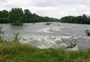
Le parcours du samedi matin, dit sportif, de la 18 ème édition du Fil Vert de Toulouse. Une belle sortie, depuis Toulouse intra-muros, pour ceux qui ne veulent pas (peuvent pas) trop s'éloigner de Toulouse. Au programme, 2 grimpettes sur les coteaux de Pech David, avec des belles vues sur la ville. Quelques rues et pistes cyclables sont au programme, forcement! 370 m de dénivelé au total.

Elevation profile

Positioning

Country:
France
Region :
Occitania
Department/Province :
Haute-Garonne
Municipality :
Toulouse
Location:
Unknown
Start:(UTM)
373569 ; 4825797 (31T) N.

Comments

Please log in to post a review or rate the element


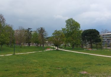
bon parcour tres varié avec de belle vues sur toulouse depuis les coteaux


Trails nearby

Trail Walking Toulouse - De Toulouse à Bouconne par le GR653 - Photo
Walking
tracegps

Walking

Difficult
(1)
Toulouse, Occitania, Haute-Garonne, France
21 km | 24 km-effort
5h 0min
No
Trail Cycle Toulouse - Canal du Midi - Photo
Cycle
frizou83

Cycle

Very easy
(1)
Toulouse, Occitania, Haute-Garonne, France
259 km | 281 km-effort
15h 55min
No
Trail Walking Toulouse - Tour de Toulouse par la Garonne  - Photo
Walking
CooolGeorges

Walking

Medium
Toulouse, Occitania, Haute-Garonne, France
9.3 km | 11 km-effort
2h 35min
Yes
Trail Walking Toulouse - Toulouse - Pinsaguel  - Photo
Walking
zazibelle

Walking

Easy
(1)
Toulouse, Occitania, Haute-Garonne, France
15.6 km | 17.5 km-effort
4h 59min
No
Trail Cycle Toulouse - Canal du Midi - Etape 1 - Photo
Cycle
frizou83

Cycle

Very easy
Toulouse, Occitania, Haute-Garonne, France
55 km | 61 km-effort
3h 28min
No
Trail Walking Toulouse - Rive Droite Garonne Toulouse Gagnac - Photo
Walking
RR31

Walking

Easy
Toulouse, Occitania, Haute-Garonne, France
24 km | 27 km-effort
5h 55min
No
Trail Walking Toulouse - Rive Droite Garonne Toulouse Gagnac - Photo
Walking
RR31

Walking

Easy
Toulouse, Occitania, Haute-Garonne, France
24 km | 27 km-effort
5h 55min
No
Trail Mountain bike Toulouse - La Garonne de Toulouse vers Blagnac - Photo
Mountain bike
tracegps

Mountain bike

Medium
Toulouse, Occitania, Haute-Garonne, France
31 km | 35 km-effort
2h 0min
Yes
Trail Walking Toulouse - TT22 Bellefontaine variante - Photo
Walking

Walking

Medium
Toulouse, Occitania, Haute-Garonne, France
11 km | 12.3 km-effort
2h 0min
No


Close
My subscriptions