Trail Mountain bike Embrun - Espace VTT FFC de l'Embrunais Savinois - Circuit n° 2 - Boucle de la Plaine sous le Roc - Photo

Espace VTT FFC de l'Embrunais Savinois - Circuit n° 2 - Boucle de la Plaine sous le Roc

 tracegps
tracegps

User

© OpenStreetMap contributors
Length
Length
5.1 km
Max alt
Max alt
813 m
Uphill gradient
Uphill gradient
51 m
Km-Effort
Km-Effort  
5.8 km
Min alt
Min alt
782 m
Downhill gradient
Downhill gradient
52 m
Boucle
Boucle
Yes
Creation date :
2014-12-10 00:00:00.0
Updated on :
2014-12-10 00:00:00.0

(1 Reviews)

Mountain bike
Mountain bike
25m
Difficulty : Easy

Scan this QR Code to open this trail in the SityTrail application

FREE GPS app for hiking

Logo SityTrail SityTrail

IGN / Geographical institutes

Download SityTrail from the App Store Download SityTrail from Google Play

Logo SityTrail SityTrail World

The world is yours!

Download SityTrail from the App Store Download SityTrail from Google Play Download SityTrail on Huawei AppGallery

About

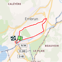
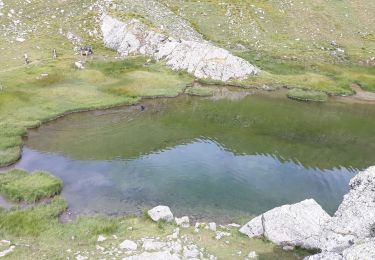
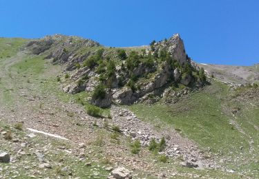
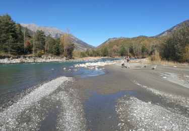
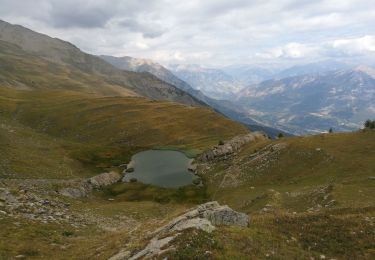
Trail Mountain bike of 5.1 km to be discovered at Provence-Alpes-Côte d'Azur, Hautes-Alpes, Embrun. This trail is proposed by tracegps.

Description

Espace VTT FFC de l'Embrunais Savinois - Circuit n° 2 - Boucle de la Plaine sous le Roc. Circuit labellisé par la Fédération Française de Cyclisme. Départ : Embrun, parking sous le pont de la Clapière Exclusivement sur route goudronnée, ce circuit très facile est destiné aux familles et aux promeneurs. Au départ, l’itinéraire longe agréablement la Durance. Puis il passe sous le Roc d’Embrun, la falaise sur laquelle le village d’Embrun a été bâti. De plus, le parcours offre une vue sur toutes les montagnes voisines.

Elevation profile

Photos

Positioning

Country:
France
Region :
Provence-Alpes-Côte d'Azur
Department/Province :
Hautes-Alpes
Municipality :
Embrun
Location:
Unknown
Start:(UTM)
300263 ; 4936220 (32T) N.

Comments

Please log in to post a review or rate the element


Devoluy vtt 3 tour des Puytrès facile


Trails nearby

Trail Walking Embrun - Lac de l'Hivernet - Photo
Walking
gildascb

Walking

Easy
(1)
Embrun, Provence-Alpes-Côte d'Azur, Hautes-Alpes, France
10.6 km | 21 km-effort
3h 55min
Yes
Trail Walking Embrun - Mont Guillaume-Col de Chanté Perdrix-Lac de l'Hivernet(07-09-16) - Photo
Walking
Dervalmarc

Walking

Difficult
(2)
Embrun, Provence-Alpes-Côte d'Azur, Hautes-Alpes, France
15.4 km | 31 km-effort
7h 4min
Yes
Trail Walking Embrun - Mont Guillaume - Col de Trempa-Latz - 2671 - 10/09/23 - Photo
Walking
GUIDE
R@ph

Walking

Very difficult
Embrun, Provence-Alpes-Côte d'Azur, Hautes-Alpes, France
13.6 km | 28 km-effort
6h 20min
Yes
Trail Walking Embrun - Mt Guillaume - Lac de l'Hivernet - Photo
Walking
GUIDE
David25400

Walking

Difficult
Embrun, Provence-Alpes-Côte d'Azur, Hautes-Alpes, France
12.7 km | 28 km-effort
4h 8min
Yes
Trail Walking Embrun - lac de l hivernet - Photo
Walking
gibello

Walking

Easy
(1)
Embrun, Provence-Alpes-Côte d'Azur, Hautes-Alpes, France
9.4 km | 19.5 km-effort
4h 1min
Yes
Trail Walking Embrun - Mont Guillaume - Photo
Walking
Marco05

Walking

Difficult
Embrun, Provence-Alpes-Côte d'Azur, Hautes-Alpes, France
12.6 km | 26 km-effort
5h 55min
Yes
Trail Walking Saint-André-d'Embrun - pinée et vietnam 221021 - Photo
Walking
GUIDE
David25400

Walking

Very easy
Saint-André-d'Embrun, Provence-Alpes-Côte d'Azur, Hautes-Alpes, France
39 km | 50 km-effort
4h 23min
No
Trail Walking Embrun - Muandes de Bourlinche 201021 - Photo
Walking
GUIDE
David25400

Walking

Very easy
Embrun, Provence-Alpes-Côte d'Azur, Hautes-Alpes, France
11.5 km | 21 km-effort
4h 3min
Yes
Trail Walking Embrun - mont guillaume 090921 - Photo
Walking
GUIDE
David25400

Walking

Very easy
Embrun, Provence-Alpes-Côte d'Azur, Hautes-Alpes, France
16.6 km | 32 km-effort
6h 30min
No


Close
My subscriptions