Trail Running Vauvenargues - Vauvenargues - Lambruisse - Photo
 tracegps
tracegps

User

© OpenStreetMap contributors
Length
Length
10.1 km
Max alt
Max alt
659 m
Uphill gradient
Uphill gradient
220 m
Km-Effort
Km-Effort  
13.1 km
Min alt
Min alt
521 m
Downhill gradient
Downhill gradient
223 m
Boucle
Boucle
Yes
Creation date :
2014-12-10 00:00:00.0
Updated on :
2014-12-10 00:00:00.0

(0 Reviews)

Running
Running
1h10
Difficulty : Medium

Scan this QR Code to open this trail in the SityTrail application

FREE GPS app for hiking

Logo SityTrail SityTrail

IGN / Geographical institutes

Download SityTrail from the App Store Download SityTrail from Google Play

Logo SityTrail SityTrail World

The world is yours!

Download SityTrail from the App Store Download SityTrail from Google Play Download SityTrail on Huawei AppGallery

About

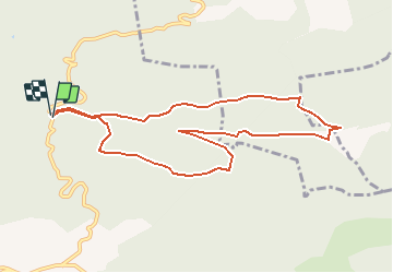
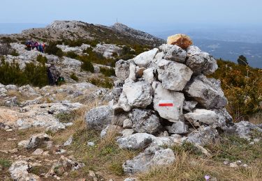
Trail Running of 10.1 km to be discovered at Provence-Alpes-Côte d'Azur, Bouches-du-Rhône, Vauvenargues. This trail is proposed by tracegps.

Description

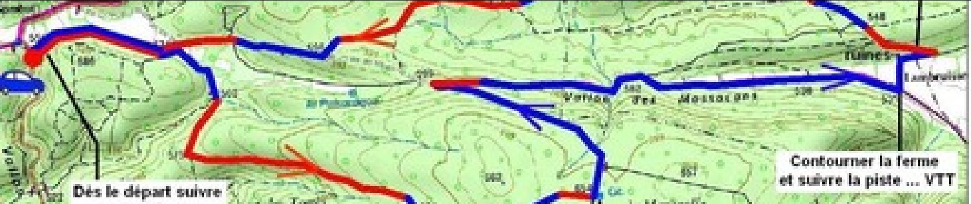
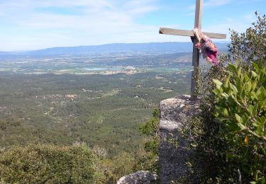
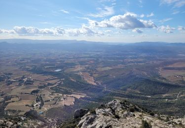
Après Vauvenargues prendre à gauche la Départementale 11 en direction du Sambuc. Garer la voiture sur le bas-côté devant la piste D.F.C.I. CD 115. Itinéraire sur belles pistes forestières faciles, larges et sans ombre. La première partie nous offre une belle vue sur le versant Nord de la montagne de Sainte-Victoire.

Elevation profile

Photos

Positioning

Country:
France
Region :
Provence-Alpes-Côte d'Azur
Department/Province :
Bouches-du-Rhône
Municipality :
Vauvenargues
Location:
Unknown
Start:(UTM)
711335 ; 4827792 (31T) N.

Trails nearby

Trail Walking Vauvenargues - Le Signal, Montagne Sainte-Victoire - Photo
Walking
tracegps

Walking

Medium
(2)
Vauvenargues, Provence-Alpes-Côte d'Azur, Bouches-du-Rhône, France
15 km | 25 km-effort
6h 19min
Yes
Trail On foot Vauvenargues - Sentier des Venturiers - Photo
On foot
PRO

On foot

Easy
Vauvenargues, Provence-Alpes-Côte d'Azur, Bouches-du-Rhône, France
5 km | 10.5 km-effort
2h 23min
No
Trail Walking Jouques - le Concors - Photo
Walking
GUIDE
amiral13

Walking

Easy
Jouques, Provence-Alpes-Côte d'Azur, Bouches-du-Rhône, France
8.5 km | 14.4 km-effort
3h 31min
Yes
Trail Walking Jouques - Mont Concors Taulisson - Photo
Walking
GUIDE
harydh

Walking

Easy
Jouques, Provence-Alpes-Côte d'Azur, Bouches-du-Rhône, France
8.4 km | 13.3 km-effort
2h 45min
Yes
Trail Walking Peyrolles-en-Provence - la trempasse - Photo
Walking
ARPF1

Walking

Medium
Peyrolles-en-Provence, Provence-Alpes-Côte d'Azur, Bouches-du-Rhône, France
10.4 km | 16.3 km-effort
3h 49min
Yes
Trail Walking Vauvenargues - Vauvenargues - Col de Suberoque - Garagaï - Croix de Provence - Prieuré - Sentier Imoucha - Le Tholonet - Photo
Walking
LtZIP

Walking

Medium
Vauvenargues, Provence-Alpes-Côte d'Azur, Bouches-du-Rhône, France
17.4 km | 28 km-effort
5h 33min
No
Trail Walking Vauvenargues - le pic des mouches et la citadelle - Photo
Walking
GUIDE
amiral13

Walking

Easy
Vauvenargues, Provence-Alpes-Côte d'Azur, Bouches-du-Rhône, France
11.4 km | 18.3 km-effort
3h 53min
Yes
Trail Walking Jouques - Concors - Photo
Walking
martilin

Walking

Medium
Jouques, Provence-Alpes-Côte d'Azur, Bouches-du-Rhône, France
8.2 km | 14.1 km-effort
3h 12min
Yes
Trail Walking Vauvenargues - Sainte-Victoire (accès par Vauvenargues et GR9) - Photo
Walking
PiloudeBamako

Walking

Difficult
Vauvenargues, Provence-Alpes-Côte d'Azur, Bouches-du-Rhône, France
14.2 km | 24 km-effort
6h 15min
Yes


Close
My subscriptions