Trail Walking Carignan-de-Bordeaux - Boucle locale Carignan-de-Bordeaux / Latresne - Photo

Boucle locale Carignan-de-Bordeaux / Latresne

 tracegps
tracegps

User

© OpenStreetMap contributors
Length
Length
4.2 km
Max alt
Max alt
66 m
Uphill gradient
Uphill gradient
108 m
Km-Effort
Km-Effort  
5.7 km
Min alt
Min alt
4 m
Downhill gradient
Downhill gradient
110 m
Boucle
Boucle
Yes
Creation date :
2014-12-10 00:00:00.0
Updated on :
2014-12-10 00:00:00.0

(0 Reviews)

Walking
Walking
1h30
Difficulty : Easy

Scan this QR Code to open this trail in the SityTrail application

FREE GPS app for hiking

Logo SityTrail SityTrail

IGN / Geographical institutes

Download SityTrail from the App Store Download SityTrail from Google Play

Logo SityTrail SityTrail World

The world is yours!

Download SityTrail from the App Store Download SityTrail from Google Play Download SityTrail on Huawei AppGallery

About

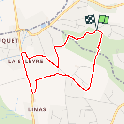
Trail Walking of 4.2 km to be discovered at New Aquitaine, Gironde, Carignan-de-Bordeaux. This trail is proposed by tracegps.

Description

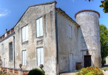
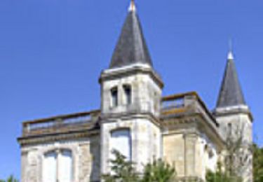
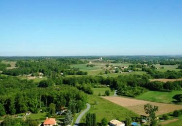
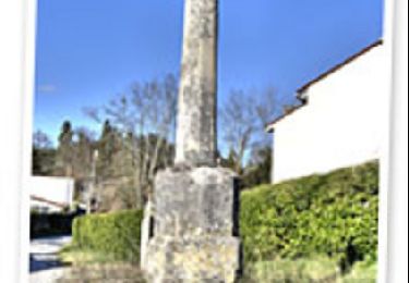
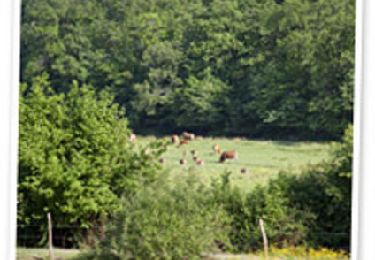
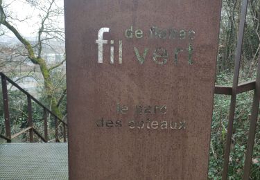
Cette boucle locale mise en place par le Conseil Général de la Gironde vous emmènera à travers le vignoble des coteaux bordelais. Vous croiserez un petit ruisseau et son petit pont, un lavoir, les châteaux Malherbes et Gassies, d'anciens habitats troglodytes et le hameau de la Seleyre.

Elevation profile

Photos

Points of interest

Point of interest Carignan-de-Bordeaux - Village de Cuchet - Photo
tracegps
CARIGNAN-DE-BORDEAUX 
Point of interest Carignan-de-Bordeaux - Domaine du Grand Arnaud - Photo
tracegps
CARIGNAN-DE-BORDEAUX 
Point of interest Carignan-de-Bordeaux - Lavoir de Bonnefond - Photo
tracegps
CARIGNAN-DE-BORDEAUX 
Point of interest Latresne - Château de Malherbes - Photo
tracegps

Positioning

Country:
France
Region :
New Aquitaine
Department/Province :
Gironde
Municipality :
Carignan-de-Bordeaux
Location:
Unknown
Start:(UTM)
698522 ; 4964293 (30T) N.

Trails nearby

Trail Walking Latresne - Circuit de Saint Pantaléon - Latresne - Photo
Walking
tracegps

Walking

Medium
(1)
Latresne, New Aquitaine, Gironde, France
5.7 km | 7 km-effort
1h 49min
Yes
Trail Walking Latresne - Circuit des châteaux - Latresne  - Photo
Walking
tracegps

Walking

Medium
(1)
Latresne, New Aquitaine, Gironde, France
4.3 km | 5.7 km-effort
1h 30min
Yes
Trail Cycle Bouliac - Piste Cyclable Bordeaux - Sauveterre de Guyenne - Roger Labépie - Photo
Cycle
tracegps

Cycle

Medium
(1)
Bouliac, New Aquitaine, Gironde, France
50 km | 57 km-effort
3h 0min
No
Trail Walking Bouliac - Circuit de Macanan - Bouliac - Photo
Walking
tracegps

Walking

Easy
(1)
Bouliac, New Aquitaine, Gironde, France
3 km | 4.1 km-effort
1h 0min
Yes
Trail Walking Bouliac - Circuit des coteaux - Bouliac - Photo
Walking
tracegps

Walking

Easy
(1)
Bouliac, New Aquitaine, Gironde, France
5.4 km | 6.9 km-effort
1h 40min
Yes
Trail Mountain bike Bouliac - 33-Bouliac-20120513 - Photo
Mountain bike
Gus64

Mountain bike

Medium
(2)
Bouliac, New Aquitaine, Gironde, France
47 km | 58 km-effort
3h 50min
Yes
Trail Walking Fargues-Saint-Hilaire - vers le coin de paradis  - Photo
Walking
la gane

Walking

Medium
Fargues-Saint-Hilaire, New Aquitaine, Gironde, France
7.1 km | 8.2 km-effort
1h 55min
Yes
Trail Bicycle tourism Latresne - Latresne-Courpiac - Photo
Bicycle tourism
ilur56

Bicycle tourism

Easy
Latresne, New Aquitaine, Gironde, France
34 km | 39 km-effort
2h 27min
No
Trail Walking Floirac - les 2 églises - Photo
Walking
Eric De Smedt

Walking

Easy
Floirac, New Aquitaine, Gironde, France
6.5 km | 8.5 km-effort
1h 32min
Yes


Close
My subscriptions