Trail Walking Rochefort-Montagne - La Roche Branlante par Rochefort Montagne - Photo

La Roche Branlante par Rochefort Montagne

 tracegps
tracegps

User

© OpenStreetMap contributors
Length
Length
15.5 km
Max alt
Max alt
1094 m
Uphill gradient
Uphill gradient
379 m
Km-Effort
Km-Effort  
21 km
Min alt
Min alt
857 m
Downhill gradient
Downhill gradient
380 m
Boucle
Boucle
Yes
Creation date :
2014-12-10 00:00:00.0
Updated on :
2014-12-10 00:00:00.0

(0 Reviews)

Walking
Walking
4h00
Difficulty : Medium

Scan this QR Code to open this trail in the SityTrail application

FREE GPS app for hiking

Logo SityTrail SityTrail

IGN / Geographical institutes

Download SityTrail from the App Store Download SityTrail from Google Play

Logo SityTrail SityTrail World

The world is yours!

Download SityTrail from the App Store Download SityTrail from Google Play Download SityTrail on Huawei AppGallery

About

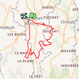
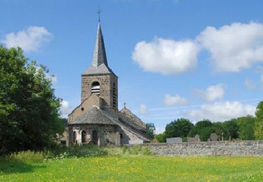
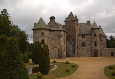
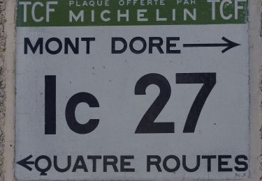
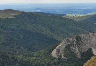
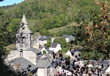
Trail Walking of 15.5 km to be discovered at Auvergne-Rhône-Alpes, Puy-de-Dôme, Rochefort-Montagne. This trail is proposed by tracegps.

Description

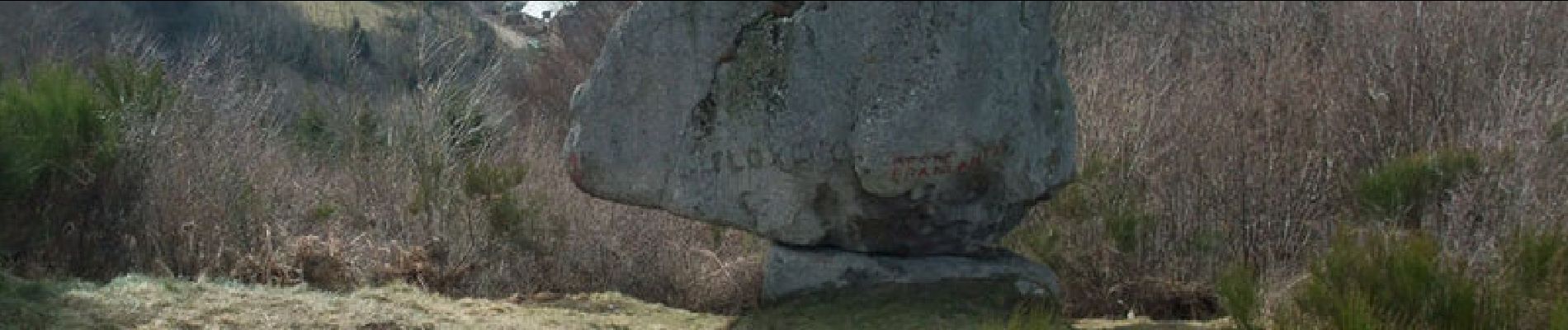
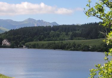
Balade sans aucune difficulté. Malgré des chemins goudronnés l'itinéraire est agréable, sans circulation autre que locale, offrant de très belles vues et la Roche Branlante, clou de la balade, est remarquable. Le rocher bouge très sensiblement après plusieurs poussées à la pointe (une flèche rouge indique l'endroit où il faut pousser en phase avec les oscillations du rocher; insensibles au début mais très visibles par la suite)

Elevation profile

Photos

Points of interest

Point of interest Rochefort-Montagne - départ - Photo
tracegps
ROCHEFORT-MONTAGNE 
Point of interest Orcival - La roche branlante - Photo
tracegps

Positioning

Country:
France
Region :
Auvergne-Rhône-Alpes
Department/Province :
Puy-de-Dôme
Municipality :
Rochefort-Montagne
Location:
Unknown
Start:(UTM)
484359 ; 5058739 (31T) N.

Trails nearby

Trail Walking Orcival - Lac de Servières à partir du Café du Lac - Photo
Walking
Dalma Chuck

Walking

Medium
(1)
Orcival, Auvergne-Rhône-Alpes, Puy-de-Dôme, France
6.6 km | 9.5 km-effort
2h 9min
Yes
Trail Walking Saint-Bonnet-près-Orcival - St_Bonnet_Orcival_Sioule - Photo
Walking
GUIDE
jagarnier

Walking

Easy
(1)
Saint-Bonnet-près-Orcival, Auvergne-Rhône-Alpes, Puy-de-Dôme, France
9.4 km | 11.8 km-effort
2h 45min
Yes
Trail Walking Saint-Pierre-Roche - St_Pierre_Roche_Sioulot - Photo
Walking
GUIDE
jagarnier

Walking

Easy
(1)
Saint-Pierre-Roche, Auvergne-Rhône-Alpes, Puy-de-Dôme, France
10.7 km | 13.2 km-effort
2h 51min
Yes
Trail On foot Saint-Pierre-Roche - Le Sioulot - Photo
On foot
PRO

On foot

Easy
Saint-Pierre-Roche, Auvergne-Rhône-Alpes, Puy-de-Dôme, France
10 km | 12.3 km-effort
2h 47min
No
Trail On foot Rochefort-Montagne - Le Puy d'Ebert - Photo
On foot
PRO

On foot

Easy
Rochefort-Montagne, Auvergne-Rhône-Alpes, Puy-de-Dôme, France
9.4 km | 12.3 km-effort
2h 47min
No
Trail On foot Orcival - Bois des Bourelles - Photo
On foot
PRO

On foot

Easy
Orcival, Auvergne-Rhône-Alpes, Puy-de-Dôme, France
6.9 km | 10.1 km-effort
2h 17min
Yes
Trail Walking Orcival - Serviere_Aiguiller_T - Photo
Walking
force

Walking

Difficult
Orcival, Auvergne-Rhône-Alpes, Puy-de-Dôme, France
12.2 km | 17.2 km-effort
2h 46min
Yes
Trail Walking Orcival - Orcival_Bois_Bourelles - Photo
Walking
GUIDE
jagarnier

Walking

Easy
Orcival, Auvergne-Rhône-Alpes, Puy-de-Dôme, France
6.9 km | 10.1 km-effort
2h 0min
Yes
Trail Walking Orcival - 290522 Lac de Servière / ferme de la tâche  - Photo
Walking
ricou1964

Walking

Easy
Orcival, Auvergne-Rhône-Alpes, Puy-de-Dôme, France
7.5 km | 10.1 km-effort
1h 51min
No


Close
My subscriptions