Trail Walking Vis-en-Artois - Vis en Artois - Rémy - Photo
 tracegps
tracegps

User

© OpenStreetMap contributors
Length
Length
10 km
Max alt
Max alt
78 m
Uphill gradient
Uphill gradient
82 m
Km-Effort
Km-Effort  
11.1 km
Min alt
Min alt
45 m
Downhill gradient
Downhill gradient
82 m
Boucle
Boucle
Yes
Creation date :
2014-12-10 00:00:00.0
Updated on :
2014-12-10 00:00:00.0

(0 Reviews)

Walking
Walking
2h00
Difficulty : Medium

Scan this QR Code to open this trail in the SityTrail application

FREE GPS app for hiking

Logo SityTrail SityTrail

IGN / Geographical institutes

Download SityTrail from the App Store Download SityTrail from Google Play

Logo SityTrail SityTrail World

The world is yours!

Download SityTrail from the App Store Download SityTrail from Google Play Download SityTrail on Huawei AppGallery

About

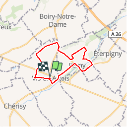
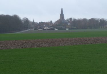
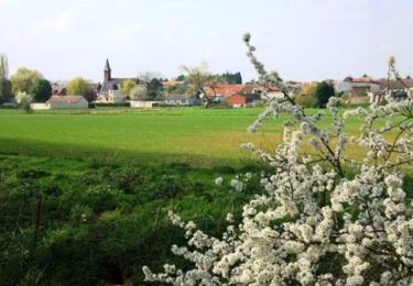
Trail Walking of 10 km to be discovered at Hauts-de-France, Pas-de-Calais, Vis-en-Artois. This trail is proposed by tracegps.

Description

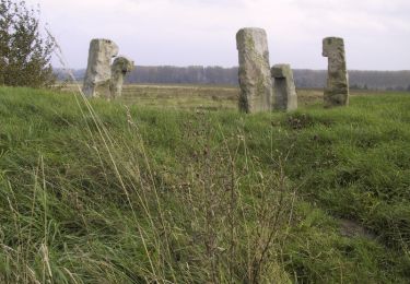
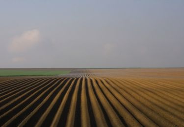
Le tour de Vis et de Remy en passant par le bois noisette et le moulin du Roy.

Elevation profile

Photos

Positioning

Country:
France
Region :
Hauts-de-France
Department/Province :
Pas-de-Calais
Municipality :
Vis-en-Artois
Location:
Unknown
Start:(UTM)
495627 ; 5566245 (31U) N.

Trails nearby

Trail Walking Monchy-le-Preux - Le chemin du Caribou - Monchy le Preux - Photo
Walking
tracegps

Walking

Medium
(1)
Monchy-le-Preux, Hauts-de-France, Pas-de-Calais, France
9.2 km | 10.1 km-effort
2h 19min
Yes
Trail Walking Chérisy - De Chérisy à Guémappe par les verts Sablons - Photo
Walking
tracegps

Walking

Medium
Chérisy, Hauts-de-France, Pas-de-Calais, France
10.3 km | 11.5 km-effort
2h 0min
Yes
Trail Walking Wancourt - Wancourt - Héninel - Guémappe - Photo
Walking
tracegps

Walking

Medium
Wancourt, Hauts-de-France, Pas-de-Calais, France
10.4 km | 11.3 km-effort
2h 0min
Yes
Trail Walking Dury - Dury - Saudemont - Recourt - Etaing - Eterpigny - Photo
Walking
tracegps

Walking

Medium
Dury, Hauts-de-France, Pas-de-Calais, France
10.6 km | 11.6 km-effort
2h 0min
Yes
Trail Walking Wancourt - Le chemin de la petite Sensée - Wancourt - Photo
Walking
tracegps

Walking

Medium
Wancourt, Hauts-de-France, Pas-de-Calais, France
10.9 km | 12.2 km-effort
2h 45min
Yes
Trail Walking Étaing - Etaing - Les Bonnettes - Sailly en Ostrevent - Photo
Walking
tracegps

Walking

Medium
Étaing, Hauts-de-France, Pas-de-Calais, France
10.7 km | 11.6 km-effort
2h 0min
Yes
Trail Walking Wancourt - Wancourt - Heninel - Domaine des cascades - Photo
Walking
tracegps

Walking

Medium
Wancourt, Hauts-de-France, Pas-de-Calais, France
10.8 km | 12.1 km-effort
2h 0min
Yes
Trail Walking Monchy-le-Preux - Monchy le Preux - Photo
Walking
tracegps

Walking

Medium
Monchy-le-Preux, Hauts-de-France, Pas-de-Calais, France
9.7 km | 10.6 km-effort
2h 0min
Yes
Trail Walking Wancourt - Wancourt - Guémappe - Heninel - Photo
Walking
tracegps

Walking

Medium
Wancourt, Hauts-de-France, Pas-de-Calais, France
10.1 km | 11.2 km-effort
2h 0min
Yes


Close
My subscriptions