Trail Walking Mandailles-Saint-Julien - Le Téton de Vénus - Mandailles Saint Julien - Photo

Le Téton de Vénus - Mandailles Saint Julien

 tracegps
tracegps

User

© OpenStreetMap contributors
Length
Length
23 km
Max alt
Max alt
1670 m
Uphill gradient
Uphill gradient
1084 m
Km-Effort
Km-Effort  
37 km
Min alt
Min alt
921 m
Downhill gradient
Downhill gradient
1084 m
Boucle
Boucle
Yes
Creation date :
2014-12-10 00:00:00.0
Updated on :
2014-12-10 00:00:00.0

(0 Reviews)

Walking
Walking
8h00
Difficulty : Difficult

Scan this QR Code to open this trail in the SityTrail application

FREE GPS app for hiking

Logo SityTrail SityTrail

IGN / Geographical institutes

Download SityTrail from the App Store Download SityTrail from Google Play

Logo SityTrail SityTrail World

The world is yours!

Download SityTrail from the App Store Download SityTrail from Google Play Download SityTrail on Huawei AppGallery

About

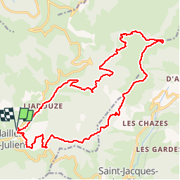
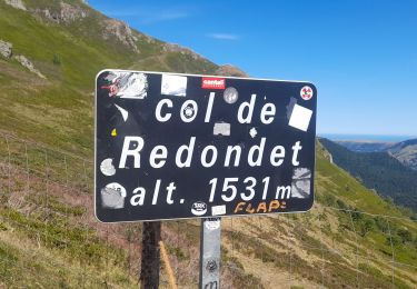
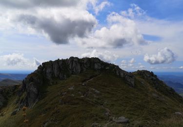
Trail Walking of 23 km to be discovered at Auvergne-Rhône-Alpes, Cantal, Mandailles-Saint-Julien. This trail is proposed by tracegps.

Description

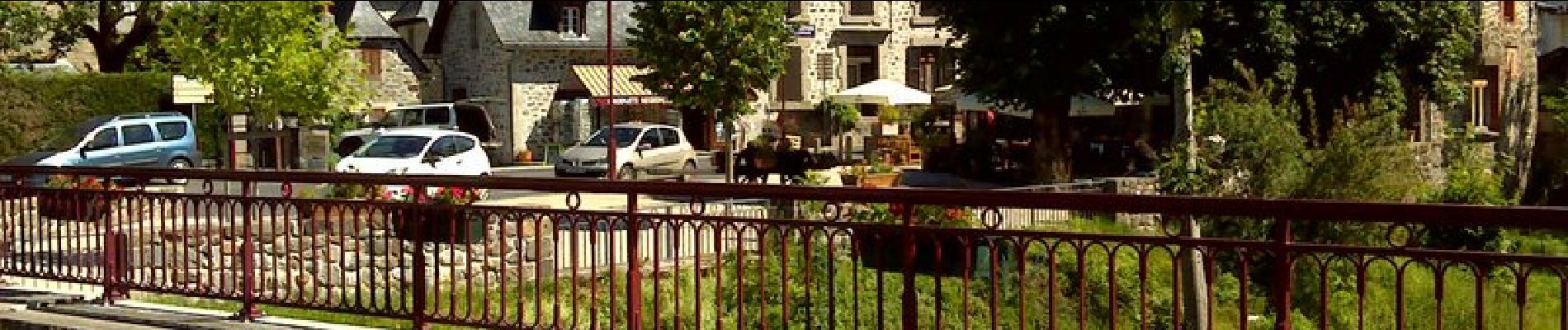
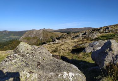
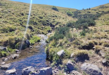
Cette superbe randonnée au départ de Mandailles-Saint-Julien, a un dénivelé assez progressif, sauf la montée du bas de vallée vers le Téton de Vénus. Mise à part la durée, compter 8:00 et pas de difficultés particulières. Nous l'avons fait fin juin par 30°. Très bonne randonnée!!

Elevation profile

Photos

Positioning

Country:
France
Region :
Auvergne-Rhône-Alpes
Department/Province :
Cantal
Municipality :
Mandailles-Saint-Julien
Location:
Unknown
Start:(UTM)
472941 ; 4990697 (31T) N.

Trails nearby

Trail Walking Mandailles-Saint-Julien - L'Elancèze - Photo
Walking
tracegps

Walking

Difficult
(1)
Mandailles-Saint-Julien, Auvergne-Rhône-Alpes, Cantal, France
12.8 km | 24 km-effort
5h 0min
Yes
Trail Walking Laveissière - Lioran 2023-08-18 Col de Rombière Col du Pertus A/R - Photo
Walking
marionneau

Walking

Easy
(1)
Laveissière, Auvergne-Rhône-Alpes, Cantal, France
12.5 km | 18.8 km-effort
4h 14min
Yes
Trail Walking Laveissière - Lioran 2023-08-09 Puy de Seycheuse - Photo
Walking
marionneau

Walking

Very difficult
(1)
Laveissière, Auvergne-Rhône-Alpes, Cantal, France
13.9 km | 23 km-effort
5h 20min
Yes
Trail Walking Le Fau - Puy violent  - Photo
Walking
sdroneau

Walking

Very difficult
Le Fau, Auvergne-Rhône-Alpes, Cantal, France
22 km | 37 km-effort
8h 29min
Yes
Trail Walking Laveissière - Lioran 2023-08-09 Puy de Seycheuse  - Photo
Walking
marionneau

Walking

Medium
Laveissière, Auvergne-Rhône-Alpes, Cantal, France
14.8 km | 25 km-effort
4h 34min
Yes
Trail Hybrid bike Mandailles-Saint-Julien - Tournemire  - Photo
Hybrid bike
nadd73

Hybrid bike

Medium
Mandailles-Saint-Julien, Auvergne-Rhône-Alpes, Cantal, France
39 km | 50 km-effort
3h 2min
No
Trail Walking Le Falgoux - puy mary - Photo
Walking
bellouelo46

Walking

Very easy
Le Falgoux, Auvergne-Rhône-Alpes, Cantal, France
5.8 km | 10.9 km-effort
2h 24min
Yes
Trail Walking Le Claux - Le Peyre Arse depuis le col d'Eylac - Photo
Walking
Hugues Michel

Walking

Medium
Le Claux, Auvergne-Rhône-Alpes, Cantal, France
7.6 km | 13.4 km-effort
2h 24min
Yes
Trail Walking Saint-Jacques-des-Blats - Grange Dévézou col du Pertus par col du Gliziou - Photo
Walking
marionneau

Walking

Easy
Saint-Jacques-des-Blats, Auvergne-Rhône-Alpes, Cantal, France
16.8 km | 24 km-effort
4h 6min
Yes


Close
My subscriptions