Trail Walking Vaugrigneuse - Autour de Saint Maurice Montcouronne - Vaugrigneuse - Photo

Autour de Saint Maurice Montcouronne - Vaugrigneuse

 tracegps
tracegps

User

© OpenStreetMap contributors
Length
Length
24 km
Max alt
Max alt
173 m
Uphill gradient
Uphill gradient
334 m
Km-Effort
Km-Effort  
29 km
Min alt
Min alt
58 m
Downhill gradient
Downhill gradient
334 m
Boucle
Boucle
Yes
Creation date :
2014-12-10 00:00:00.0
Updated on :
2014-12-10 00:00:00.0

(0 Reviews)

Walking
Walking
5h00
Difficulty : Medium

Scan this QR Code to open this trail in the SityTrail application

FREE GPS app for hiking

Logo SityTrail SityTrail

IGN / Geographical institutes

Download SityTrail from the App Store Download SityTrail from Google Play

Logo SityTrail SityTrail World

The world is yours!

Download SityTrail from the App Store Download SityTrail from Google Play Download SityTrail on Huawei AppGallery

About

Trail Walking of 24 km to be discovered at Ile-de-France, Essonne, Vaugrigneuse. This trail is proposed by tracegps.

Description

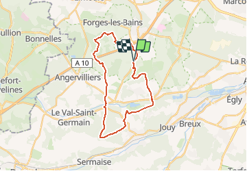
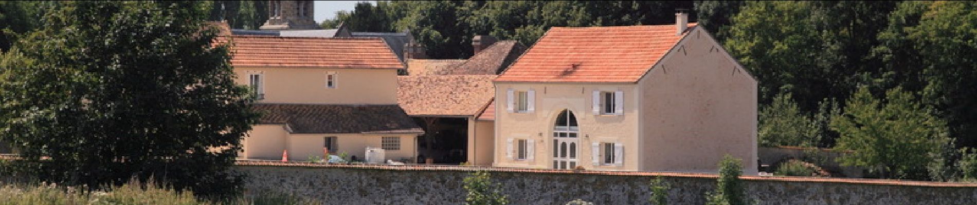
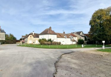
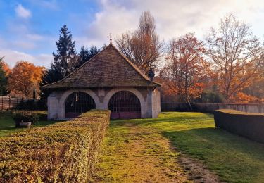
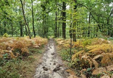
Au départ de Vraugrigneuse, cette boucle commence à longer le golf de Courson Monteloup, puis contourne Saint Maurice Montcouronne par l’Est et le Sud. Après le centre équestre de la Folleville, une grande ligne droite sur un chemin pavé, on passe devant le château de Baville. L’itinéraire rejoint le GR11 au bois du Marais, passe devant le château du Marais ; il quitte le GR11 près de Forges les Bains pour reprendre le cap de Vaugrigneuse via le hameau de Launey Maréchaux.

Elevation profile

Photos

Positioning

Country:
France
Region :
Ile-de-France
Department/Province :
Essonne
Municipality :
Vaugrigneuse
Location:
Unknown
Start:(UTM)
435226 ; 5383662 (31U) N.

Trails nearby

Trail Walking Limours - Essonne_RD_Limours=>Viaduc=>Prédecelle=>Chaumusson - Photo
Walking
BMorin91470

Walking

Easy
(1)
Limours, Ile-de-France, Essonne, France
7.4 km | 8.4 km-effort
2h 30min
Yes
Trail Walking Limours - 20210319_Limours_Viaduc_Prédecelle_Amont - Photo
Walking
BMorin91470

Walking

Easy
(1)
Limours, Ile-de-France, Essonne, France
8.7 km | 9.9 km-effort
2h 30min
Yes
Trail Mountain bike Limours - St Arnoult 33km-2h30 - Photo
Mountain bike
delalex

Mountain bike

Difficult
(1)
Limours, Ile-de-France, Essonne, France
34 km | 39 km-effort
2h 33min
Yes
Trail Mountain bike Fontenay-lès-Briis - Soucy / Le Marais - Photo
Mountain bike
Bora431

Mountain bike

Medium
(2)
Fontenay-lès-Briis, Ile-de-France, Essonne, France
25 km | 30 km-effort
1h 52min
Yes
Trail Walking Limours - Essonne_Limours=>Chaumusson=>Pecqueuse=>Villevert=>Limours - Photo
Walking
BMorin91470

Walking

Medium
Limours, Ile-de-France, Essonne, France
11.5 km | 13.3 km-effort
3h 1min
Yes
Trail Walking Bruyères-le-Châtel - Boucle Fontenay les Briis - Photo
Walking
chessyca

Walking

Very easy
Bruyères-le-Châtel, Ile-de-France, Essonne, France
22 km | 26 km-effort
5h 4min
Yes
Trail Walking Saint-Maurice-Montcouronne - Boucle St Maurice Montcouronne - Brigitte - Photo
Walking
chessyca

Walking

Very easy
Saint-Maurice-Montcouronne, Ile-de-France, Essonne, France
21 km | 24 km-effort
4h 19min
Yes
Trail Walking Limours - Rumba à limour - Photo
Walking
philou91

Walking

Medium
Limours, Ile-de-France, Essonne, France
11.9 km | 13.8 km-effort
3h 28min
Yes
Trail Walking Fontenay-lès-Briis - Essonne_Fontenay-Les-Briis=>Roche-Turpin=>Soucy(bis) - Photo
Walking
BMorin91470

Walking

Easy
Fontenay-lès-Briis, Ile-de-France, Essonne, France
8.6 km | 10.2 km-effort
2h 8min
Yes


Close
My subscriptions