Trail Walking Entrechaux - Entrechaux en Vaucluse - Photo
 tracegps
tracegps

User

© OpenStreetMap contributors
Length
Length
9.5 km
Max alt
Max alt
383 m
Uphill gradient
Uphill gradient
312 m
Km-Effort
Km-Effort  
13.7 km
Min alt
Min alt
259 m
Downhill gradient
Downhill gradient
314 m
Boucle
Boucle
Yes
Creation date :
2014-12-10 00:00:00.0
Updated on :
2014-12-10 00:00:00.0

(1 Reviews)

Walking
Walking
2h40
Difficulty : Medium

Scan this QR Code to open this trail in the SityTrail application

FREE GPS app for hiking

Logo SityTrail SityTrail

IGN / Geographical institutes

Download SityTrail from the App Store Download SityTrail from Google Play

Logo SityTrail SityTrail World

The world is yours!

Download SityTrail from the App Store Download SityTrail from Google Play Download SityTrail on Huawei AppGallery

About

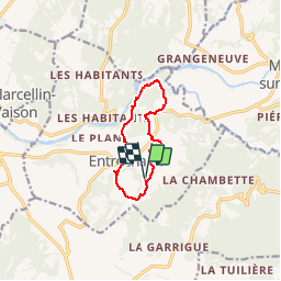
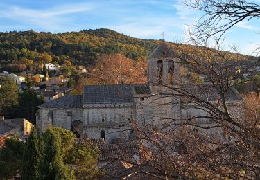
Trail Walking of 9.5 km to be discovered at Provence-Alpes-Côte d'Azur, Vaucluse, Entrechaux. This trail is proposed by tracegps.

Description

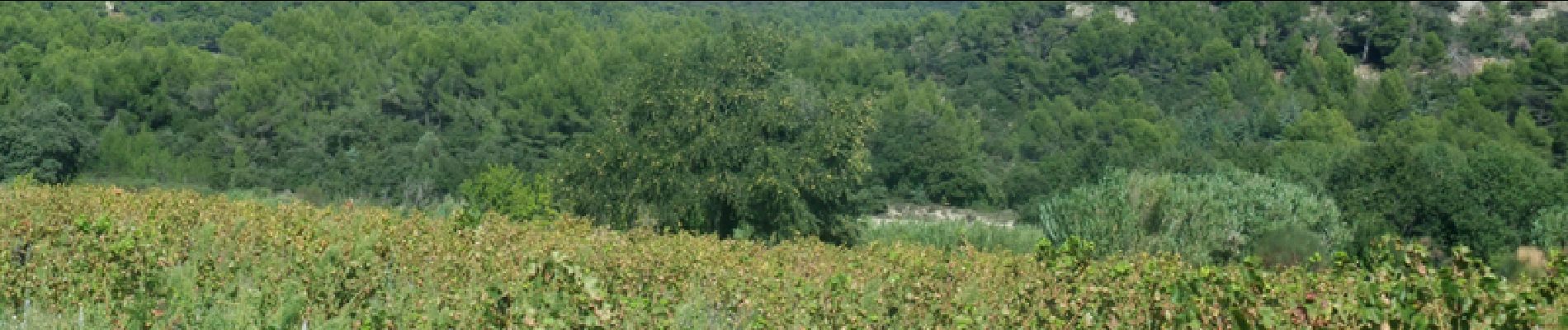
Départ près du cimetière d'Entrechaux. Une balade entre vignes et les cerisiers; parmi les chênes et pins. Une vue sur les gorges de l'Ouvèze, en amont de Vaison la Romaine. Ici l'Ouvèze serpente tranquillement mais on sait ce qu'elle peut faire !!!

Elevation profile

Photos

Points of interest

Point of interest Entrechaux - 1 - Photo
tracegps
ENTRECHAUX 
Point of interest Entrechaux - départ - Photo
tracegps
ENTRECHAUX 
Point of interest Entrechaux - Point de Vue - Photo
tracegps
ENTRECHAUX 

Positioning

Country:
France
Region :
Provence-Alpes-Côte d'Azur
Department/Province :
Vaucluse
Municipality :
Entrechaux
Location:
Unknown
Start:(UTM)
671214 ; 4897800 (31T) N.

Comments

Please log in to post a review or rate the element


Trails nearby

Trail On foot Mollans-sur-Ouvèze - Roubion - Photo
On foot
PRO

On foot

Easy
Mollans-sur-Ouvèze, Auvergne-Rhône-Alpes, Drôme, France
4.6 km | 7.3 km-effort
1h 39min
Yes
Trail On foot Mollans-sur-Ouvèze - Pisserouille - Photo
On foot
PRO

On foot

Easy
Mollans-sur-Ouvèze, Auvergne-Rhône-Alpes, Drôme, France
3.5 km | 5.9 km-effort
1h 19min
Yes
Trail On foot Mollans-sur-Ouvèze - Crête et Ubac de Bluye - Photo
On foot
PRO

On foot

Easy
Mollans-sur-Ouvèze, Auvergne-Rhône-Alpes, Drôme, France
7.4 km | 12.8 km-effort
2h 54min
Yes
Trail On foot Mollans-sur-Ouvèze - Adret de Bluye - Photo
On foot
PRO

On foot

Easy
Mollans-sur-Ouvèze, Auvergne-Rhône-Alpes, Drôme, France
9.1 km | 16.6 km-effort
3h 46min
Yes
Trail On foot Mollans-sur-Ouvèze - Mollans - Pierrelongue - Photo
On foot
PRO

On foot

Easy
Mollans-sur-Ouvèze, Auvergne-Rhône-Alpes, Drôme, France
7.5 km | 10.9 km-effort
2h 28min
Yes
Trail Walking Malaucène - Campagne de Malaucène - Photo
Walking
tracegps

Walking

Easy
(2)
Malaucène, Provence-Alpes-Côte d'Azur, Vaucluse, France
6.6 km | 8.1 km-effort
1h 30min
Yes
Trail Mountain bike Entrechaux - Tour de base VTT - Photo
Mountain bike
oldsars

Mountain bike

Very difficult
(1)
Entrechaux, Provence-Alpes-Côte d'Azur, Vaucluse, France
19.2 km | 28 km-effort
Unknown
Yes
Trail Walking Malaucène - Autour de Malaucène  - Photo
Walking
GUIDE
nadinebondoux

Walking

Difficult
Malaucène, Provence-Alpes-Côte d'Azur, Vaucluse, France
18.3 km | 27 km-effort
5h 53min
Yes
Trail Walking Malaucène - Malaucène  - Photo
Walking
GUIDE
Roger Philippe Wallez

Walking

Very difficult
Malaucène, Provence-Alpes-Côte d'Azur, Vaucluse, France
18.6 km | 27 km-effort
6h 32min
Yes


Close
My subscriptions