Trail Walking Roquefixade - Boucle de Roquefixade - Photo

Boucle de Roquefixade

 tracegps
tracegps

User

© OpenStreetMap contributors
Length
Length
14.1 km
Max alt
Max alt
887 m
Uphill gradient
Uphill gradient
582 m
Km-Effort
Km-Effort  
22 km
Min alt
Min alt
482 m
Downhill gradient
Downhill gradient
581 m
Boucle
Boucle
Yes
Creation date :
2014-12-10 00:00:00.0
Updated on :
2014-12-10 00:00:00.0

(1 Reviews)

Walking
Walking
6h00
Difficulty : Medium

Scan this QR Code to open this trail in the SityTrail application

FREE GPS app for hiking

Logo SityTrail SityTrail

IGN / Geographical institutes

Download SityTrail from the App Store Download SityTrail from Google Play

Logo SityTrail SityTrail World

The world is yours!

Download SityTrail from the App Store Download SityTrail from Google Play Download SityTrail on Huawei AppGallery

About

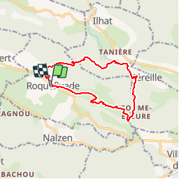
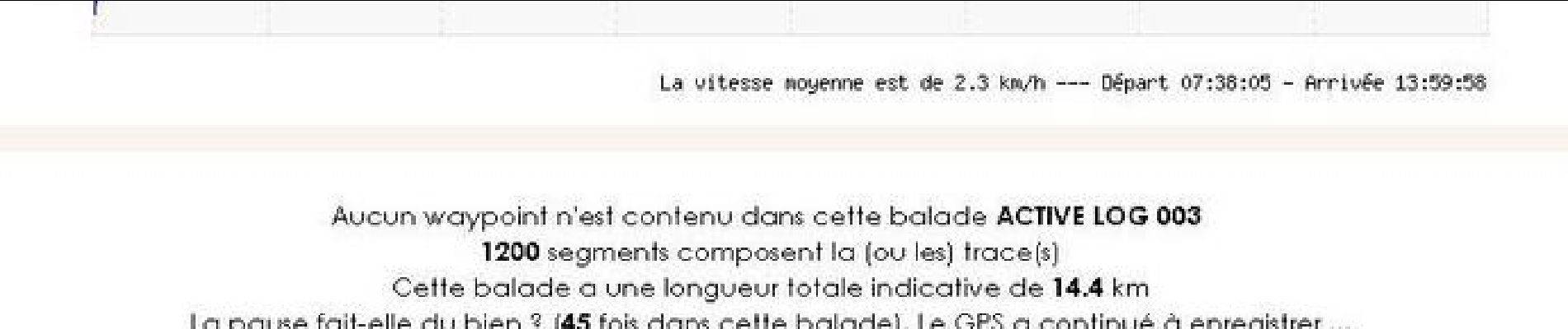
Trail Walking of 14.1 km to be discovered at Occitania, Ariège, Roquefixade. This trail is proposed by tracegps.

Description

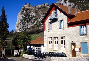
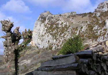
Départ de Roquefixade, à voir les ruines du château et le superbe panorama sur les Pyrénées.

Elevation profile

Photos

Positioning

Country:
France
Region :
Occitania
Department/Province :
Ariège
Municipality :
Roquefixade
Location:
Unknown
Start:(UTM)
398371 ; 4754373 (31T) N.

Comments

Please log in to post a review or rate the element


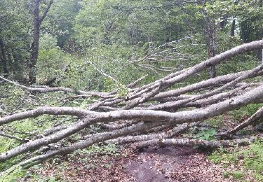
Il y a un écueil important dans ce sity-guide: la remontée aux environs du km 11. Il faut monter à gauche et passer la clôture en barbelés, puis c'est un long passage en champ d'herbes hautes mêlées à des épines.La longue descente est aussi assez éprouvante (zones humides, boueuses, en forte pente).par contre les gorges de Pereille et le retour final sont vraiment très beaux.


Trails nearby

Trail Walking Roquefixade - Le tour de Roquefixade - Photo
Walking
tracegps

Walking

Easy
(1)
Roquefixade, Occitania, Ariège, France
6.5 km | 10 km-effort
1h 30min
Yes
Trail Walking Roquefixade - roquefixade  - Photo
Walking
cappelle

Walking

Easy
Roquefixade, Occitania, Ariège, France
7.4 km | 10.8 km-effort
4h 0min
Yes
Trail On foot Roquefixade - Randonnée à Roquefixade - Photo
On foot
PRO

On foot

Easy
Roquefixade, Occitania, Ariège, France
3.7 km | 6.6 km-effort
1h 30min
Yes
Trail Walking Montferrier - découverte du château de montsegur et du village par montferroer - Photo
Walking
fab0202

Walking

Medium
Montferrier, Occitania, Ariège, France
12.6 km | 21 km-effort
3h 42min
Yes
Trail Walking Montferrier - Sentier cathare - Château de Montsegur - Photo
Walking
toutankhcarton

Walking

Medium
Montferrier, Occitania, Ariège, France
12.6 km | 21 km-effort
4h 48min
Yes
Trail Walking Roquefixade - 02 - ROQUEFIXADE à MONTSEGUR -  Chemin des Bons-Hommes GR107 ou sentier cathare 367 - Photo
Walking
jopost

Walking

Medium
Roquefixade, Occitania, Ariège, France
15.4 km | 25 km-effort
5h 18min
No
Trail Coupling Roquefixade - Cathare Fin Roquefixade. Foix - Photo
Coupling
jeff2

Coupling

Difficult
Roquefixade, Occitania, Ariège, France
21 km | 30 km-effort
4h 24min
No
Trail Walking Sautel - orrit avec Michel et tony 180419 - Photo
Walking
jopost

Walking

Easy
Sautel, Occitania, Ariège, France
4.3 km | 5.8 km-effort
1h 14min
No
Trail Walking Freychenet - Col de la Lauze - Le Fourcat (2001m) - Photo
Walking
jopost

Walking

Difficult
Freychenet, Occitania, Ariège, France
20 km | 37 km-effort
4h 3min
Yes


Close
My subscriptions