Trail Walking Montaigu - La rosière - Photo
 tracegps
tracegps

User

© OpenStreetMap contributors
Length
Length
5.7 km
Max alt
Max alt
217 m
Uphill gradient
Uphill gradient
149 m
Km-Effort
Km-Effort  
7.7 km
Min alt
Min alt
116 m
Downhill gradient
Downhill gradient
149 m
Boucle
Boucle
Yes
Creation date :
2014-12-10 00:00:00.0
Updated on :
2014-12-10 00:00:00.0

(1 Reviews)

Walking
Walking
1h45
Difficulty : Medium

Scan this QR Code to open this trail in the SityTrail application

FREE GPS app for hiking

Logo SityTrail SityTrail

IGN / Geographical institutes

Download SityTrail from the App Store Download SityTrail from Google Play

Logo SityTrail SityTrail World

The world is yours!

Download SityTrail from the App Store Download SityTrail from Google Play Download SityTrail on Huawei AppGallery

About

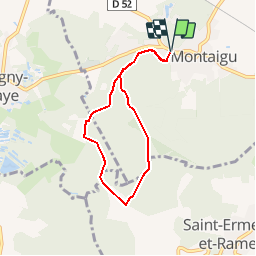
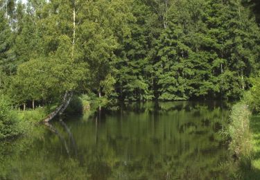
Trail Walking of 5.7 km to be discovered at Hauts-de-France, Aisne, Montaigu. This trail is proposed by tracegps.

Description

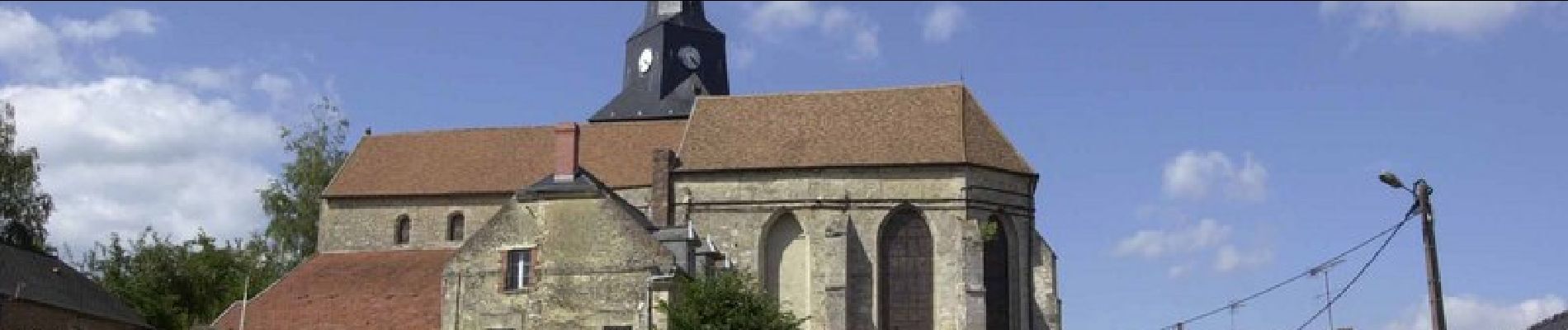
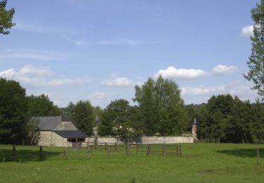
Cette agréable balade familiale vous laisse le temps de flâner en sous-bois, dans la fraîcheur de la forêt du plateau de Saint-Erme, où la lumière joue entre les arbres, puis elle revient vers l'ancienne motte féodale de Montaigu et sa belle église gothique. Toutes les infos sont ICI

Elevation profile

Photos

Positioning

Country:
France
Region :
Hauts-de-France
Department/Province :
Aisne
Municipality :
Montaigu
Location:
Unknown
Start:(UTM)
559843 ; 5487309 (31U) N.

Comments

Please log in to post a review or rate the element


Trails nearby

Trail Walking Mauregny-en-Haye - Le bois Françon - Photo
Walking
tracegps

Walking

Very difficult
(1)
Mauregny-en-Haye, Hauts-de-France, Aisne, France
8.4 km | 11.2 km-effort
3h 15min
Yes
Trail Mountain bike Saint-Erme-Outre-et-Ramecourt - La Maison-Bleue et le Bois Françon - Photo
Mountain bike
tracegps

Mountain bike

Very difficult
Saint-Erme-Outre-et-Ramecourt, Hauts-de-France, Aisne, France
20 km | 26 km-effort
3h 0min
Yes
Trail Walking Coucy-lès-Eppes - Le mont Héraut - Photo
Walking
tracegps

Walking

Very difficult
Coucy-lès-Eppes, Hauts-de-France, Aisne, France
12.7 km | 15.2 km-effort
3h 30min
Yes
Trail Walking Saint-Erme-Outre-et-Ramecourt - La maison bleue - Photo
Walking
tracegps

Walking

Very difficult
Saint-Erme-Outre-et-Ramecourt, Hauts-de-France, Aisne, France
11.6 km | 15 km-effort
3h 15min
Yes
Trail Mountain bike Coucy-lès-Eppes - Bosses de Coucy - Photo
Mountain bike
solisolo

Mountain bike

Medium
Coucy-lès-Eppes, Hauts-de-France, Aisne, France
70 km | 0 m-effort
4h 0min
Yes
Trail sport Coucy-lès-Eppes - 2898807-COUCY 2013 70k - Photo
sport
solisolo

sport

Very easy
Coucy-lès-Eppes, Hauts-de-France, Aisne, France
69 km | 0 m-effort
Unknown
Yes


Close
My subscriptions