Trail Walking Seraucourt-le-Grand - Fontaine - Photo
 tracegps
tracegps

User

© OpenStreetMap contributors
Length
Length
9.1 km
Max alt
Max alt
86 m
Uphill gradient
Uphill gradient
63 m
Km-Effort
Km-Effort  
9.9 km
Min alt
Min alt
67 m
Downhill gradient
Downhill gradient
65 m
Boucle
Boucle
Yes
Creation date :
2014-12-10 00:00:00.0
Updated on :
2014-12-10 00:00:00.0

(0 Reviews)

Walking
Walking
2h30
Difficulty : Medium

Scan this QR Code to open this trail in the SityTrail application

FREE GPS app for hiking

Logo SityTrail SityTrail

IGN / Geographical institutes

Download SityTrail from the App Store Download SityTrail from Google Play

Logo SityTrail SityTrail World

The world is yours!

Download SityTrail from the App Store Download SityTrail from Google Play Download SityTrail on Huawei AppGallery

About

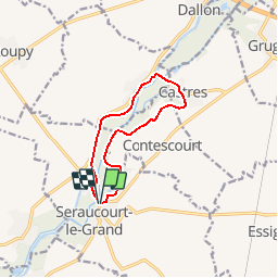
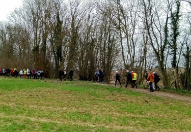
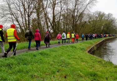
Trail Walking of 9.1 km to be discovered at Hauts-de-France, Aisne, Seraucourt-le-Grand. This trail is proposed by tracegps.

Description

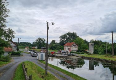
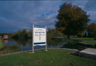
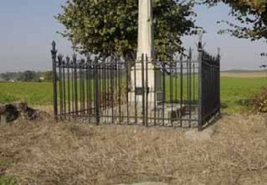
Situé sur le bras mort du canal, l'ancien port de Seraucourt a été reconverti en halte nautique. Sous le signe de l'eau et de la botanique, ce circuit traverse la zone floristique et ornithologique des marais de la Somme, entre peupleraie, aulnaie et saulaie. Toutes les infos sont ICI

Elevation profile

Photos

Positioning

Country:
France
Region :
Hauts-de-France
Department/Province :
Aisne
Municipality :
Seraucourt-le-Grand
Location:
Unknown
Start:(UTM)
515257 ; 5514355 (31U) N.

Trails nearby

Trail Mountain bike Castres - Parcours fontaines les clercs - Photo
Mountain bike
alainwald

Mountain bike

Easy
Castres, Hauts-de-France, Aisne, France
52 km | 57 km-effort
4h 14min
Yes
Trail Mountain bike Dallon - pays de ham - Photo
Mountain bike
alainwald

Mountain bike

Very easy
Dallon, Hauts-de-France, Aisne, France
56 km | 61 km-effort
4h 21min
Yes
Trail Walking Saint-Simon - Le point y - Photo
Walking

Walking

Very easy
Saint-Simon, Hauts-de-France, Aisne, France
6 km | 6.4 km-effort
Unknown
Yes
Trail Walking Saint-Simon - Le point Y - Photo
Walking
tracegps

Walking

Easy
Saint-Simon, Hauts-de-France, Aisne, France
6 km | 6.4 km-effort
1h 45min
Yes
Trail Walking Tugny-et-Pont - La-pierre-à-Bénie - Photo
Walking
tracegps

Walking

Very difficult
Tugny-et-Pont, Hauts-de-France, Aisne, France
13.6 km | 14.8 km-effort
3h 45min
Yes
Trail Walking Montescourt-Lizerolles - Montescourt-Lizerolles du 14-04-2024 - Photo
Walking
VANDERPUTTENMi

Walking

Very difficult
Montescourt-Lizerolles, Hauts-de-France, Aisne, France
19.8 km | 21 km-effort
4h 52min
Yes
Trail Walking Castres - Castres du 02-04-2023 après midi  - Photo
Walking
VANDERPUTTENMi

Walking

Medium
Castres, Hauts-de-France, Aisne, France
8.7 km | 9.9 km-effort
1h 58min
Yes
Trail Walking Castres - Castres du 02-04-2023 le matin - Photo
Walking
VANDERPUTTENMi

Walking

Medium
Castres, Hauts-de-France, Aisne, France
9.5 km | 10.4 km-effort
2h 12min
Yes
Trail Walking Artemps - Artemps 02  - Photo
Walking
José800

Walking

Medium
Artemps, Hauts-de-France, Aisne, France
8.8 km | 9.7 km-effort
2h 13min
Yes


Close
My subscriptions