Trail Walking Trescléoux - Tour des Baronnies du Buëch - Trescleoux - Serres - Photo

Tour des Baronnies du Buëch - Trescleoux - Serres

 tracegps
tracegps

User

© OpenStreetMap contributors
Length
Length
12.7 km
Max alt
Max alt
1524 m
Uphill gradient
Uphill gradient
912 m
Km-Effort
Km-Effort  
25 km
Min alt
Min alt
650 m
Downhill gradient
Downhill gradient
932 m
Boucle
Boucle
No
Creation date :
2014-12-10 00:00:00.0
Updated on :
2014-12-10 00:00:00.0

(0 Reviews)

Walking
Walking
4h30
Difficulty : Difficult

Scan this QR Code to open this trail in the SityTrail application

FREE GPS app for hiking

Logo SityTrail SityTrail

IGN / Geographical institutes

Download SityTrail from the App Store Download SityTrail from Google Play

Logo SityTrail SityTrail World

The world is yours!

Download SityTrail from the App Store Download SityTrail from Google Play Download SityTrail on Huawei AppGallery

About

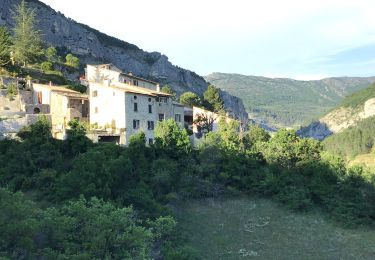
Trail Walking of 12.7 km to be discovered at Provence-Alpes-Côte d'Azur, Hautes-Alpes, Trescléoux. This trail is proposed by tracegps.

Description

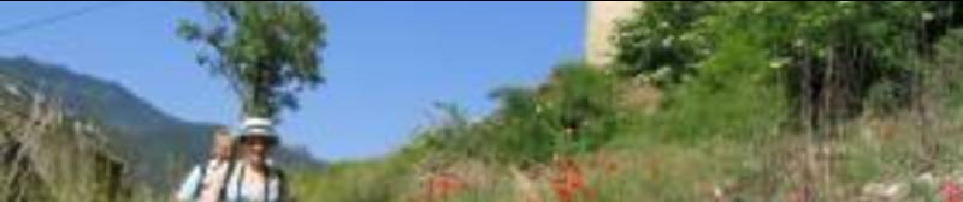
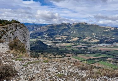
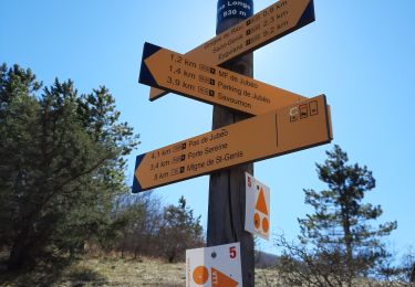
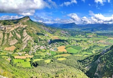
Le tout nouveau Tour des Baronnies du Buëch est un projet initié par la communauté des communes interdépartementale des Baronnies. « Colonne vertébrale » de la petite randonnée dans le Buëch, il constitue un produit d’appel pour la randonnée sur notre territoire. Cette itinéraire en crête offre des paysages somptueux tout en gardant une vue sur l’itinéraire réalisé et à parcourir. Cette étape fait la liaison avec Serres par la crête d'Aumage. Deux sites remarquables sur cet itinéraire: (La grotte d'Aumage, ou des Mazelières) et le "nez" de Beaumont(1544m) qui constitue un splendide et vertigineux promontoire au dessus de la vallée du Buëch. La Montée est longue est soutenue, la descente parfois assez raide. (Les moins chevronnés pourront descendre par Montclus, mais il faut prévoir une liaison par la route) D’autres informations, carte et road-book sont disponibles ICI

Elevation profile

Photos

Positioning

Country:
France
Region :
Provence-Alpes-Côte d'Azur
Department/Province :
Hautes-Alpes
Municipality :
Trescléoux
Location:
Unknown
Start:(UTM)
715888 ; 4914775 (31T) N.

Trails nearby

Trail Walking Garde-Colombe - R33   La Montagne de Saint Genis - Photo
Walking
GUIDE+

Walking

Medium
Garde-Colombe, Provence-Alpes-Côte d'Azur, Hautes-Alpes, France
11.4 km | 19.4 km-effort
3h 59min
Yes
Trail On foot Garde-Colombe - Revuaire - Photo
On foot
Marco05

On foot

Difficult
Garde-Colombe, Provence-Alpes-Côte d'Azur, Hautes-Alpes, France
12.1 km | 21 km-effort
4h 42min
Yes
Trail Walking Garde-Colombe - Le réduire.. gorge du riou - Photo
Walking
gibello

Walking

Medium
Garde-Colombe, Provence-Alpes-Côte d'Azur, Hautes-Alpes, France
12.1 km | 21 km-effort
5h 3min
Yes
Trail Mountain bike Garde-Colombe - Pas du Colombier - Photo
Mountain bike
cazycricri

Mountain bike

Very difficult
Garde-Colombe, Provence-Alpes-Côte d'Azur, Hautes-Alpes, France
29 km | 41 km-effort
3h 10min
Yes
Trail Walking Orpierre - rocher st Michel - Photo
Walking
margotte

Walking

Medium
Orpierre, Provence-Alpes-Côte d'Azur, Hautes-Alpes, France
9 km | 16 km-effort
3h 41min
Yes
Trail Walking Garde-Colombe - Plan d’eau de St Genis  - Photo
Walking
Pierrannick

Walking

Easy
Garde-Colombe, Provence-Alpes-Côte d'Azur, Hautes-Alpes, France
4.2 km | 5.2 km-effort
1h 37min
No
Trail Walking Orpierre - 220822 La Louze - Photo
Walking
mzonzon05

Walking

Very difficult
Orpierre, Provence-Alpes-Côte d'Azur, Hautes-Alpes, France
12.5 km | 19.4 km-effort
2h 42min
Yes
Trail Walking Trescléoux - Le Suillet via Le Rocher Pointu au Départ de Trescléoux - Photo
Walking
PapouBertrand

Walking

Very difficult
Trescléoux, Provence-Alpes-Côte d'Azur, Hautes-Alpes, France
13.2 km | 25 km-effort
6h 20min
Yes
Trail Walking Trescléoux - TRESCLEOUX Les granges de la montagne o s  - Photo
Walking
RobinMicheline

Walking

Medium
(1)
Trescléoux, Provence-Alpes-Côte d'Azur, Hautes-Alpes, France
9.5 km | 16.6 km-effort
2h 54min
Yes


Close
My subscriptions