Trail Walking Montferrier - Pic du Han par les Monts d'Olmes - Photo

Pic du Han par les Monts d'Olmes

 tracegps
tracegps

User

© OpenStreetMap contributors
Length
Length
9.8 km
Max alt
Max alt
2050 m
Uphill gradient
Uphill gradient
614 m
Km-Effort
Km-Effort  
18 km
Min alt
Min alt
1487 m
Downhill gradient
Downhill gradient
613 m
Boucle
Boucle
Yes
Creation date :
2014-12-10 00:00:00.0
Updated on :
2014-12-10 00:00:00.0

(0 Reviews)

Walking
Walking
5h30
Difficulty : Difficult

Scan this QR Code to open this trail in the SityTrail application

FREE GPS app for hiking

Logo SityTrail SityTrail

IGN / Geographical institutes

Download SityTrail from the App Store Download SityTrail from Google Play

Logo SityTrail SityTrail World

The world is yours!

Download SityTrail from the App Store Download SityTrail from Google Play Download SityTrail on Huawei AppGallery

About

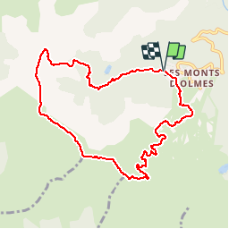
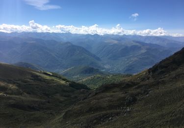
Trail Walking of 9.8 km to be discovered at Occitania, Ariège, Montferrier. This trail is proposed by tracegps.

Description

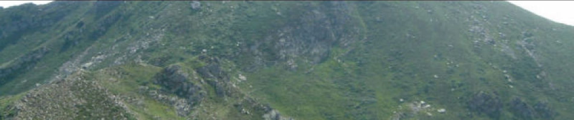
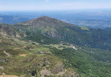
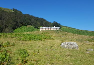
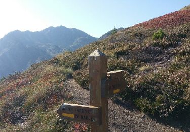
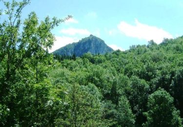
Un joli parcours en boucle permettant d'admirer de près le Pic de St Barthelemy que l'on voit depuis Toulouse par temps clair. On passe par le col de Cadène, le pic du Han puis les crêtes jusqu'au col d'Aygue Torte avant de redescendre sur les Monts d'Olmes. La suite avec des photos ICI Balade proposée par le site « Les Balades et Randonnées de Fred »

Elevation profile

Photos

Positioning

Country:
France
Region :
Occitania
Department/Province :
Ariège
Municipality :
Montferrier
Location:
Unknown
Start:(UTM)
396987 ; 4744409 (31T) N.

Trails nearby

Trail Walking Montferrier - Pic de Saint-Barthélémy - Pla de la Galine - Photo
Walking
tracegps

Walking

Difficult
(1)
Montferrier, Occitania, Ariège, France
15.3 km | 31 km-effort
7h 0min
Yes
Trail Snowshoes Montferrier - Mont d'Olmes - le Planas - Photo
Snowshoes
j2c11

Snowshoes

Easy
Montferrier, Occitania, Ariège, France
7.2 km | 13.4 km-effort
4h 17min
Yes
Trail Walking Montferrier - Pic St Barthélémy - Photo
Walking
doume82

Walking

Medium
(1)
Montferrier, Occitania, Ariège, France
11 km | 24 km-effort
5h 55min
Yes
Trail Walking Montferrier - st Barthélémy  - Photo
Walking
chrisgps

Walking

Medium
Montferrier, Occitania, Ariège, France
10.3 km | 23 km-effort
6h 51min
Yes
Trail Walking Montferrier - BOUCLE Mt d'Olmes Mt Fourcat L'Estagnole Pic du Han retour Cadène - Photo
Walking
jopost

Walking

Difficult
Montferrier, Occitania, Ariège, France
15.3 km | 29 km-effort
8h 30min
Yes
Trail Walking Montferrier - MOULZOUNE l'étang à l'Etang des Truites - Photo
Walking
jopost

Walking

Medium
Montferrier, Occitania, Ariège, France
11.2 km | 21 km-effort
5h 18min
Yes
Trail Walking Montferrier - Château de Montségur par le Sentier Cathare  - Photo
Walking
tracegps

Walking

Very difficult
(1)
Montferrier, Occitania, Ariège, France
11.7 km | 19.7 km-effort
5h 49min
No
Trail Walking Montferrier - roc de la Gourgue - Photo
Walking
chrisgps

Walking

Easy
Montferrier, Occitania, Ariège, France
14.2 km | 23 km-effort
6h 1min
Yes
Trail Walking Montferrier - Les monts D’holmes - Photo
Walking
Laurent-Fornt

Walking

Montferrier, Occitania, Ariège, France
7.5 km | 14.3 km-effort
3h 5min
Yes


Close
My subscriptions