Trail Walking Fresnes-sous-Coucy - Une belle forêt française - Photo

Une belle forêt française

 tracegps
tracegps

User

© OpenStreetMap contributors
Length
Length
13.1 km
Max alt
Max alt
218 m
Uphill gradient
Uphill gradient
252 m
Km-Effort
Km-Effort  
16.4 km
Min alt
Min alt
99 m
Downhill gradient
Downhill gradient
253 m
Boucle
Boucle
Yes
Creation date :
2014-12-10 00:00:00.0
Updated on :
2014-12-10 00:00:00.0

(1 Reviews)

Walking
Walking
4h00
Difficulty : Very difficult

Scan this QR Code to open this trail in the SityTrail application

FREE GPS app for hiking

Logo SityTrail SityTrail

IGN / Geographical institutes

Download SityTrail from the App Store Download SityTrail from Google Play

Logo SityTrail SityTrail World

The world is yours!

Download SityTrail from the App Store Download SityTrail from Google Play Download SityTrail on Huawei AppGallery

About

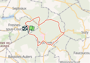
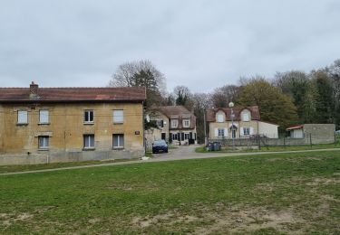
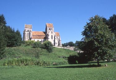
Trail Walking of 13.1 km to be discovered at Hauts-de-France, Aisne, Fresnes-sous-Coucy. This trail is proposed by tracegps.

Description

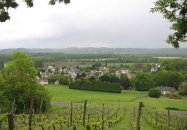
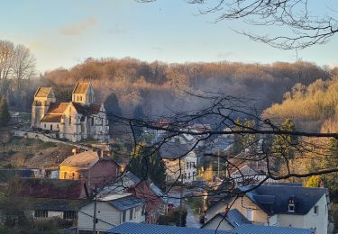
Le pouvoir de prendre contact avec la nature, c'est le pouvoir de s'émerveiller, Le Miracle d'être, Robert Hainard. Laissez-vous charmer par ce massif de 9 000 ha à la topographie mouvementée avec une grande diversité de sols induisant une variété des milieux végétaux et une richese faunistique incontournables. Toutes les infos sont ICI

Elevation profile

Positioning

Country:
France
Region :
Hauts-de-France
Department/Province :
Aisne
Municipality :
Fresnes-sous-Coucy
Location:
Unknown
Start:(UTM)
528208 ; 5488468 (31U) N.

Comments

Please log in to post a review or rate the element


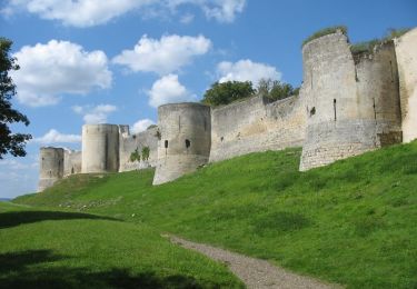
Magnifique sortie très bien balisée .Avons passé un moment de dépaysement étonnant à 30 minutes de la maison.Nous y retournerons!


Trails nearby

Trail Cycle Coucy-le-Château-Auffrique - Trésors cachés en forêt de Saint-Gobain - 50 km - Coucy le Château Auffrique - Photo
Cycle
tracegps

Cycle

Difficult
(1)
Coucy-le-Château-Auffrique, Hauts-de-France, Aisne, France
50 km | 61 km-effort
5h 0min
Yes
Trail Walking Septvaux - La route serpentine - Photo
Walking

Walking

Very easy
(1)
Septvaux, Hauts-de-France, Aisne, France
10.2 km | 12.5 km-effort
Unknown
Yes
Trail Walking Coucy-le-Château-Auffrique - Le Circuit d'Enguerrand - Photo
Walking
tracegps

Walking

Difficult
(1)
Coucy-le-Château-Auffrique, Hauts-de-France, Aisne, France
10.5 km | 12.5 km-effort
3h 0min
Yes
Trail Walking Barisis-aux-Bois - soirée calme en première ligne  - Photo
Walking
José800

Walking

Difficult
Barisis-aux-Bois, Hauts-de-France, Aisne, France
10.6 km | 14.1 km-effort
2h 45min
Yes
Trail Walking Coucy-la-Ville - coucy la ville. septvaux - Photo
Walking
alainwald

Walking

Easy
Coucy-la-Ville, Hauts-de-France, Aisne, France
18.2 km | 22 km-effort
3h 45min
Yes
Trail Cycle Coucy-le-Château-Auffrique - Trésors cachés en forêt de Saint-Gobain - 26 km - Coucy le Château Auffrique - Photo
Cycle
tracegps

Cycle

Medium
Coucy-le-Château-Auffrique, Hauts-de-France, Aisne, France
26 km | 31 km-effort
2h 30min
Yes
Trail Walking Prémontré - Laon - Photo
Walking
MERMOZ33

Walking

Very difficult
Prémontré, Hauts-de-France, Aisne, France
17.7 km | 21 km-effort
4h 25min
No
Trail Road bike Coucy-le-Château-Auffrique - forêt de saint gobain  - Photo
Road bike
inesmyt

Road bike

Very easy
Coucy-le-Château-Auffrique, Hauts-de-France, Aisne, France
52 km | 62 km-effort
3h 31min
Yes
Trail Walking Septvaux - Septvaux - La Route Serpentine - Photo
Walking
tracegps

Walking

Difficult
Septvaux, Hauts-de-France, Aisne, France
10.2 km | 12.5 km-effort
3h 0min
Yes


Close
My subscriptions