Trail Walking Barisis-aux-Bois - soirée calme en première ligne  - Photo

soirée calme en première ligne

 José800
José800

User

© OpenStreetMap contributors
Length
Length
10.6 km
Max alt
Max alt
163 m
Uphill gradient
Uphill gradient
263 m
Km-Effort
Km-Effort  
14.1 km
Min alt
Min alt
70 m
Downhill gradient
Downhill gradient
262 m
Boucle
Boucle
Yes
Creation date :
2023-04-08 12:08:08.164
Updated on :
2023-04-08 15:41:56.421

(0 Reviews)

Walking
Walking
2h45
Difficulty : Difficult

Scan this QR Code to open this trail in the SityTrail application

FREE GPS app for hiking

Logo SityTrail SityTrail

IGN / Geographical institutes

Download SityTrail from the App Store Download SityTrail from Google Play

Logo SityTrail SityTrail World

The world is yours!

Download SityTrail from the App Store Download SityTrail from Google Play Download SityTrail on Huawei AppGallery

About

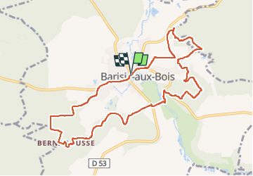
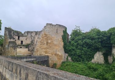
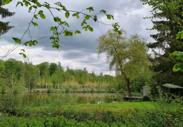
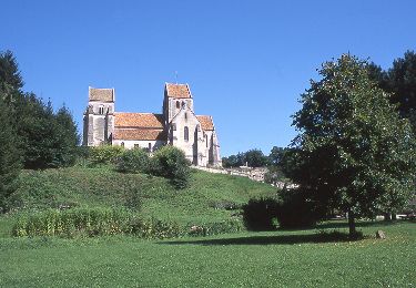
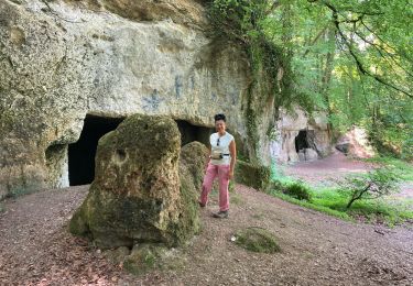
Trail Walking of 10.6 km to be discovered at Hauts-de-France, Aisne, Barisis-aux-Bois. This trail is proposed by José800.

Description

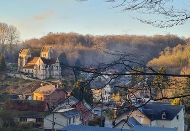
une belle Randonnée à Barisis au bois 02 village au milieu de la forêt de St Gobain. le chemin permet de voir les vestiges de la grande guerre , six pupitres avec des informations et de photos le jalonnent. le chemin au printemps offre de très belles vues sur les bois et les fleurs au bord du chemin.

Elevation profile

Photos

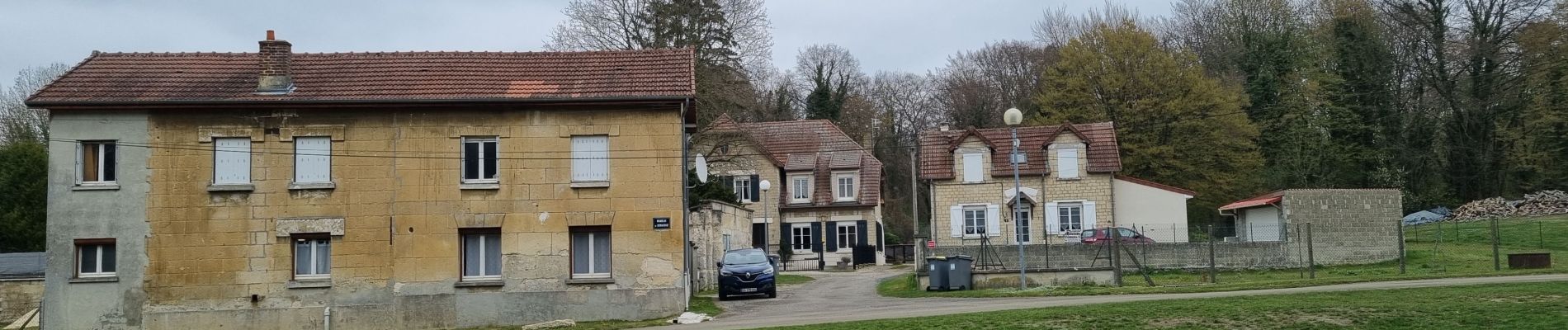
23 photos in total. Please click on a photo to see them all in the gallery.

Positioning

Country:
France
Region :
Hauts-de-France
Department/Province :
Aisne
Municipality :
Barisis-aux-Bois
Location:
Unknown
Start:(UTM)
523734 ; 5491822 (31U) N.

Trails nearby

Trail Walking Septvaux - La route serpentine - Photo
Walking

Walking

Very easy
(1)
Septvaux, Hauts-de-France, Aisne, France
10.2 km | 12.5 km-effort
Unknown
Yes
Trail Walking Fresnes-sous-Coucy - Une belle forêt française - Photo
Walking
tracegps

Walking

Very difficult
(1)
Fresnes-sous-Coucy, Hauts-de-France, Aisne, France
13.1 km | 16.4 km-effort
4h 0min
Yes
Trail Walking Coucy-la-Ville - coucy la ville. septvaux - Photo
Walking
alainwald

Walking

Easy
Coucy-la-Ville, Hauts-de-France, Aisne, France
18.2 km | 22 km-effort
3h 45min
Yes
Trail Mountain bike Sinceny - parcours vtt rond d'Orléans  - Photo
Mountain bike
alainwald

Mountain bike

Difficult
Sinceny, Hauts-de-France, Aisne, France
47 km | 56 km-effort
4h 20min
Yes
Trail Walking Saint-Gobain - parcours Barisis-aux-bois - Photo
Walking
alainwald

Walking

Medium
Saint-Gobain, Hauts-de-France, Aisne, France
18.1 km | 23 km-effort
4h 17min
Yes
Trail Walking Septvaux - Septvaux - La Route Serpentine - Photo
Walking
tracegps

Walking

Difficult
Septvaux, Hauts-de-France, Aisne, France
10.2 km | 12.5 km-effort
3h 0min
Yes
Trail Walking Barisis-aux-Bois - Barisis  - Photo
Walking
jpblimond

Walking

Medium
Barisis-aux-Bois, Hauts-de-France, Aisne, France
20 km | 25 km-effort
4h 45min
Yes
Trail Walking Barisis-aux-Bois - soirée calme en première ligne  - Photo
Walking
José800

Walking

Difficult
Barisis-aux-Bois, Hauts-de-France, Aisne, France
10.4 km | 13.9 km-effort
3h 50min
Yes
Trail Mountain bike Amigny-Rouy - Amigny rouy  - Photo
Mountain bike
hm

Mountain bike

Very difficult
Amigny-Rouy, Hauts-de-France, Aisne, France
34 km | 43 km-effort
3h 17min
Yes


Close
My subscriptions